-2")
Weekly Planner: We live in the tropics now
It’s warm, it’s humid, and it’s going to rain a lot. Welcome to the tropics.
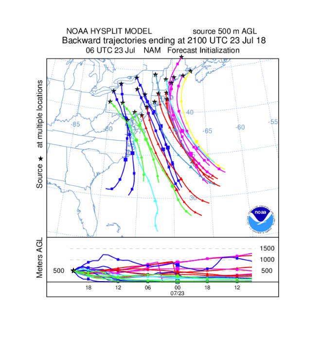
A deep southeasterly flow (which, not coincidentally, draws air parcels directly from the tropical Atlantic into the Northeast) has established itself over the past 24 hours. Dew points have increased and so has the moisture content in the atmosphere, and with a frontal boundary draped from the Mid Atlantic into the Northeast states, showers and thunderstorms have been common during the afternoon and early evening hours.
This will continue over the next several days – essentially through the end of the week – as the pattern remains slow and stagnant.
What exactly is causing this tropical moisture to surge so far north and west into the Northeast states? A Western Atlantic Ridge has expanded and moved westward, and troughing in the Southeast States has effectively become “trapped”. The combination is enhancing the flow of low level and mid level air, which is leading to the advection of deep moisture along the East Coast.
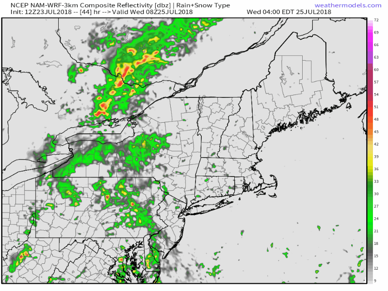
The pattern doesn’t look likely to change this week. After opportunities for showers throughout the Northeast on Monday and Tuesday, particularly in the Interior, the flow shifts slightly to the east on Wednesday, with the potential for widespread torrential downpours from Pennsylvania into New York and New Jersey during the afternoon and evening hours.
Forecast model and ensemble guidance are hinting at the idea that Wednesday could be the most significant day when it comes to flooding potential. The ECMWF in particular suggests that flooding will be possible across a fairly widespread area, as deep moisture aligns with sufficient lift for precipitation and instability for showers to become heavier in nature.
The potential for tropical downpours is likely to last until at least Friday, when a more notable disturbance approaches the Northeast states. Forecast models suggest an area of more impressive mid level winds will move through, along with a frontal boundary, which suggests the possibility of organized thunderstorms during the afternoon hours. Timing and intensity of any organized storms remains uncertain, but the potential is certainly there for thunderstorms of significance.
The weekend and beyond
After Friday’s frontal boundary finally shifts through, dew points will temporarily drop. It currently appears that the weekend could be much nicer than the weather we’re experiencing in the Northeast this week, with lower dew points and more comfortable conditions, although the potential for some scattered showery activity will still persist.
The bad news is that the pattern looks likely to snap back to tropical once again after that. The flow turns more south/southwesterly on all ensemble guidance by next week, and dew points increase as the Western Atlantic ridge begins to flex its muscles yet again.
We’ll be keeping a close eye on the pattern over the next few days, as we always do, but here are your highlights for now:
- Moist, warm, tropical downpours are likely. Every day. Until Friday.
- Organized storms are possible Friday with a front moving through the Northeast
- The weather temporarily improves this weekend after Friday’s front draws in some cooler and drier air
- Don’t get too excited, because tropical moisture and warmth returns right after that