-2")
NYC Area Forecast: Autumn air arrives, won’t be here for long
If you stepped outside this morning, you’d have noticed a major change in the airmass overhead. Dew points have fallen from the 70’s into the 50’s, and will continue falling throughout the afternoon as northwest winds usher in cooler and drier air. This is likely a welcomed change after several weeks of very high dew points, heat and thunderstorm chances.
Over the next two days, temperatures are expected to average near or below normal in the NYC Area and much of the Northeast states. Northwest winds will keep the air cooler and dry, with the airmass feeling more like Autumn than late summer. That’s the good news.
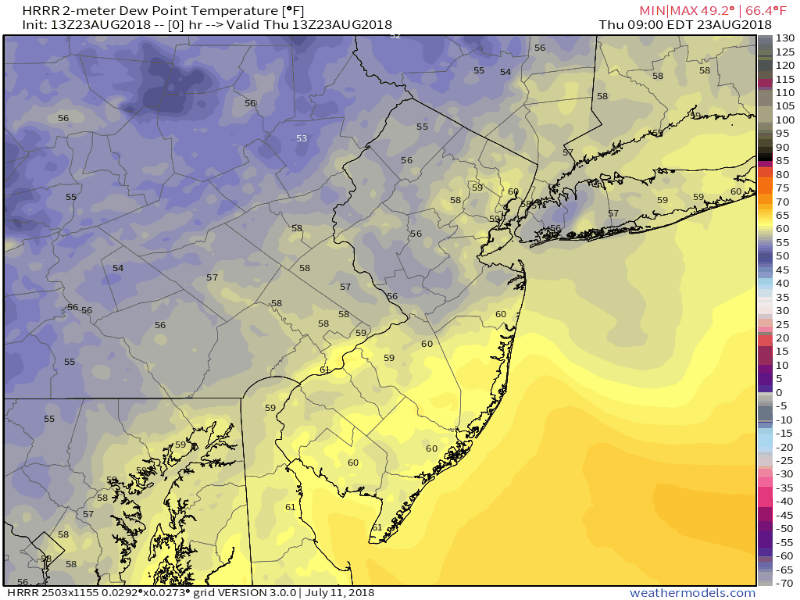
Falling dew points today. It’s going to feel like Autumn.
The bad news? It won’t stick around long. The cooler and drier air will be fleeting by this weekend, with a large ridge building across the Central and Eastern United States. These ridges of high pressure act to enhance warm, southerly winds in our area and bring warmer temperatures into the region once again.
After a gradual warmup by the end of the weekend and into the early part of next week, forecast model guidance is in good agreement that the airmass will become hot – very hot – with opportunities for thunderstorms and increasing humidity. A few runs of the European model have suggested heat index values over 100 F in the NYC area next week. Yikes.
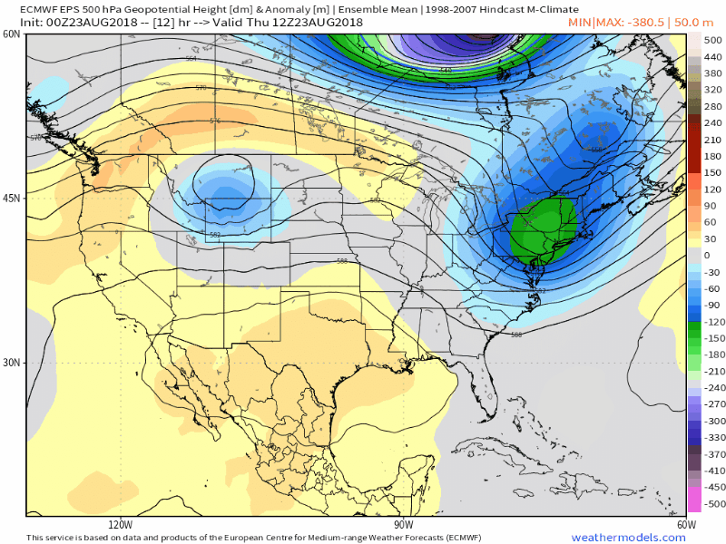
A cool trough is replaced with a large ridge over the Eastern USA resulting in — you guessed it — more heat.
The thunderstorm chances are likely to build as the week goes on (there will be some opportunity on Monday as well). As the ridge builds over the region and flexes, instability will build and moisture will increase. With disturbances riding into New England, the likelihood of thunderstorms will increase toward the end of the week and weekend.
Some of these storms could be organized or more impactful, but it remains to be seen exactly when that will be. We always watch these events carefully when storms ridge along the edge of a large ridge with instability – often times, organized areas of thunderstorms can roll southward along the northern edge of the ridge (which is where the NYC Area and New England will be).
In summation: Enjoy the crisp air while it is here through the early part of the weekend. Get your hot coffee’s. Wear your plaid shirts. But don’t take out the AC or put away the bathing suit – you’re going to want them next week.