-2")
Hurricane Michael strengthens, aims toward Florida Gulf Coast
Hurricane Michael strengthened again this morning, reaching a Category 2 on the Saffir-Simpson scale with maximum sustained winds of 110mph. The storm also deepened to 965hPa as it continues to organize itself in the Southeastern Gulf of Mexico. The intensifying storm is predicted to make landfall on Wednesday as a Category 3 Major Hurricane, the most substantial hurricane threat for the Florida Gulf Coast in over a decade.
The National Hurricane Center suggests that Hurricane Michael will continue strengthening today as it encounters an increasingly favorable atmospheric environment. Lower wind shear and warmer waters of the Gulf of Mexico will promote increasing storm structure and strengthening wind speeds.

Impacts and Preparations
The impacts from Hurricane Michael along the Florida Gulf Coast appear increasingly likely to be life-threatening. The National Hurricane Center is forecasting an 8 to 12 foot storm surge along the barrier islands and immediate Gulf Coast land areas, and a 6 to 10 foot storm surge further inland. Rising tides and storm surge present an extremely dangerous threat to life and property in those regions.
A Storm Surge Warning has been issued by the National Weather Service for areas along the Florida Gulf Coast, and even southward along some of Florida’s westward facing shores. Rising tides and wave heights may bring rough surf and increased water levels to places as far south as Tampa, despite the worst of the storm missing well to the northwest.
Here are some #HurricaneMichael last minute preparedness items. Preparations should be completed no later than Tuesday morning. pic.twitter.com/rgAPgtzpbm
— NWS Tallahassee (@NWSTallahassee) October 9, 2018
Hurricane and tropical storm-force winds are also anticipated along many parts of the Florida Gulf Coast beginning late Tuesday Night and continuing into Wednesday. Mandatory evacuations have begun in many regions and by all measures, hurricane preparations should be finalized no later than this afternoon for residents in those locations.
Preparations for residents who choose to stay, and even those who choose to leave, are a critical part of hurricane preparedness. Far too often, stories emerge after the storm that detail a lack of preparedness from residents that resulted in life-threatening conditions. The National Weather Service in Tallahassee offers a list of preparation suggestions (detailed above)
The very latest information on the storm (Technical)
Hurricane Michael continues to organize its inner core this morning. The latest microwave pass showed an organizing eyewall, which previously had remained open on the storms western side. Additional bursts of thunderstorm activity around the center of the storm, and an increasingly organized satellite appearance, suggests that overall organization of the storm continues.
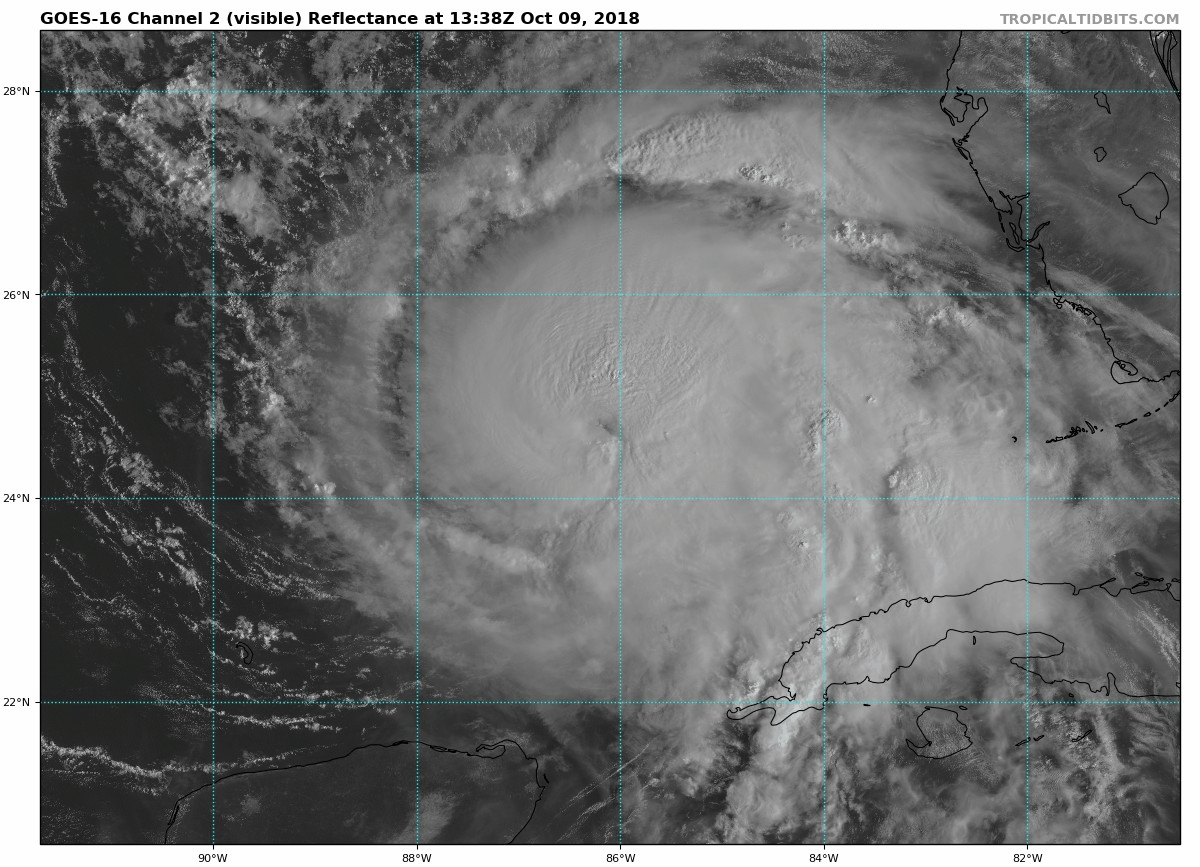
Over the next 12 to 24 hours, atmospheric conditions will become increasingly favorable for strengthening of Michael. Wind shear, which had previously been steady around 15 knots, will begin to weaken further. Drier air, which had been present to the west of the storm, will begin to become less prevalent as the storm takes control of its environment. And finally, the system will continue to traverse the warmer waters of the Gulf of Mexico.
The increasingly organized appearance occurring in tandem with the continuation of vertical hot towers and persistent, aggressive convection suggests that the storm is very likely to strengthen today and may undergo a burst of strengthening this afternoon once the inner core is completely organized.
All of these factors lead to the continued suggestion that Hurricane Michael will strengthen today into Wednesday, likely into a Major Category 3 Hurricane and perhaps into a Category 4 Hurricane as it approaches landfall on Wednesday. Short term and high resolution weather models are generally in agreement with this thinking.
Stay tuned today for more details and information. This post will be continually updated with the latest.
Leave a Reply
Want to join the discussion?Feel free to contribute!