-2")
NYC Area Forecast: Impacts from Michael today with rain, storms
Moisture from the remnants of Hurricane Michael will stream northward over the next several hours, and its interaction with a frontal boundary in the Northeast will prove sufficient to develop numerous showers and thunderstorms. A warm front will lift northward through the Mid-Atlantic later this morning, providing the first impetus for shower and thunderstorm development. Some of this rain is expected to be “torrential” in nature – heavy and sporadic, but many cause localized flooding.
Tropical moisture is responsible for a large majority of our heavy rain threats around the Mid-Atlantic and Northeast this time of year, and when it interacts with a frontal boundary, it can often mean trouble. While this threat remains progressive (i.e, it will be out of here by Friday) it is still noteworthy. After the warm front lifts northward later today, instability is expected to build across the Mid-Atlantic, New Jersey and the NYC Metro Area.
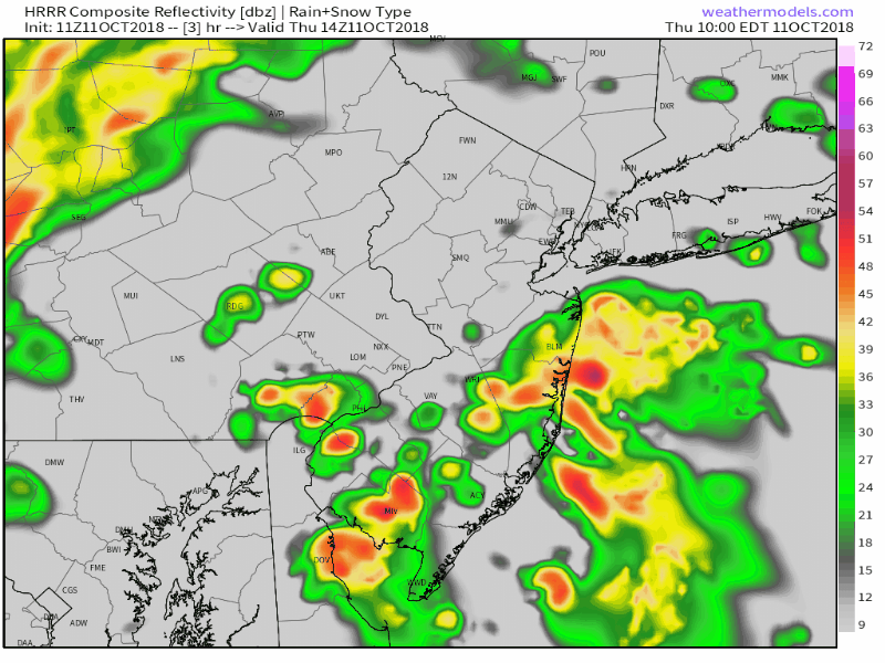
Showers and thunderstorms are increasingly likely this afternoon across the region.
This will serve as additional fuel for showers and thunderstorms later this afternoon, with a cold front expected to shift southward through New Jersey. Forecast models suggest that additional storms will develop through the late afternoon and evening hours. Some of these could be strong or perhaps even severe, with the threat for some stronger winds and a widely isolated weak tornado (these tropical systems have a way of spinning those up).
The forecast becomes very complicated later this evening, and our forecasting team continues to closely track the remnants of Michael as they move northward today. Some forecast model guidance suggests that tropical moisture from the remnants of Michael will begin interacting with the frontal boundary while it is draped across the Mid Atlantic from the DelMarVa region towards New Jersey, setting off very heavy rainfall and leading to flooding potential.
Other model guidance (the GFS and ECMWF for example) are more progressive with this front, pushing it offshore by the time the remnants of Michael can “ride” along it. That would keep the threat for heavy rain further offshore. A strong jet streak to our north suggests the potential that rain could head further north than models indicate, so we’ll be watching very closely. If it does get further north towards the NYC Area, the heaviest would come overnight into the early morning hours of Friday.
Friday and the weekend
After the remnants of Michael pass, and whether the heavy rain gets to the NYC Area on Friday morning or not, the weather will take a much cooler turn. Humidity is expected to lower dramatically through Friday with the passage of a significant cold front that is associated with cooler, more dense and dry air. In fact, dew points may fall from the 70’s into the 30’s by Saturday morning – and let us be the first to tell you, it will feel dramatically different in terms of sensible weather conditions!
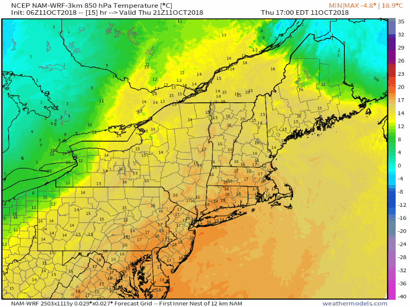
Much cooler air will move into the Northeast this weekend!
The airmass that is expected to settle in to the Northeast this weekend is one of the coolest of the Autumn season so far, and high temperatures are only expected to reach into the lower 60’s. A weak frontal wave now looks likely to ride along the secondary front on Saturday morning. This will lead to a period of showers on Saturday, and – get ready for this – the potential for snow in the higher elevations of the Northeast as cooler air moves in aloft. No accumulation of significance is anticipated, and for most areas it will simply be a cold, damp rain (sweater weather, anyone?).
After this frontal wave passes, Sunday looks cool and Autumn-like as well, with temperatures below normal and pleasant conditions. The cooler than normal weather appears likely to persist after that, with the pattern not supporting any more major warmups.
Leave a Reply
Want to join the discussion?Feel free to contribute!