-2")
Amplified pattern will eventually bring cool air, storm risks to East
The North Pacific Jet has been a real bear of a forecast over the past few weeks. Model guidance has struggled with tropical forcing and the effects of re-curving typhoons (just to name a few things), and the results haven’t been pretty – we have seen a few shots of colder air modeled in the medium term simply vanish as they approach.
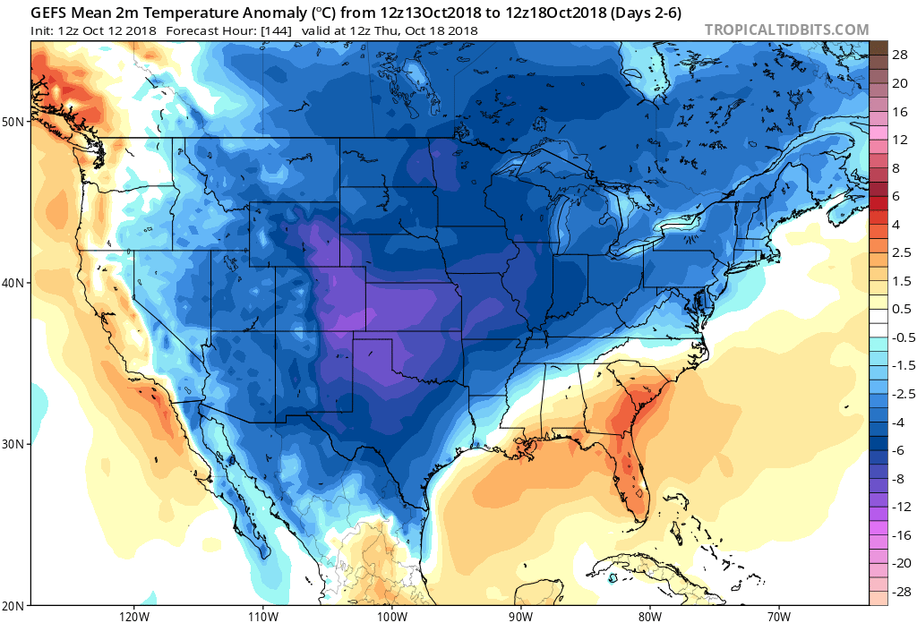
As you may be aware if you’ve stepped outside in the Northeast these past few days, it finally arrived. The pattern in the North Pacific Ocean, and hemispherically, is expected to change further over the next week or two. These changes will support continued amplification of the North Pacific jet stream, and the possibility of enhanced storminess in the Central and Eastern United States.
Forecast models are in good agreement that a North Pacific jet extension will reach poleward during the Days 8 to 12 time frame, with ridging developing toward British Columbia and becoming quite anomalous in Western Canada. This is a key part of the forecast, as the large ridge in Western Canada results in cooler air being displaced into Central and Eastern Canada. Meanwhile, a split flow is forecast to develop underneath the anomalous ridge, with troughing in the Southwestern United States and Four Corners region.
This will help advect colder air into Southeast Canada, the Great Lakes and Northeast states during the Days 10-15 range (as we near the end of October). The jet stream is likely to amplify during this time frame, with the potential for an active and cooler than normal pattern from the Central to Eastern United States to close out the month.
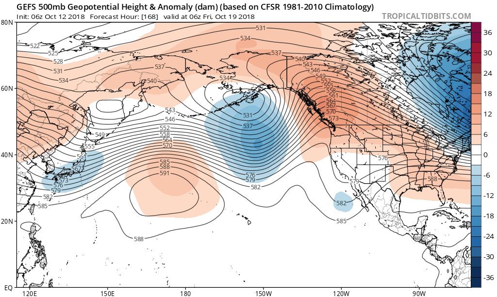
Forecast models suggest that a large, anomalous ridge will develop in British Columbia and will remain persistent for several days.
Making matters more notable is the fact that model guidance suggests this pattern will be quite persistent. Instead of a progressive evolution, with the pattern only favorable for a few days, global ensemble guidance signals a “standing” pattern, where the main wave features are generally in the same synoptic location and strength for several days in a row.
As a result, the synoptic pattern being forecast argues for continued near/below normal temperatures as well as the possibility of storminess, including the potential for a Nor’Easter during the tail end of October. Pinning down the exact days is very difficult, but we can certainly recognize that the pattern during the Day 10-15 time frame features a heightened potential for a storm of significance. We’ll be watching the evolution very closely over the next several days.
Trackbacks & Pingbacks
1missive
Leave a Reply
Want to join the discussion?Feel free to contribute!