-2")
NYC Area Forecast: Autumn air arrives this weekend
The remnants of Hurricane Michael brought plenty of rainfall to parts of the area overnight Thursday into Friday morning, with bands rotating onshore and producing localized flooding. This was especially true over parts of Southeastern New Jersey, where upwards of 4″ of rainfall was observed in some locations.
The reality of the situation is that it could have been much worse in our area. Michael was pushed seaward by an incoming cold front, and the pattern was slightly more progressive. If not for this, we could be dealing with a prolonged heavy rainfall event and widespread flooding concerns. Instead, Autumn like weather is expected to shift into the area this weekend.
Friday afternoon and evening
The National Weather Service has issued a Wind Advisory through this afternoon, as strong northwesterly winds are expected in the wake of the departing remnants of Michael. Gusts upward of 40 mph are possible in some areas, particularly in the late morning and early afternoon hours. These could cause some localized damage, especially if loose objects are left outside.
The winds will die down later tonight and the weather will remain very cool. This will be one of the cooler afternoon and evenings in quite some time – low humidity and blustery winds will lead to a true Autumn feel to the air. Clouds will begin to increase later this evening in advance of an incoming weak disturbance
Saturday
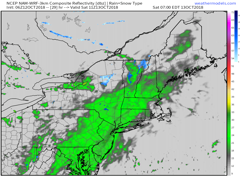
If you ever wanted a good Autumn excuse to sleep in – you’re going to get it on Saturday. An additional shortwave is forecast to move eastward along a secondary frontal zone from late Friday night into Saturday, and enough lift in the atmosphere will help precipitation develop once again. Although moisture is more limited, the synoptic forcing will allow for rain to develop again, first in Pennsylvania and New York and then eastward towards the coast on Saturday morning.
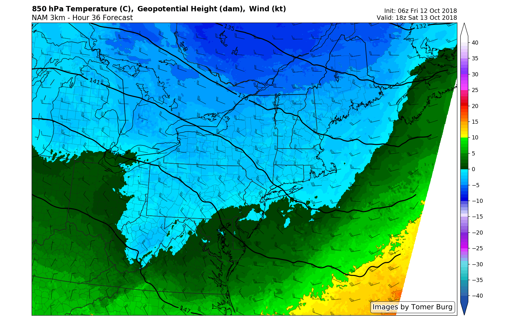
With a cooler airmass in place already, and clouds/rain present, temperatures are expected to average solidly below normal. During the morning hours, it will be raw, rainy, damp and cool – a big departure from the weather we have observed over the past few weeks. After a slow morning, the system will quickly exit and improving weather is anticipated from about 12:00 noon onward. Sunshine will return and the weather will become much more tolerable.
Sunday and beyond
High pressure builds in behind the weak storm system from Saturday departs, and the result will be pleasant weather to wrap up the weekend. Plenty of sunshine is expected, and temperatures will likely average near or slightly below normal. It will be a winner of an Autumn day.
Unfortunately, the progressive and somewhat unsettled pattern looks to continue thereafter. Despite cooler temperatures, another disturbance is expected to traverse the Northeast states on Monday and Tuesday, with the potential for rain returning to the forecast.
Leave a Reply
Want to join the discussion?Feel free to contribute!