-2")
Hurricane Dorian poses major threat to Florida coastline
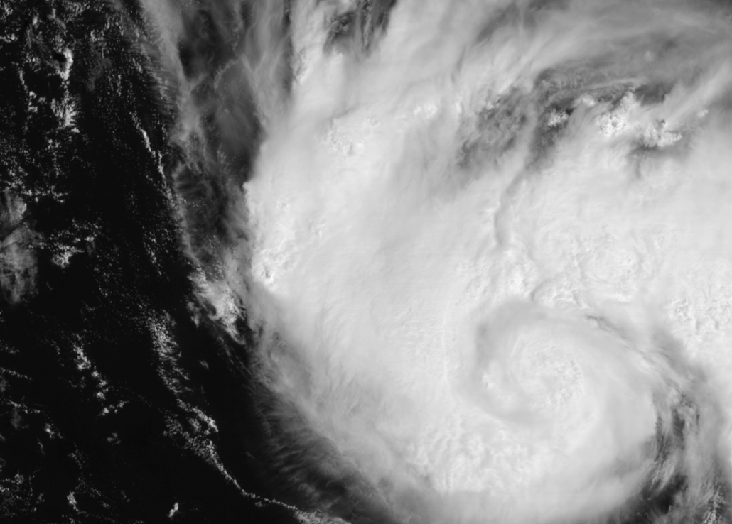
Hurricane Dorian is a Category 1 hurricane this morning, with maximum sustained winds of 85 miles per hour. After strengthening yesterday, the storms intensity has leveled off a bit thanks to the ingestion of dry air. But the National Hurricane Center suggests that Dorian will continue to strengthen again today, with the expectation that the system will become a Major Hurricane by Friday afternoon.
Dorian is expected to move into an environment conducive to intensification of tropical cyclones. Warm water and relatively low mid and upper level atmospheric shear lies ahead in the Bahamas, and the National Hurricane Center forecasts the storm to be a powerful hurricane by the time it begins to turn westward toward the Florida coastline, reaching Category 4 status before landfall.
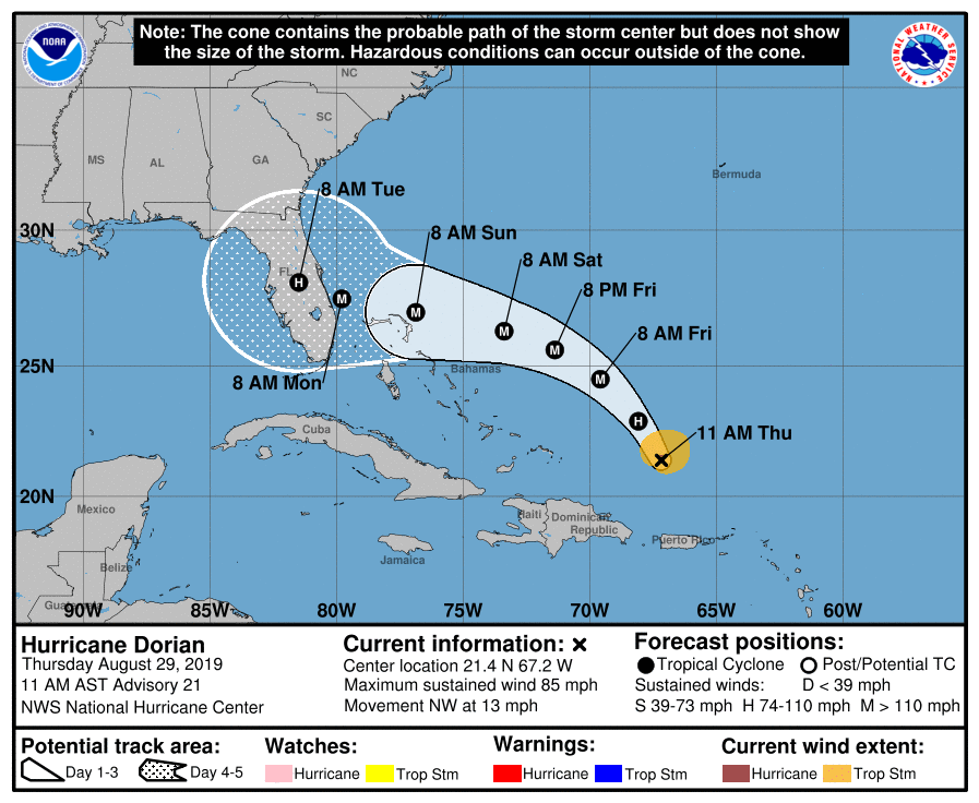
The details of Dorian’s future as it approaches Florida have become increasingly murky over the past 24 hours. Forecast model guidance diverges as the storm turns west toward the Florida Coast, with some models taking the storm further north into the Central part of Floridas eastern coast, while others turn Dorian due west toward Southeast Florida, closer to Miami.
Growing uncertainty in regards to Dorian’s exact track
Several atmospheric features near Dorian will impact the systems final track. One of the most important, however, is a strong ridge of high pressure that is forecast to build to to the north of the storm late this week. Known more affectionately as a WAR (Western Atlantic Ridge), this feature is expected to effectively “block” Dorian’s northward escape route.
The timing and intensity of this ridge, as you might imagine, is a major inflection point in the eventual track of the system and a big divergent point on forecast models. Models which are stronger with this ridge take Dorian further south, while models which are weaker allow the storm to track further north.
These details will likely not be resolved for at least 24 to 48 hours as forecast model and ensemble guidance continues to struggle with finite details and interactions between Dorian and its surroundings.
Building concern for major impacts along the Florida coastline
Current forecasts suggest that Dorian will be a major hurricane approaching the Southeast or Central-East Florida coastline by Sunday. Dorian would be the first hurricane to make landfall in that part of Florida in almost 15 years (25 years for some counties).

Of additional concern is the recent population rise in Florida. Many residents in these areas have not experienced a landfalling hurricane in at least 15 years – and some have not experienced one at all.
Since 2005, when Hurricane Wilma made landfall, Florida has seen a population increase of 3.52 million people. Much of this population is in South Florida, including the regions that are at the highest risk for impacts from Dorian.
Residents along Florida’s eastern coastline should have hurricane preparations underway. The next 24 to 48 hours are a critical time in preparation before the storm begins to make its approach. If you need help with your emergency plan, or do not have one, there are many resources available to help you along the way.
If you have flights into our out of eastern Florida late this weekend or early next week, plan for significant delays and cancellations. With a major hurricane expected to approach, many airlines and airports will shut down flights in and out of the region.
Stay tuned for more information over the coming days. If you have questions, concerns, or need more information, just shoot us an email.
Leave a Reply
Want to join the discussion?Feel free to contribute!