-2")
Bahamas, Florida prepare for potentially devastating Hurricane Dorian
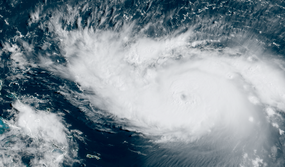
Hurricane Dorian strengthened again this morning, with maximum sustained winds now 110 miles per hour. The storm is moving slowly northwestward and is expected to continue to move toward the Bahamas today. The National Hurricane Center is forecasting Dorian to become a powerful major hurricane over the next 12 to 24 hours as it moves towards the Bahamas and the Florida coastline.
The storm is expected to curve westward this weekend and slow down considerably, moving into atmospheric conditions favorable for strengthening. Very warm waters near the Bahamas combined with low atmospheric wind shear are expected to allow the system to intensify.
Eventually, the system is expected to make landfall in Southeast Florida as a powerful and extremely dangerous major hurricane. Exactly how it gets there remains a major uncertainty. Forecast model guidance is still divergent with the track of the storm as it approaches the Northern Bahamas on Sunday, with some models taking the storm further north while others slow the system down near the Southeast Florida coastline.
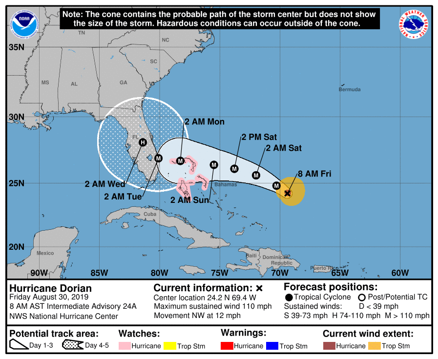
The National Hurricane Center continues to suggest that Dorian will make landfall as a powerful Category Four hurricane in Southeast Florida from Sunday into Monday. In fact, the latest forecast has increased maximum sustained winds to 140 miles per hour prior to landfall.
The region of Southeast Florida at the highest risk for landfall has not seen a land-falling hurricane in at least 15 years. A major hurricane has not made landfall in some parts of Southeast Florida since 1964. Florida has seen a population increase of 3.2 million people since 2004, with a high concentration of that increase in the Southeast parts of the state.
Preparation well underway in Bahamas, Florida
Residents from the Bahamas to Florida have begun preparations well in advance of Hurricane Dorian’s arrival. Many have begun to evacuate to higher ground after completing hurricane preparations at their homes.
Local retail outlets are reporting very low availability of water and other essentials. The water was off the shelves as early as two days ago in Central Florida and retailers have struggled to restock near the coastline.
In the Bahamas, residents are preparing for the worst. The National Hurricane Center is currently forecasting a Category Four hurricane to pass directly over Elbow Cay in the Northern Bahamas. While some have chosen to evacuate, others are completing preparations locally and preparing to ride the storm out.
The Northern Bahamas look to be particularly susceptible to major impacts from Hurricane Dorian late this weekend. This includes cities such as Freeport, Treasure Cay and Marsh Harbour.
Residents are reminded to take all hurricane preparations seriously, and to finish them by Saturday. Do not wait to rush your preparedness to completion. You can access more information here on hurricane preparedness steps. Be sure to check your evacuation routes and know where to go if and when an evacuation order is issued.
Forecast models still uncertain on Dorians future near Florida
While guidance did converge a bit overnight, there is still a divergence in track among most models as Dorian moves through the Bahamas. The main uncertainty stems from whether the storm will dip southwestward in the Bahamas before turning north up the Florida coast, or if it will continue on a northwest heading straight toward the coastline.
A slower track tends to open up a “window” where Dorian could turn almost due north, perhaps skirting the coastline of Florida as it does so. But overnight model guidance trended away from this idea, with agreement on landfall in Southeast Florida early next week.

Most ensemble guidance suggests that the storm will slow down considerably once it passes the Northern Bahama Islands. A Category Four hurricane slowly approaching the Southeast Florida coastline could be absolutely devastating for the Northern Bahamas and Florida coastline as a whole.
The National Hurricane Center suggests that maximum sustained winds will approach 140 miles per hour as the storm slows down and approaches the Florida coast. The lack of forward speed suggests a triple threat of high winds, heavy rainfall, and storm surge that could cause life-threatening conditions in the aforementioned areas.
More information to come today
Stay tuned over the next 12 to 24 hours as observations of Hurricane Dorian continue. While some uncertainties are likely to continue up until landfall, the forecast track and localized impacts of the system should begin to become more clear today and tonight.
Leave a Reply
Want to join the discussion?Feel free to contribute!