-2")
NWS confirms EF-0 tornado in Manorville
An EF-0 tornado touched down in Manorville, NY on Monday afternoon, producing winds up to 85 miles per hour. The tornado was on the ground for 1.6 miles and caused significant tree and structural damage, although it was only 50 yards in width.
A complex of storms developed in New Jersey during the early afternoon hours and shifted eastward toward Long Island. Around 4:30pm, the National Weather Service issued a Tornado Warning for parts of Suffolk County, including Manorville. The tornado occurred between 4:33 and 4:38pm.
According to the NWS, the tornado first touched down on Dayton Street in Manorville, shifting northeastward while causing tree damage. The tornado continued toward Rosewood street while causing continued tree and home damage. The tornado eventually crossed the Long Island Expressway near exit 69 before lifting.
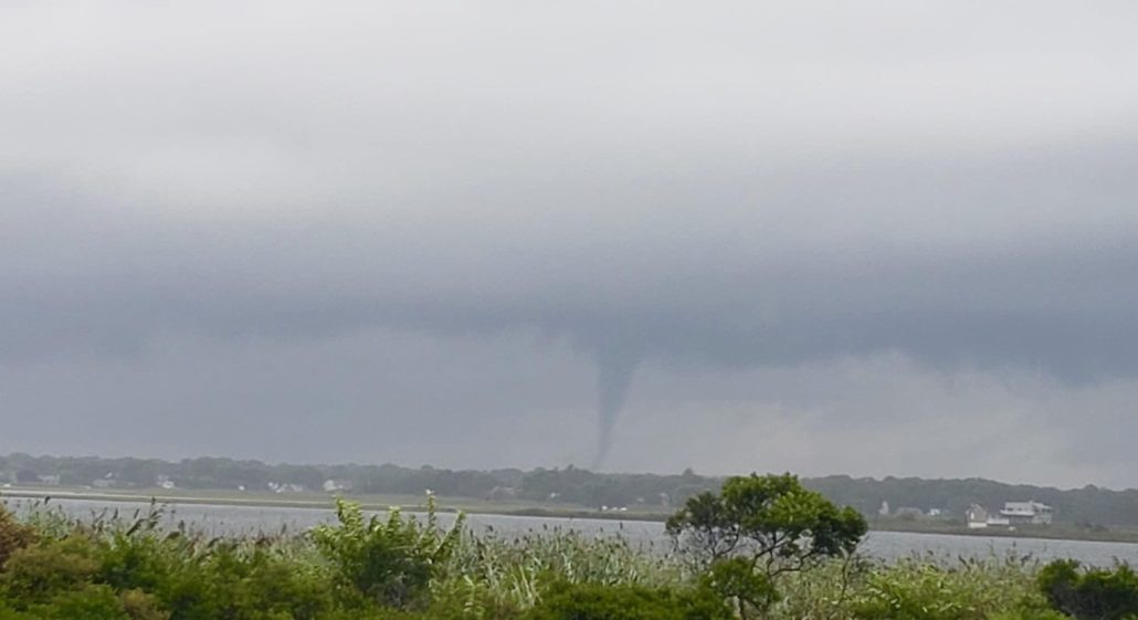
Radar imagery at the time of the tornado showed a Tornado Debris Signature, or an indication of strong rotation and debris being lofted into the air. The very same complex of storms also produced a larger waterspout off the coast of Fire Island just one hour earlier.
The Storm Prediction Center had placed the area in a “Marginal Risk” for severe weather earlier in the day, noting the presence of ample atmospheric wind shear. August and September are active severe weather seasons on Long Island, when ocean temperatures are at their warmest.
On Monday, instability in the atmosphere was somewhat low but ample wind shear existed for rotating thunderstorms. The instability and wind shear were able to juxtapose on Long Island – where low level wind shear was enhanced further – to produce the waterspout and tornado.
Leave a Reply
Want to join the discussion?Feel free to contribute!