-2")

Weekly Planner: Coastal storm will sit menacingly offshore
“He’s just standing there…menacingly”, is most likely what we will be repeating this week as a coastal storm forms off the East Coast. Forecast models are in good agreement that the system will develop during the early to middle part of the week, perhaps taking on subtropical characteristics a few hundred miles off the East Coast.
Before that occurs, though, we have a frontal boundary to deal with. Clouds will increase on Sunday, with showers and drizzle possible by the afternoon and evening. These showers are likely to persist on Monday, particularly during the afternoon hours when a frontal boundary slides eastward toward the coastline.
Some improvement is possible for periods of time through Tuesday morning, but conditions will go downhill again shortly thereafter.
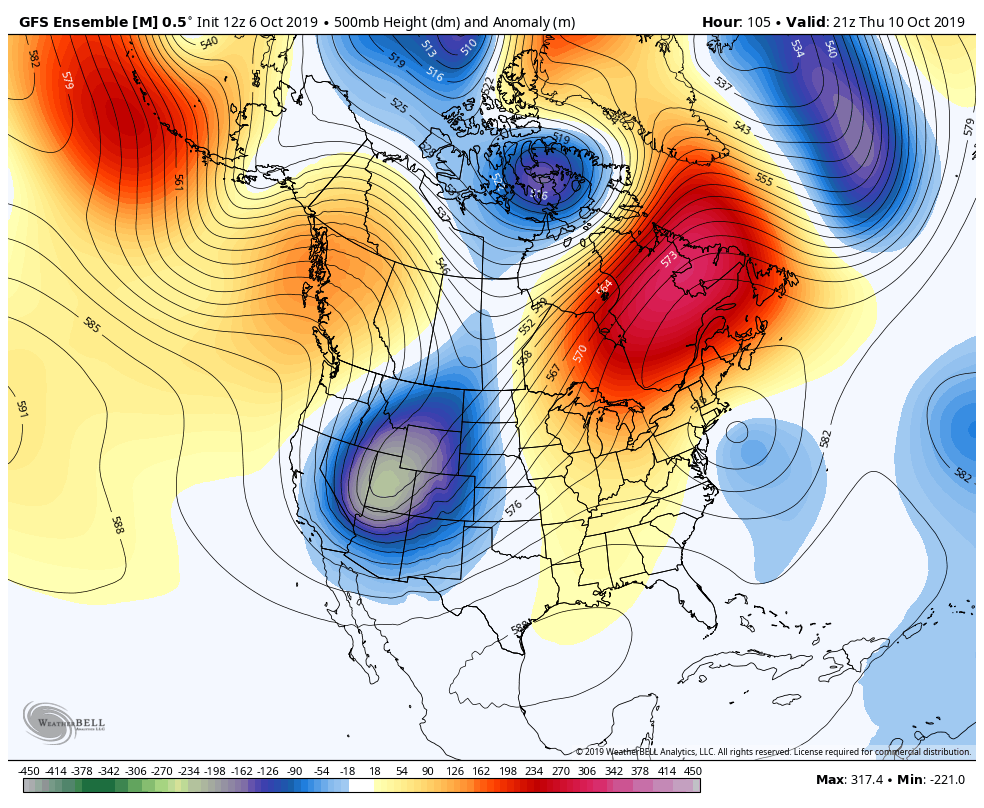
A blocking high pressure is to blame
The root cause of our issues this week will be a large and anomalous high pressure to our north, over Eastern Canada. You’ll often hear us refer to these high pressure areas as “blocking” highs or ridges. They are aptly named for their tendency to block the movement of other systems and slow down the atmospheric flow.
This one will be no different. The high pressure forming over Eastern Canada will effectively block the northward movement of the coastal storm that forms this week, prolonging the effects along the coast.
The good news, for most of us, is that the storm will remain well offshore. This will help to limit the overall effects. Still, areas along the coast could see a few days of sporadic rainfall and onshore flow. This will lead to coastal flooding and beach erosion in some areas.
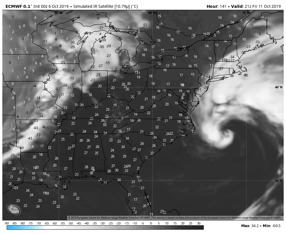
The exact track and intensity of the storm will be important in determining impacts along the immediate coast. Our suggestion is to expect unsettled weather near the coast, but stay tuned for further details and specifics as we move into the early part of the work week.
The weather pattern will likely support a continuation of relatively cool (no heat waves, finally) and active weather over the next two weeks.
Trackbacks & Pingbacks
2fifty-eight
Leave a Reply
Want to join the discussion?Feel free to contribute!