-2")

Another messy winter storm expected from Monday into Tuesday
One common thread running through all of our winter storm threats so far this season has been mixed precipitation types. An upcoming storm, expected to impact the area from Monday into Tuesday, is likely to be no different. Precipitation may begin as snow, but will then change to a mix of sleet and freezing rain before turning to plain rain on Tuesday.
The storm systems journey begins in the Central United States, with a low pressure center moving northward towards New England early next week. The system will be mostly driven by a process known as warm air advection, or the movement of warm air throughout the atmosphere.
Warm air advection can be an effective way to form precipitation, and in fact it has often been associated with some of the stronger bands of wintry precipitation in the past. However the process also brings forward great challenges – as the atmospheric column is often warming while precipitation is forming.
On Monday afternoon, forecast models agree that precipitation should begin to expand throughout the Mid-Atlantic. Periods of snow are possible in Pennsylvania and may move towards New Jersey by the afternoon and early evening. Uncertainty is quite high in regards to how much snow falls, as the antecedent airmass won’t be very cold and the warming atmospheric column could lead to a quick transition to a wintry mix.
When warming occurs aloft (a few thousand feet above our heads) snowflakes either cannot effectively form, or are melted as they fall to the surface. Sometimes they will refreeze on their way down (sleet) and other times they will freeze on a cold surface (freezing rain). Both of these are possible on Monday afternoon and evening.
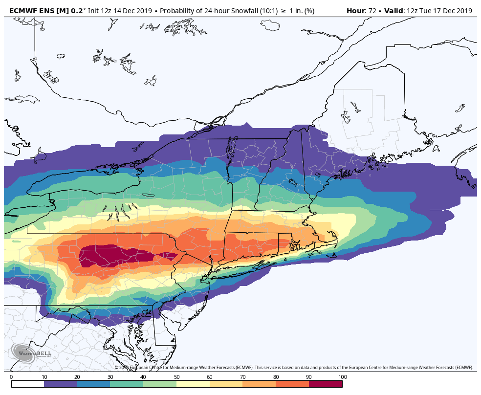
Uncertainty with bands of snow on Monday
A few forecast models are suggesting the potential for a heavier band of snow associated with warm air advection and focused along a frontal boundary on Monday. This could lead to dynamic cooling, where heavy precipitation rates cool the atmosphere and allow snow to fall. If this does occur, a band of 1-3″ of snow would be possible from Eastern PA into parts of New Jersey.
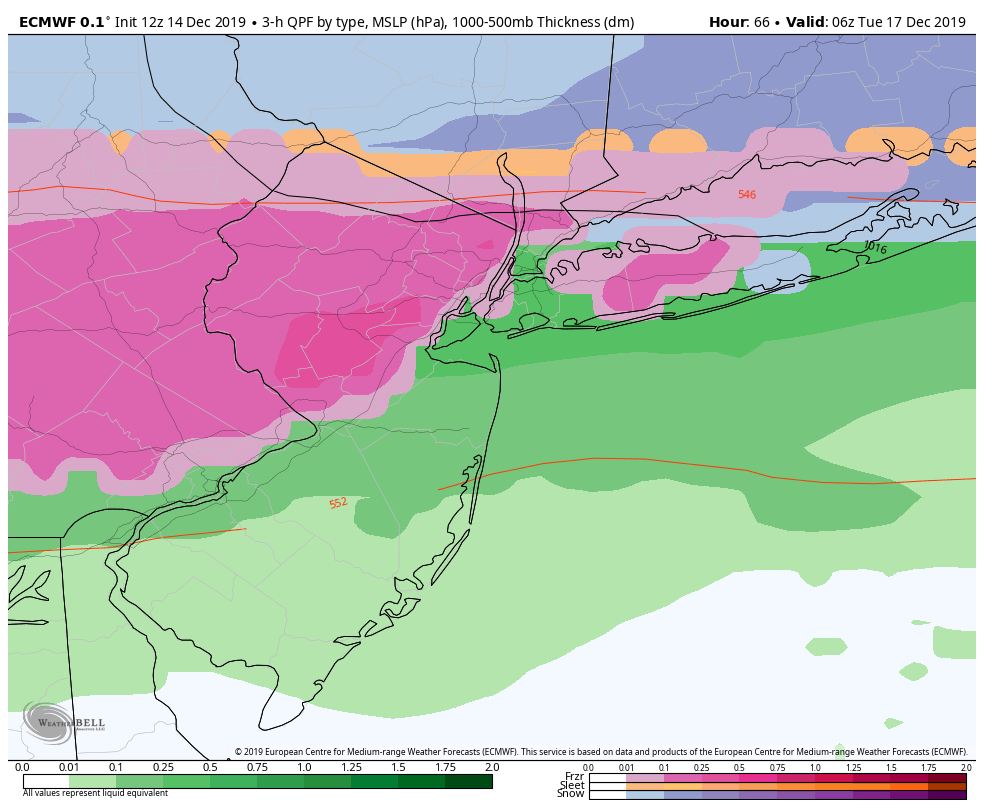
Otherwise, after beginning as snow, precipitation is expected to quickly change to a wintry mix and then plain rain. This will occur first near the coast and will be slower to occur inland – which is quite typical for these types of storm systems.
Wintry precipitation looks likely to begin by the mid afternoon on Monday, with the best potential for a band of snow in the aforementioned areas between 5:00 and 7:00pm. Thereafter, precipitation should transition to rain near the coast, but sleet and freezing rain may continue across the interior until 6:00am on Tuesday. Eventually, precipitation will change to plain rain everywhere.
Highlights and recommended preparation
This will be another tough forecast and it will be important to monitor temperatures and observations leading right up to the event. With that being said, here’s how we currently see the event playing out across the area:
Monday 4:00pm: Precipitation spreads into PA and NJ and may begin as snow in some areas. A transition to sleet and freezing rain will occur rather quickly in Southern PA and Central NJ
Monday 7:00pm: A band of heavier precipitation may form in Eastern PA and Northern NJ, perhaps including NYC. This could result in light snowfall amounts if the precipitation rate is heavy enough
Monday 9:00pm: Precipitation changes to sleet and freezing rain, and then plain rain near the coast. Freezing rain continues across the interior
Tuesday 2:00am: Freezing rain may continue across the interior leading to very icy conditions. Plain rain near the coast and in the immediate suburbs of NYC
Tuesday 6:00am: Freezing rain is relegated to the higher elevations and interior while a damp, cold rain persists across the rest of the area
Tuesday 4:00pm: Drizzle and light precipitation finally ends
Stay tuned for further details and updates as we move closer to the event. As is often the case with these wintry mixed precipitation events, changes and tweaks can be expected to the forecast.
Leave a Reply
Want to join the discussion?Feel free to contribute!