-2")
Saturday Soaker, Light Mix Monday?
Good evening and Happy Friday!
Today has been another gloomy and cool Friday across much of the Mid-Atlantic and Northeast as out next system gradually approaches from the south. Increasing mid-level flow from the southwest has lead to a warmer and more moist air working its way into the region, with clouds on a steady increase during the afternoon hours. Despite the increasing cloudiness, temperatures have been able to reach into the middle to upper 40’s across the entire New York metro area. This is anywhere from 10-12 degrees above-normal for early January.
Clouds will continue to thicken during the evening and overnight hours as more moist air begins to stream northward ahead of a large cut-off low over the Southeastern states. It appears that any showers for the metro area should hold off until the early morning hours of Saturday, but southern portions of New Jersey could see some light to moderate rain begin to overspread the area by 11pm-1am. With thickening clouds, a mild mid-level airmass, and an approaching storm system, temperatures will only fall just a bit after sunset. Lows will only be able to reach back down into the middle to upper 30’s before southerly winds begin to cause an increase in temperatures overnight into the upper 30’s and lower 40’s.
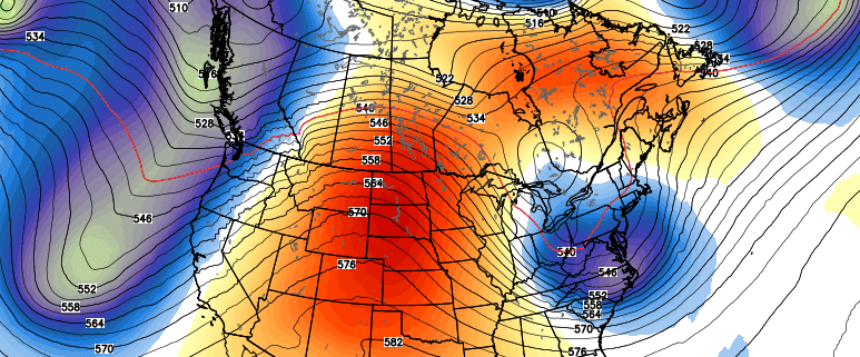
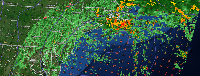
This evenings regional radar mosaic showing a large upper level low approaching the Mid-Atlantic this evening
Soaker of a Saturday Incoming, Improving Conditions on Sunday
As the large upper level low located to our south begins to slightly become more organized Friday night and into Saturday, a surface low pressure system will begin to develop near Norfolk, Virginia. As this low begins solidify, a large area of steady rain should begin to overspread the entire New York metro area by 5-7am. The surface low pressure located to our south will help to direct a deep moisture feed directly into the area, likely causing a heavier batch of rain to move through around 8-10 am. While dynamics aren’t too impressive with this system overall, we could still see some localized areas of very heavy rainfalls with even a rumble of thunder mixed in–especially over portions of Long Island. As we head into the late morning and early afternoon hours on Saturday, the surface low pressure should then track off of the Southern New Jersey coast pushing the vast majority of the remaining heavy rainfall off the Mid-Atlantic coast. Additionally, highs will be once again be stuck in the lower to middle 40’s across much of the area, with upper 40’s possible along the coast.
Due to less-than-impressive dynamics and the potential for some dry air to get involved at the mid-levels of the atmosphere, the remaining precipitation on the western edge of the low should be more “showery” in nature-with drizzle possible as well. While occasional light to moderate rainfall is likely into the afternoon hours, the overall intensity should be greatly reduced when compared to the morning. These dreary conditions should last well into the evening hours, with the chance at some breaks in the precipitation before the main area of low pressure heads off to the north and east. The rain will finally tapper off from west to east Saturday night, with conditions quickly improving as this system pulls away. Expect breezy conditions and temperatures falling back down into the lower to middle 30’s for much of the area.
Sunday will be much more calm, with stout northwesterly flow overspreading the entire Northeast. Breezy and cool conditions are to be expected for much of the day as an area of high pressure begins to push southeastward from Canada. Additionally, high temperatures will also reach back into lower to middle 40’s, with middle to upper 30’s off to the north and west of the city. Calm conditions and clearing skies will last well into the evening and overnight hours as high pressure continues to build into the area. Conditions will be quite ripe for radiational cooling to take place Sunday night, with lows dropping into the lower to middle 20’s for the majority of the metro area, with teens even possible for NW NJ and SNY.
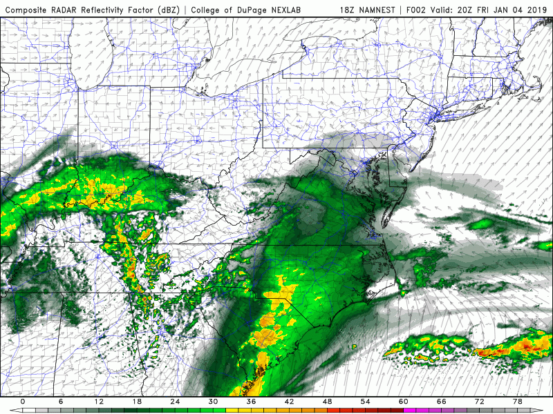
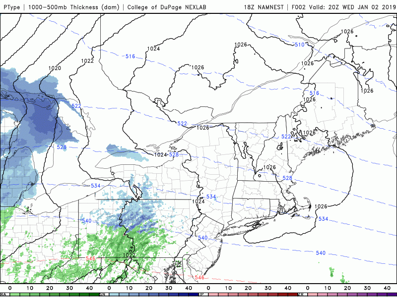
This evenings hi-res NAM model showing the evolution of the storm system later this evening and into Saturday night
Light Mix Possible Monday Night, Above-Normal Temps Continue Into Next Week
A large mid-level ridge will be over much of the East Coast on Monday, leading to cooler temps and relatively calm conditions, however our next system will not be far behind.
Another large, but disorganized area of energy will be over the Northern Plains by Monday afternoon, likely resulting in a sizable amount of mixed precipitation breaking out over the Midwest. Model guidance over the past day or so has become less organized with this upper level system, leading to a weaker surface reflection and much less precipitation overall. As this system likely begins to move through the Ohio Valley on Monday night and into the very early morning hours of Tuesday, the area of high pressure over the Northeast will begin to move offshore. As of right now there is a strong chance that the initial precipitation that moves through the Northeast will come in as a mix of snow, sleet, and freezing rain due to the residual cold air from the departing high pressure system. As we get into the day on Tuesday, all leftover precipitation should change to plain rain as warmer air from the south pushes into our area. At this time, chances of any significant impacts from wintry weather appear quite low.
Most of the reliable computer model guidance have the upper level system responsible for this system lingering over the Northeast through Wednesday, potentially producing another batch of light mixed precipitation over the Northeast, but it is much too early to talk about any specifics at this time.
We’ll continue to update you on both potential system over the coming days!
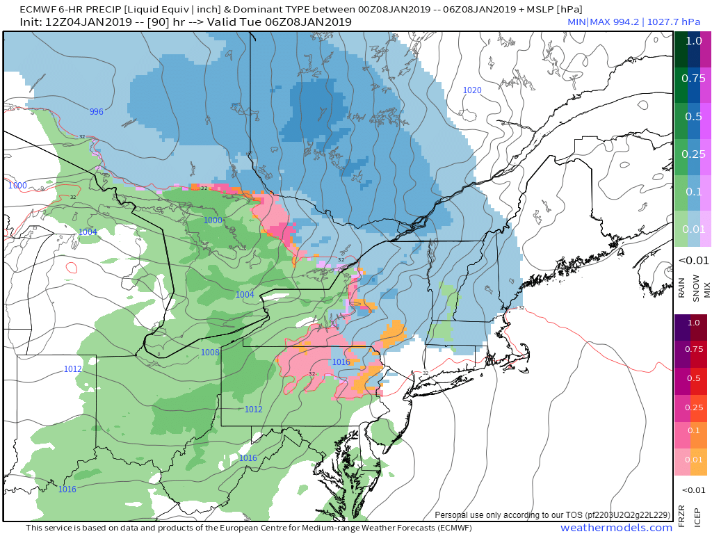
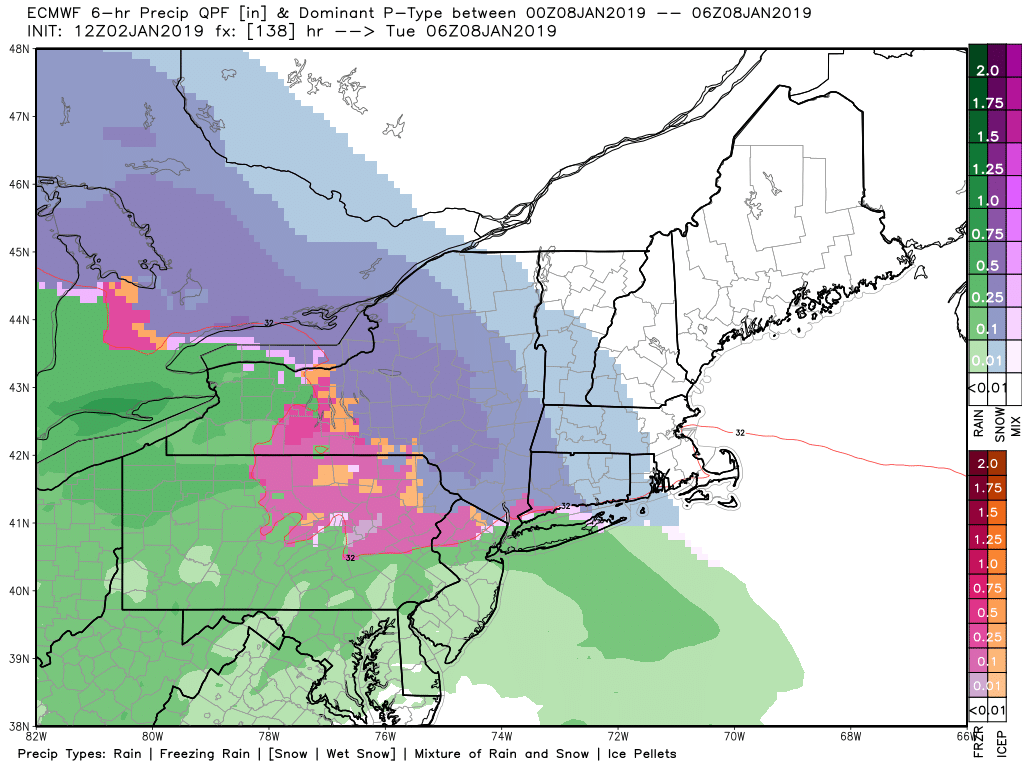
This afternoons ECMWF model showing the potential for some light mixed precip entering the Northeast on Monday night
Have a great weekend!
Steven Copertino