-2")

Cool and pleasant weekend, more rain early next week
Stop us if you’ve heard this before: More rain, and zero snow, is in the forecast.
We’ll start with some good news. Pleasant weather is likely to continue for the next few days, taking us through the weekend, as a cold high pressure remains in control. While it will be chilly, with temperatures below average for some periods of time, temperatures will eventually moderate. Plenty of sunshine is expected, with no hazardous weather through Sunday.
The next chance for impactful weather will come early next week. A storm system will eject from the Plains into the Great Lakes, with a low pressure system moving into New England. Without any mechanism to keep cold air in place, temperatures will warm up rapidly. Showers are likely from late Monday into Tuesday, with dreary conditions.
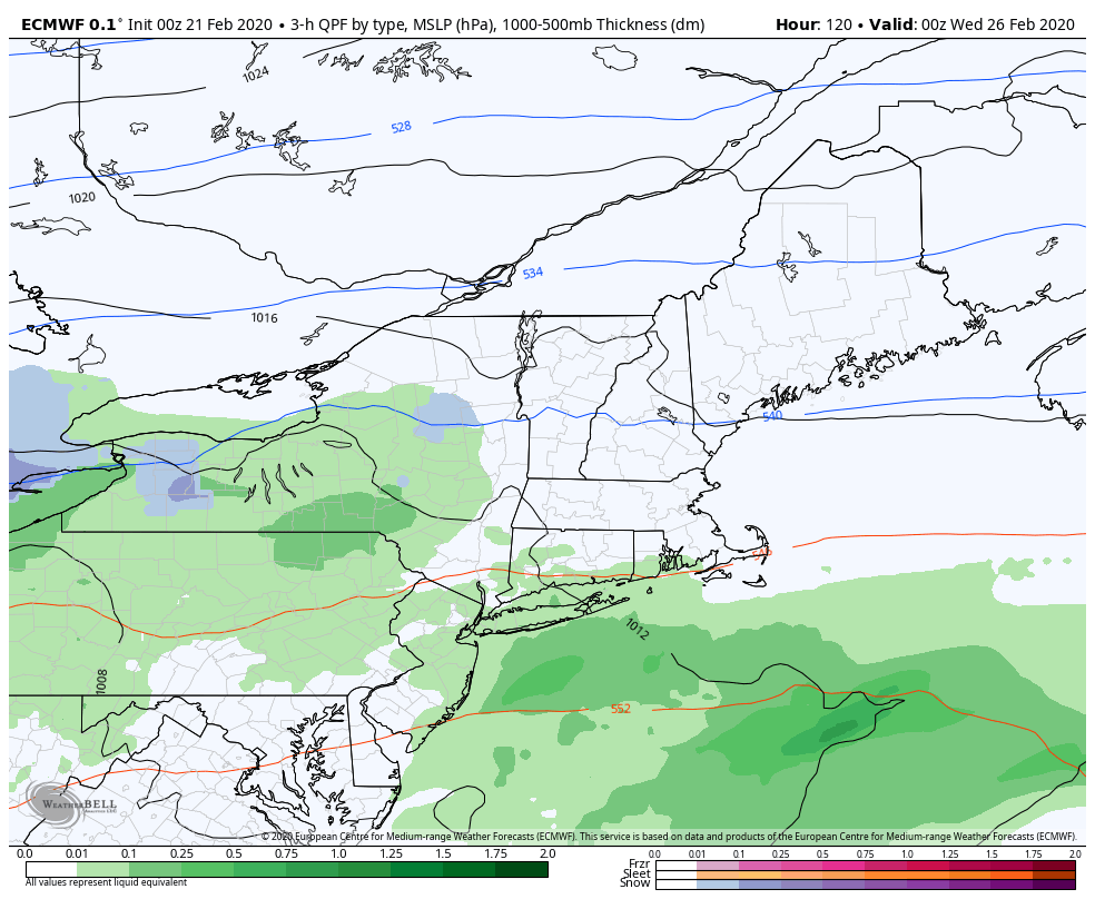
Unsettled weather conditions may persist through midweek, as a few disturbances track through the Mid Atlantic and New England. Again, temperatures will remain warm and there is little support for frozen precipitation anywhere – so expect more of the same song and dance that this winter has offered us so far.
After this storm system passes by the middle of next week, the weather pattern could feature temperatures near or slightly below seasonal averages for a period of time. But again, wintry weather precipitation chances look low. The nail in the proverbial coffin could come by early March, when forecast model guidance is already suggesting that ridging may develop along the East coast – promoting warmth and active weather conditions.
Stay tuned for more on the evolving weather forecast through the weekend, and more importantly have a wonderful Friday!
Trackbacks & Pingbacks
3heights
Leave a Reply
Want to join the discussion?Feel free to contribute!