-2")
The science behind sea breeze fronts
We have all been there before: A warm summer day is rudely interrupted by a sudden wind shift accompanied by cooler temperatures. Sometimes, clouds move in and sky conditions turn overcast. Other times, strong thunderstorms suddenly develop. No matter what the situation, a sea breeze causes a disruption in an otherwise pleasant and warm summer day. Originating from our local ocean waters, these temperature and wind shift boundaries are the center of many difficult forecasts.
There are several meteorological processes that lead to the formation of sea breeze fronts. In one way or another, almost all of them tie back to the sun. The sun, in all of its glory, heats up the earths surface during the late morning and early afternoon. Of course, heating effects on land and ocean are quite different. Unlike the ocean, the suns heat only warms the very top of the Earth’s land and soil. Since the grounds heat remains near the surface, it radiates upward much more quickly.
As this occurs, a localized “low pressure” occurs with warm air rising upward. Over the adjacent ocean waters, cooler and more dense air begins to sink downward and inland toward the land masses. It is able to undercut the less dense, rising warm air over the land, and form a sharp temperature boundary. This boundary begins to move inland and creates the sea breeze front. Many times, this same air rises and then begins circulating toward the ocean again.

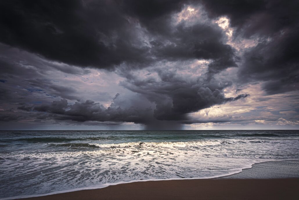
Sea breeze fronts can also serve as highways for the development of thunderstorms. Many times, the atmosphere will be unstable due to the heating of the sun on land. On many days, instability can go untouched due to a lack of lifting mechanisms in the atmosphere to force the development of thunderstorms. The sea breeze boundary and the associated lift can force the development of thunderstorms right along the boundary itself. These storms are often intense as they tap into the aforementioned instability.
The sea breeze’s nighttime secret
After the sun sets, the sea breeze process actually reverses! You may not notice it, but the process completes its cycle in a totally opposite manner. This is known as a “land breeze”. These occur when the lands temperature during the evening is cooler than the surface of the ocean. This commonly occurs in the fall and winter, when ocean temperatures are still fairly warm relative to their surroundings and the nights are cool over land.
The land temperature falling below the ocean temperature results in an increase in the air’s density. Gravity pulls this air downward and spills it over the water. The air undercuts the lighter and warmer air near the water, forcing it up into the atmosphere and forming a weak low pressure system. So while the summer time sea breeze may be most disruptive, the process is actually ongoing occasionally at night as well.
The next time you notice a gust of wind and dropping temperatures near the water, imagine the atmospheric processes going on near and around you! And then pick up your towel and umbrella and head inland for warmer temperatures – and perhaps a drink.
Leave a Reply
Want to join the discussion?Feel free to contribute!