-2")
Warmer, humid pattern begins to settle in
Summer begins today, and the weather pattern is ready to join the party.
Forecast model guidance is in good agreement that a warmer and more active weather pattern will settle in to the area over the coming week. In fact, almost all guidance suggests that temperatures will average several degrees above normal in NYC for at least the next two weeks.
In the short term, warmth and humidity is already here. Temperatures this afternoon and evening will rise well into the 80’s, and the development of showers and storms will occur by this afternoon. Sufficient instability and moisture is present in the atmosphere for the development of thunderstorms that will be capable of torrential rainfall and lightning.
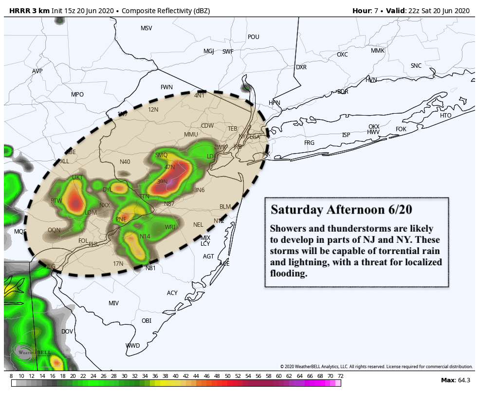
Wind shear, however, is lacking – which suggests two important things. First, thunderstorms will have trouble staying organized (we are not anticipating a severe weather threat as a result). Second, storms will move very slowly, suggesting the potential for localized flooding.
Keep an eye to the sky for the remainder of the day today, as thunderstorms could form rather quickly and produce lightning and heavy rainfall.
A transitional week lies ahead
Notable changes are expected to the weather pattern next week. The story begins in the Central United States, where a large ridge of high pressure is forecast to expand over the coming days. This will help advect warmer air from the Southern and Central United States towards the Great Lakes, Northeast and Mid Atlantic. As a result, temperatures will trend noticeably warmer in NYC during the next few days.
A temporary reprieve is forecast during the middle to latter part of the week, as a trough slides through Southeast Canada. This will lead to a period of storminess, with temperatures temporarily trending back towards normal from Wednesday through Friday. It remains to be seen if any severe weather threat will accompany this disturbance, but at bare minimum it looks to be active and unsettled.
By late week and into the upcoming weekend, temperature will be trending warmer once again.
Warmth and humidity, with little resistance
One of the hallmarks of this Spring’s weather pattern was resistance to the expansion of heat and humidity in New England. While much of the Central United States experienced heat, an active pattern of troughs and cutoff lows “deflected” the heat away from our area. That will change as we move toward next weekend and beyond.
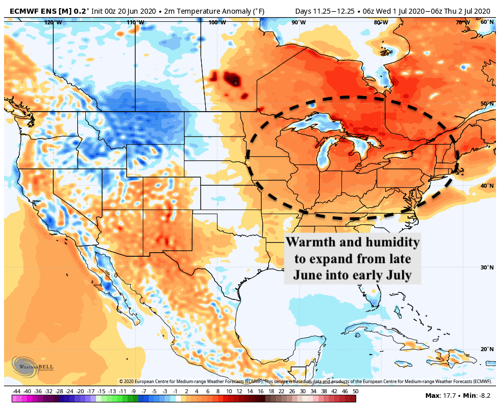
Almost all guidance agrees that ridging will expand dramatically across the Central United States, leading to widespread warmth and humidity expanding into the Northeast states. This will likely be the first period of the summer where it feels truly “oppressive” outside, with very warm temperatures and at least above normal moisture content.
The longevity of the pattern appears impressive, too – most guidance suggests that above normal temperatures will persist straight into the early part of July.
Trackbacks & Pingbacks
3sanscrit
Leave a Reply
Want to join the discussion?Feel free to contribute!