-2")

NYC Forecast: Unsettled weather likely to persist
Highlights: A temporary decrease in humidity occurs later today, but will be followed by the return of unsettled weather this weekend. Another upper level low may deflect heat from the region next week, and lead to an increasing chance of showers.
QuickCast
Hazards: None. All clear at the area beaches as well with a very low risk of rip currents.
This afternoon: Warm, less humid and more comfortable. A northwest breeze keeps things a bit more crisp than the past few days. Highs in the mid to upper 80’s.
Tonight: Clear and comfortable once again. Low temperatures generally in the mid 60’s.
Thursday: Cooler than the past few days, with a few isolated storms around. Highs in the lower to mid 80’s.
Detailed Forecast Discussion
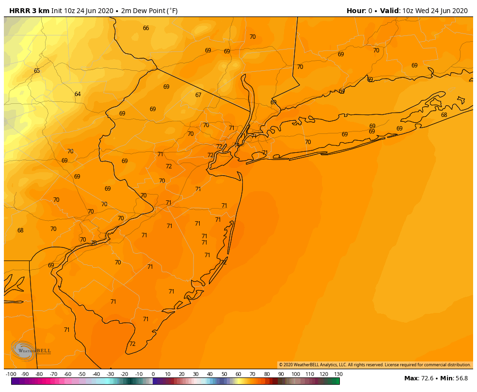
An unsettled and changeable weather pattern is expected to continue through the end of this week. A frontal boundary passes the area today, dragging in cooler air and northwesterly winds with it. This will be a noticeable change after several days of warm, southerly winds. Lower humidity is expected this afternoon and into this evening as a result.
Tonight (6/24): Expect a cooler evening, with lows in the 60’s. The most notable change will be lower dew points. Depending on your tolerance, you may be okay opening the windows with a bit of a westerly breeze expected.
Thursday (6/25): The coolest day of the week so far, highs will only reach the middle 80’s. Dew points will be lower and a westerly wind component will keep the air feeling at least slightly drier. A few isolated to scattered storms are possible again during the afternoon, mostly on the Seabreeze front in Central and Southern New Jersey. These may continue into the evening hours.
Friday (6/26): Temperatures begin to warm up once again and dew points increase. The airmass will feel very heavy and somewhat uncomfortable once again. High temperatures are expected to reach back into the upper 80’s, with the chance for a few isolated to scattered storms during the afternoon and evening hours.
Extended Forecast
Our area will be caught between two storm systems during the weekend, leading to varying but still unsettled weather conditions. Temperatures will be warm on both days, with highs in the middle to upper 80’s. Showers and storms are possible during the afternoon and evening hours. The best chance for storms currently looks to be Sunday, when a cold front sinks southward from New England.
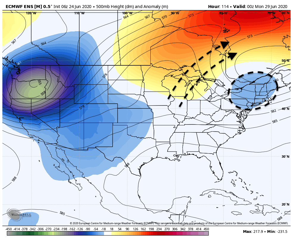
An upper level low is expected to drift southward from Canada next week. While the details of timing and intensity are uncertain, the position of the upper low should encourage a northeast flow, which would suggest cooler temperatures and a chance of showers through the middle of the week – with heat and humidity temporarily deflected away from the area again.
Leave a Reply
Want to join the discussion?Feel free to contribute!