-2")
PTC9 moves into Caribbean, tropical rains possible in NYC next week
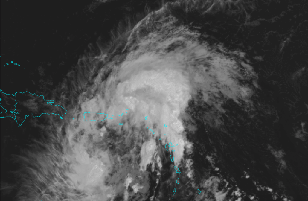
Potential Tropical Cyclone Nine (PTC9) has moved into the Caribbean today. The storm is expected to gradually strengthen into a Tropical Storm over the next 24-48 hours. Tropical moisture will also move up the East Coast next week, leading to the potential for heavy rainfall.
QuickCast
This evening: Pleasant and warm weather is likely to continue. Low temperatures will fall into the upper 60’s and lower 70’s.
Thursday (7/30): Partly cloudy conditions will persist, with high temperatures near 90. Expect the chance for a few isolated storms, but hazards should be limited overall. The chance for isolated storms main continue into the evening.
Friday (7/31): Pleasant conditions will continue, with temperatures a few degrees cooler than the past several days. Expect light winds and less humid weather.
Forecast Discussion
Pleasant weather conditions are expected to continue tonight. A few isolated to scattered storms are possible on Thursday, but coverage is expected to remain quite low. The chance for storms could persist into the evening hours and then is expected to decrease by Friday morning. Temperatures will trend notably lower by Friday, with highs only in the middle to upper 80’s. Overall weather hazards are expected to be quite low through the weekend.
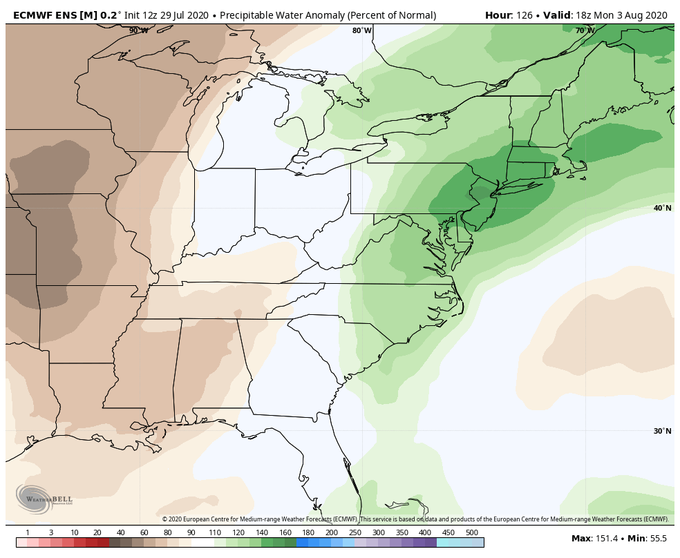
The weather will become more active later this weekend, when tropical moisture moves northward along the East Coast. A persistent trough to our west and ridge in the Western Atlantic will act as a highway for moisture, including the potential for showers and thunderstorms each day.
This moisture may eventually be enhanced by Potential Tropical Cyclone Nine, which is currently traversing the Caribbean. The track of the system remains uncertain – especially given that a closed center of circulation has yet to form. Regardless, moisture from the storm could make its way up the East Coast, which would obviously exacerbate rainfall problems next week as well.
Ensemble data is in good agreement that next week will feature above normal precipitation in the NYC Area. While the details remain murky, expect the potential for showers and thunderstorms each day, including the possibility of localized flooding with persistent tropical moisture in the area.
Trackbacks & Pingbacks
1good-for-nothing
Leave a Reply
Want to join the discussion?Feel free to contribute!