-2")
Tropical Storm Isaias forms, could impact Florida this weekend
Tropical Storm Isaias formed on Wednesday evening, and will continue a track through the Caribbean over the next few days. The system could eventually impact parts of Florida this weekend. This is the earliest than an ‘I’-named storm, or 9th-named storm, has formed. Records date back to 1851.
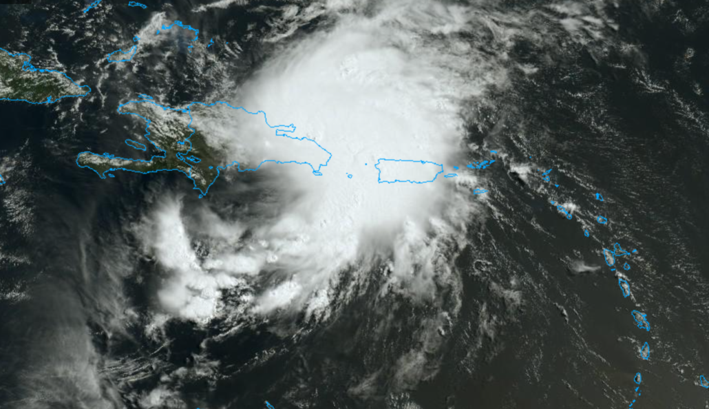
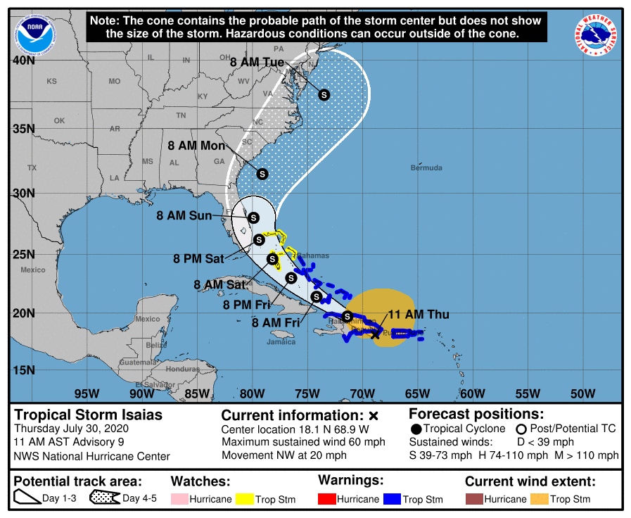
11:00am Thursday: The National Hurricane Center placed Isaias south of the Dominican Republic, with maximum sustained winds of 60 miles per hour. The storm has strengthened in the last 12 hours. Isaias is forecast to continue northwestwards, making landfall in Hispaniola sometime today.
Eventually, the circulation will re-emerge in the Bahamas, to the north of Cuba, on Friday and Saturday. Isaias is quite large. Tropical Storm force winds extend out 345 miles from the storms center, mainly to the northeast.
Track and intensity uncertainty remains high
Forecast model guidance has struggled to pin down the details of Isaias’ eventual track. The system has been slow to form a center of circulation until this evening, and model guidance has fluctuated as to where the storm will track over the next 24-48 hours as a result.
A tropical systems strength has a major impact on how the storm is steered by low and mid level winds in the atmosphere. When storms are disorganized (open waves), forecast models can often have difficulty discerning what the dominant steering mechanism will be.

A critical moment in Isaias’ life will come as the storm passes near Hispaniola today. The official NHC forecast takes the storm directly over some of Hispaniola’s most rugged terrain, which has been known to “shred” the circulation of tropical systems. Any deviation in this track could lead to the system remaining more consolidated.
Assuming Isaias remains organized after passing Hispaniola, the storm will re-emerge into the Bahamas and have a chance to reorganize. Eventually, most guidance suggests that the storm will make a close approach to Florida and the Southeast US coastline this weekend.
Impacts in NYC are possible, but could be indirect
Assuming Isaias stays alive on its trek towards Florida, the system is then eventually forecast to turn northward. The NYC Area may eventually become “sandwiched” between a trough to our west and ridge to our east, with moisture from Isaias surging northward. The result would be the potential for heavy, tropical rainfall early next week.
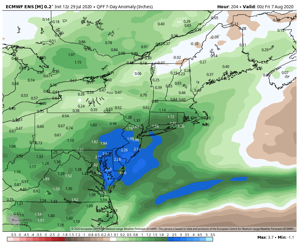
The details of this scenario obviously remain uncertain, but ensemble guidance has been hinting at the heavy rainfall potential over the past few days. With abnormally high moisture content, it would not take much to cause heavy rainfall and flooding issues in our area should this scenario play out.
For now, we will have to watch and wait as Isaias plays out. The system has a long and difficult road ahead of it as it makes its way through the Caribbean over the next few days.
Leave a Reply
Want to join the discussion?Feel free to contribute!