-2")
Laura strengthening, will approach Texas coast as a major hurricane
Laura was upgraded to a hurricane this morning, per the National Hurricane Center, with maximum sustained winds of 75mph. The storm is tracking northwest into the warm waters of the Gulf of Mexico. It is expected to strengthen considerably over the next 24-36 hours and approach the Texas coastline as a major hurricane.
The forecast track of Laura has shifted slightly to the left over the past 24 hours. This puts the Galveston and Houston metro areas closer to storm, raising significant concern for impacts in those regions as the storm comes ashore.
Latest observations and trends
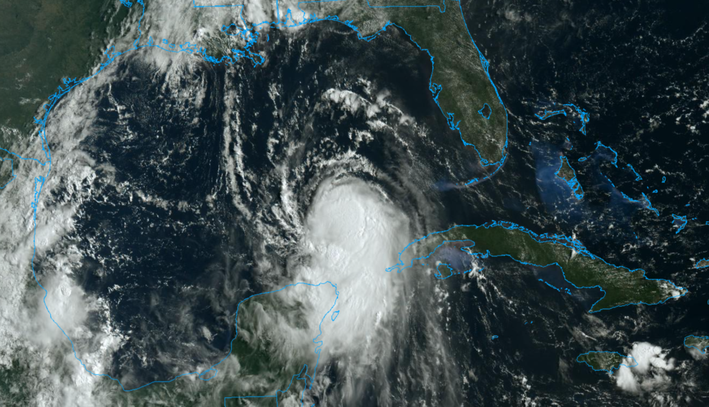
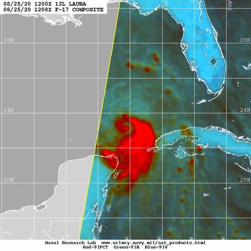
Laura is displaying signs of increased organization this morning, with convection wrapping around the center of the storm. Visible and infrared satellite imagery suggest ncreasingly coherent inner core. Northerly shear continues, but deep convection has begun to wrap around the storms center. Pressure is dropping and is expected to continue to fall through the afternoon.

The most recent recon missions into the storm suggest that the vortex may still be ever-so-slightly tilted as a result of northerly wind shear. Vortex tilting is not uncommon, especially for storms emerging from interactions with landmasses or undergoing wind shear. Nevertheless, it is when the low/mid level vortex’s become stacked that the system could begin to intensify rapidly. We will be carefully watching for that throughout the day.
Laura is in the process of moving over very warm waters in the Gulf of Mexico, in an environment characterized by low atmospheric wind shear. This should promote continued organization over the next 24-36 hours. The National Hurricane Center is forecasting rapid intensification, with the storm reaching Category 2 strength later on Wednesday.
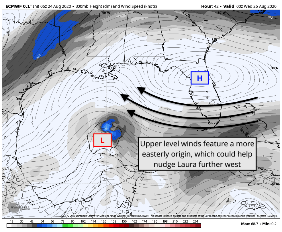
In the short term, Laura has once again been tracking to the south/west of model forecasts. This is a trend that has been consistently observed over the past 24-48 hours. Northerly wind shear is likely causing downshear convective development and organization, readjusting the storms low level center, which model guidance is handling very poorly.
In the next 12 hours or so, Laura will continue to traverse warm waters in a low shear environment. Organization should be steady to start, but may pick up in speed by tonight. The storm may cross a cooler eddy over parts of the Central Gulf tonight/tomorrow morning that may temporarily limit intensification, but it will then emerge back into warm waters shortly thereafter.
Major hurricane will target Texas coast
All global models and ensembles agree that Laura will target the Texas coastline as a major hurricane by the middle of this week. The forecast track has shifted slightly to the left over the past 24 hours, which puts areas like Galveston Bay and the Houston metro area in a precariously close position to the storms track.
Overnight EPS and GEFS ensembles both shifted slightly west, with a growing cluster of ensemble members tracking Laura close to Galveston Bay as a major hurricane. This trend has persisted for the past 24 hours – and is likely not unrelated to the short term trends of the storm verifying to the south/west of model positions.

The main uncertainty with Laura’s track continues to relate back to its strength, and the steering of the storm as it moves over the Gulf of Mexico. Yesterday, we broke down the differences in model guidance as it relates to the systems strength. A stronger Laura, trending further southwest over time, is less susceptible to wind shear – and also is steered more westerly by the upper level/enfironmental winds.
A weaker Laura, drifting more northerly, would be steered more directly by the lower/mid level atmospheric winds – guiding the storm closer to the LA/TX border. This appears to be a more unlikely scenario at this time. As mentioned, Laura has repeatedly verified to the south and west of short term model solutions and is now showing signs of increased organization.
The westerly leaning models, which suggest Laura could strengthen and approach the TX coast as a major hurricane, should be weighted more heavily in the forecast moving forward, especially with more recent runs of the EPS and GEFS suite both leaning in that direction.
With that being said, our suggestion is to continue to follow the official National Hurricane Center forecasts when making decisions.
Life-threatening conditions possible as Laura approaches the coast
As Laura approaches the Texas coastline, the storm is expected to feature a myriad of life-threatening and potentially catastrophic hazards. These will include, but will not be limited to: Destructive winds, life-threatening storm surge, torrential rainfall, and tornadoes.
Residents along the entire Texas coastline are urged to make final hurricane preparations today as the storm system begins to develop in the Gulf of Mexico. Evacuation orders have already been issued for some areas like Galveston – and may be expanded later today.
There are a few important steps that you can take to help you and your family prepare:
- Develop a hurricane plan and discuss it with your family. Know where you will go, what you will bring, and how you will get there if and when the time comes that you need to move.
- Have a hurricane kit handy. This includes essential tools, non perishable foods, and supplies.
- Know your flood zones in your local area. It is critically important to know which areas will flood first and how you should react.
- Know your evacuation routes. Research the routes and understand how you will need to get there if an evacuation is ordered.
- Check official sources for weather information – most importantly, the National Hurricane Center and your local governments.
Our friends at Space City Weather are focused specifically on impacts to Houston. We strongly suggest following their blog posts for information if you live in the Houston area.
Thanks
Great blog John, thanks