-2")
NYC Forecast: Pleasant weekend, rain from Delta early next week
Briefing: Pleasant and warm conditions will continue this weekend, with plenty of sunshine. Temperatures will remain warmer than normal throughout the Northeast, especially on Saturday. Unsettled weather will return to the area early next week, as moisture from the remnants of Hurricane Delta moves up the East Coast.
NYC QuickCast
This afternoon: A cool start, becoming warmer during the afternoon. Highs in the upper 60’s. Partly cloudy with a light breeze.
Tonight: Cool, breezy and clear. Temperatures falling into the middle 50’s.
Saturday: Much warmer, with highs in the upper 70’s. Showers and storms are possible to the north of NYC, in New England, but these are not expected to reach the metro area.
Sunday: Sunny and pleasant to start. Becoming increasingly cloudy as the day goes on, with some showers moving in to the area later in the evening.
Forecast Discussion: Pleasant weekend, remnant of Delta approach next week
The weekend will begin with increasingly warm temperatures, as a southwesterly flow in the mid and upper levels of the atmosphere helps to advect in warm temperatures. Temperatures on Saturday will average several degrees above normal. High temperatures are expected to reach the upper 70’s.
To the north of NYC, a strong disturbance will evolve throughout New England on Saturday afternoon. A notable mid level jet streak will slide through New York, Vermont and New Hampshire. Meanwhile, weak instability could help to support another threat for strong winds. The Storm Prediction Center has placed parts of New England in a Level 1 (Marginal) Risk for severe thunderstorms as a result.
Aside from the thunderstorm threat, Saturday looks like an excellent day to check out fall foliage which is now peaking in New York State. Peak colors are quickly working southward through the Catskills and towards the Hudson Valley.
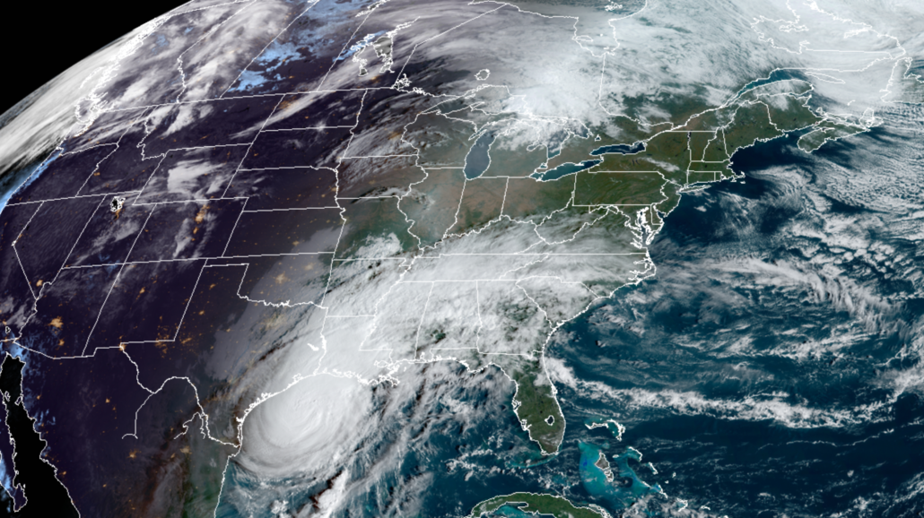
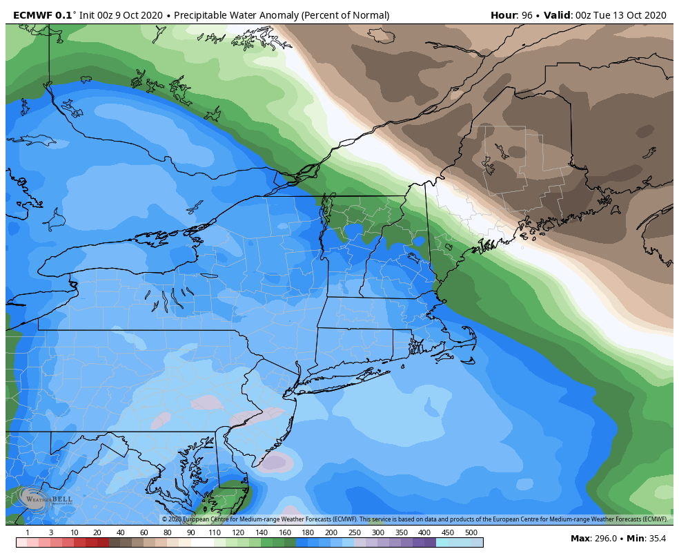
Here in NYC, conditions will be warm and pleasant. That very same front will slowly sink southward, but it will eventually be slowed by the approaching remnants of Hurricane Delta. The tropical system, which will make landfall in Louisiana today, will slide towards the East Coast and bring tropical moisture with it.
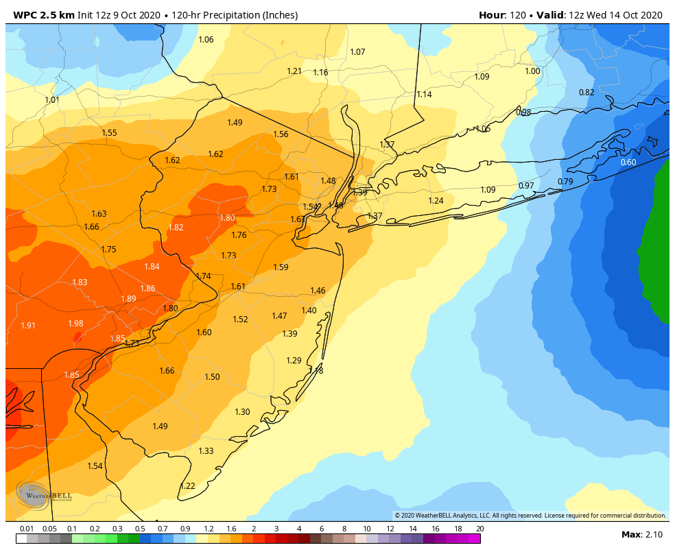
Steady and occasionally heavy rainfall is likely on Monday. Ensemble guidance suggests the presence of anomalous tropical moisture and impressive lift – both strongly suggesting that rain will be widespread. Most ensemble guidance suggests rainfall totals will range from 1-2″ areawide. A localized area of 2″+ potential will exist near and along a frontal boundary, from Southeast PA into NJ and parts of the NYC Metro.
Rain is expected to continue through Tuesday morning before the system clears out of the area. Improving conditions will then return by the middle of next week with cooler temperatures. The weather pattern looks rather benign with minimal hazards from the middle to end of next week.
Trackbacks & Pingbacks
2suggest
Leave a Reply
Want to join the discussion?Feel free to contribute!