-2")
NYC Forecast: Pushing through the fog
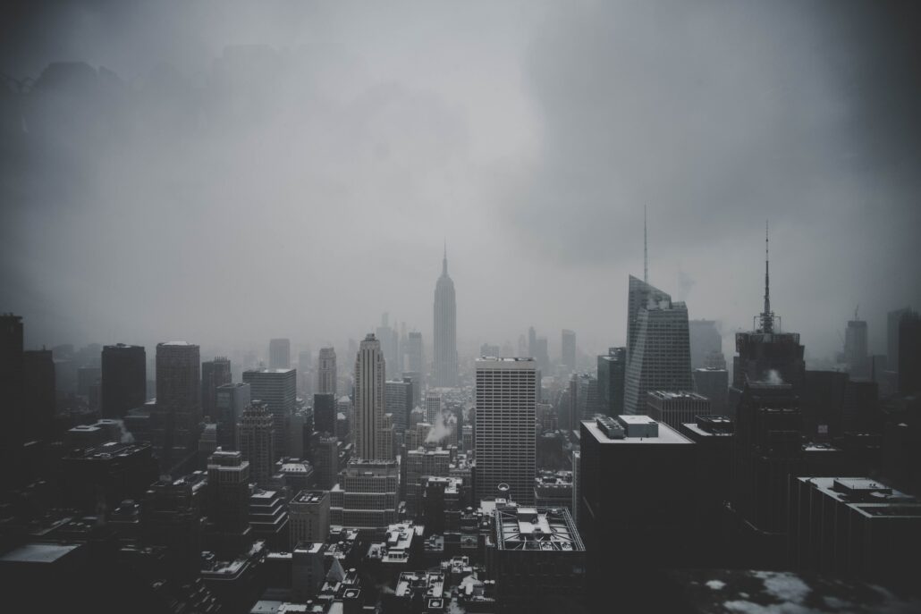
Fog has settled in to the area again today, and is expected to gradually lift this afternoon. It has been slow to do so, but some breaks in the clouds have been observed on visible satellite imagery. Unseasonably warm and humid weather will follow once the clouds break, with high temperatures in the lower 70’s. The fog will return tonight, with dreary and showery weather on Friday.
Fog has been the word of the week, with temperature inversions developing each morning and plentiful moisture leading to widespread low clouds. This afternoon will be a bit of an anomaly, as warmer temperatures and slightly drier conditions in the low levels of the atmosphere will allow for clearing.
Short term forecast models are struggling (big shock there) to properly handle the degree of low clouds. As a result, temperature forecasts are fluctuating by several degrees. Still, the expectation is that high temperatures will reach into the upper 60’s and lower 70’s by Thursday afternoon, especially Southern New Jersey as well as the urban corridor from Newark to NYC.
NYC QuickCast
Tonight: Warm and pleasant to start, increasing clouds by the mid evening hours. Low temperatures in the lower 60’s with areas of drizzle.
Friday: Foggy and dreary with areas of drizzle. Clearing is less likely than days prior. Highs in the mid 60’s with light easterly winds.
Saturday: Foggy and drizzly conditions early, improving by late morning. Highs near 70 with partly cloudy skies in the afternoon hours.
Sunday: The nicest day of the past few, but notably cooler. High temperatures only reaching the upper 50’s with a westerly wind direction.
How can we forecast the development of fog?
There are several ways for fog to develop. One of the most important things to know is that fog is a type of low cloud – very close to the surface. It is technically defined as a visible aerosol, containing tiny water droplets or sometimes ice crystals.
Forecasting fog can often be quite difficult, as it is heavily modulated by local geography. For instance, fog can develop more frequently near the ocean or bodies of water but often has trouble pushing over higher elevations or mountains. As you might imagine, this creates complications for fog forecasts in our local area (how far inland will fog move, etc).

Over the past few days, the forecasts for fog to develop during the evenings has been fairly easy. The forecast sounding pictured above shows a classic fog profile. There is a temperature inversion (rising temperature with height), plenty of low level saturation and moisture, and very light winds. In this situation, fog will almost always develop.
Forecast soundings throughout the area have this same “look” later tonight and Friday morning, as well as Saturday morning, with lots of moisture in the low levels and inversion to trap it there. As a result, we anticipate the development of more fog on both nights.
baran aydin
baran aydin
türk kahvesinin faydaları
bakkal acmak karlı mı
I’ve recently started a blog, the information you offer on this site has helped me tremendously. Thank you for all of your time & work. “Marriage love, honor, and negotiate.” by Joe Moore.
Hurda bakır alan hurdacı firması olarak her türlü madeni değerinde alıyoruz. Hurda alım satımında lider konumdayız.