-2")
NYC Forecast: Active, unsettled weather in the week ahead
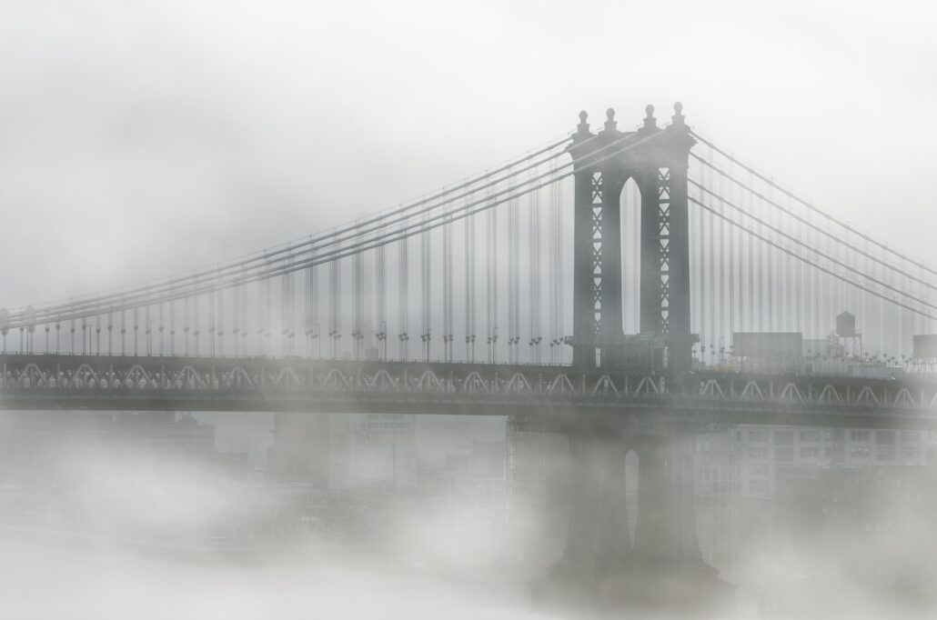
Did you miss the fog, drizzle and low clouds? We have great news! They are all set to return to the forecast in NYC this week. Showers and dreary weather are expected almost every day beginning on Monday. Multiple rounds of low pressure will bring additional rainfall to the area through Thursday, with fog and dreary conditions in between.
The forecast is quite complicated, and driven by multiple disturbances embedded within the atmospheric flow. This results in a low confidence forecast overall, as model guidance struggles with the timing and intensity of individual perturbations. Still, there is a good bit of certainty that the week will be unsettled and unpleasant as a whole.
Showers start Monday as a weak coastal low forms
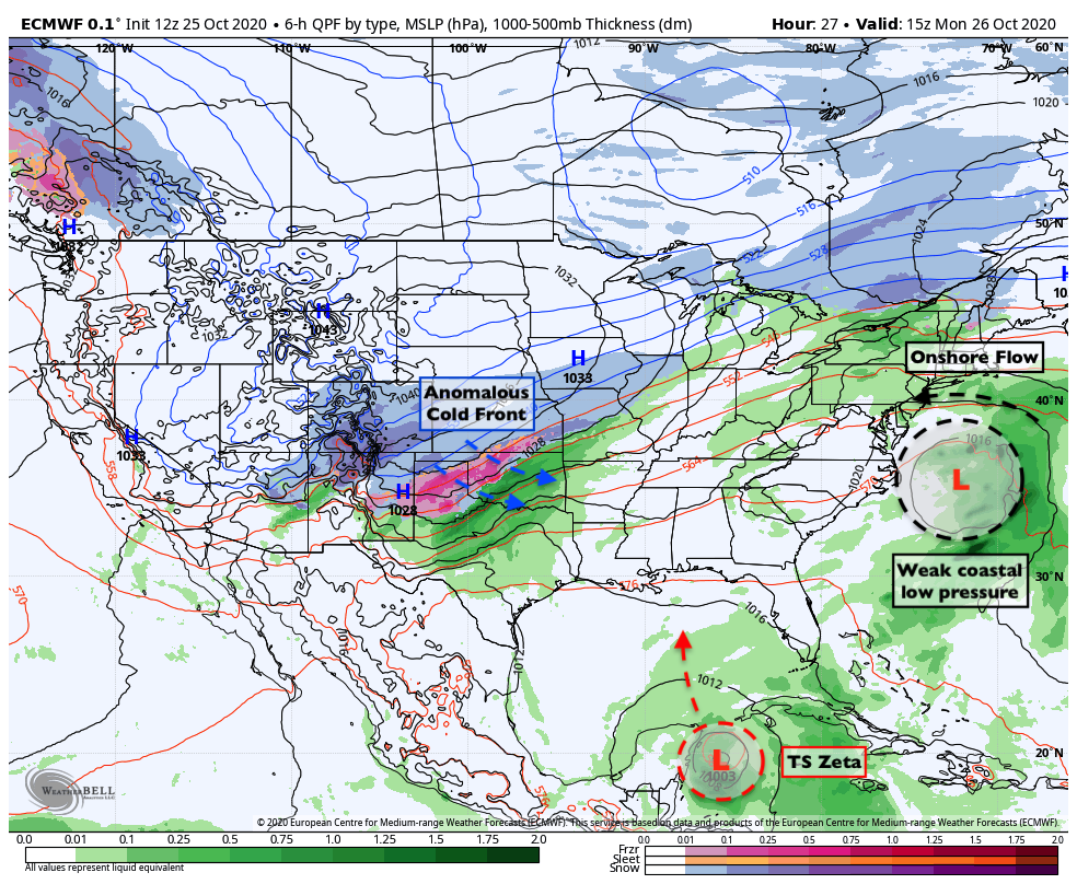
The trouble begins on Monday when a weak low pressure system forms off the Mid Atlantic coast. Low pressure is expected to develop gradually, with an onshore flow developing during the morning and afternoon hours. This will lead to a thick deck of stratus clouds. Moisture in the low levels of the atmosphere will lead to drizzle and some fog in addition to scattered showers.
Temperatures will also remain quite raw – with highs expected to reach only the lower 60’s. Cool and damp winds out of the northeast will be persistent from the morning hours of Monday into the overnight period and Tuesday morning. The coastal storm will gradually shift northeast of the area on Tuesday.
All of this is occurring while an anomalous cold front is surging southward into the Plains states. Temperatures there will reach 30 to 40 degrees below normal in spots, with widespread winter weather. Meanwhile, Tropical Storm Zeta will move towards the Yucatan on Monday and then into the Gulf of Mexico. These two features will become keys to the forecast in the NYC Area later in the week.
Zeta and upper low will lead to midweek trouble
Tropical Storm Zeta will move northward into the Gulf of Mexico this week, eventually making landfall along the Central Gulf Coast. Moisture from the system will surge northward into the Tennessee and Mississippi River Valley by Wednesday and Thursday.
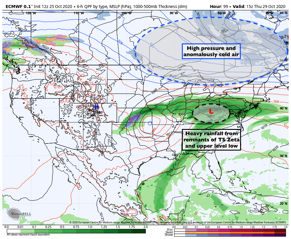
Meanwhile, the upper level system bringing anomalous cold and snow to the Plains will begin to shift eastward. Zeta will interact with this system, and impressive atmospheric dynamics will allow for areas of steady and heavy rain to expand northward. These rains will move into the Tennessee and Ohio Valleys first, and then gradually shift towards the Northeast and Mid Atlantic States.
Wednesday will be the one potential “winning” day of the week. We’ll be in between storm systems, with weak high pressure building in. While some fog and drizzle is possible in the morning, the majority of the day is expected to remain dry.
By later this week, ensemble guidance is in great agreement that areas of heavy rainfall will move into NYC once again. A new low pressure area will develop in the Ohio Valley, and baroclinicity will be enhanced between the developing low pressure and a strong high pressure to its north. This could lead to periods of heavy rain in the NYC Area on Thursday.
Winter weather possible in New England late this week
As the low pressure center begins to shift eastward, ensemble guidance is in good agreement that anomalously cold air will begin to seep southward from Canada. On Friday, the potential exists for the redevelopment of a coastal low pressure off the coast of New England.

The combination of the cold air seeping southward and the developing coastal storm system opens the door for winter weather potential in New England. Much of the threat will be modulated by how strong the storm system becomes – in other words, will it be amplified enough to send moisture and precipitation into the cold air in New England?
Latest runs of the ECMWF and ECMWF Ensemble seem to think so. Folks in Northern New England, particularly Central and Northern New York, Vermont and New Hampshire should have their eyes peeled for some wintry precipitation on Friday.
Eventually, this system will slide off the New England coast and all regional meteorologists will exhale and pour themselves a crisp drink for the weekend – which, as it stands now, is expected to be quite pleasant.
türk kahvesinin faydaları