-2")

Weekly Forecast: Cold start, trending much warmer
Anomalous cold and strong winds have highlighted the forecast today, but they won’t be here for long. As the week goes on, temperatures will trend above normal. Later this week and weekend, temperatures could reach as much as 20 degrees above normal, with high temperatures near 70 degrees in the NYC Metro.
Wind gusts over 40 miles per hour were common throughout the area today, and there are scattered power outages as a result of downed trees and power lines. Temperatures averaged between 10 and 20 degrees below normal, with highs in the lower to middle 40’s. Winds should begin to decrease in intensity as we approach sunset.
QuickCast Briefing: Increasingly warm this week with very little risk of precipitation other than a few showers on Tuesday morning. High temperatures approaching 70 by this weekend, with warmth continuing into next week.
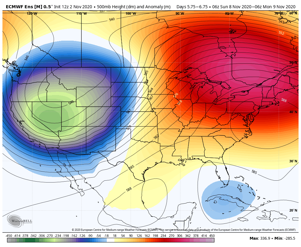
By the middle of this week, the storm system responsible for the anomalous cold will begin its shift away from the area. This will allow atmospheric heights to rise, with high pressure building in. Temperatures will gradually warm, with high temperatures eclipsing 60 degrees by Thursday.
The warmth will be dialed up even further this weekend. Ensembles are in great agreement that a deep trough will amplify in the Western United States, eventually reaching the Plains. As a result, ridging will also amplify rapidly along the East Coast. Near record-breaking heights are possible in the mid levels of the atmosphere.
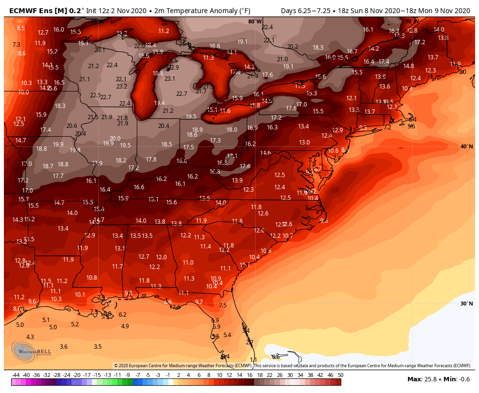
Temperatures from Thursday through the weekend could reach the upper 60’s and lower 70’s throughout the area – 15 or more degrees above normal in some spots. Guidance is in good agreement that this warmth will last well into next week as well, with no signs of cold air returning until at least the second half of November.
Hurricane Eta rapidly strengthening in Caribbean
Hurricane Eta, the record-tying 28th storm of the 2020 Atlantic Hurricane Season, strengthened from a Tropical Storm to a Category Four Hurricane in less than 24 hours, nearing a record for the fastest intensifying tropical cyclone on record (Wilma, 2005). The storm is expected to continue westward towards Nicaragua over the next day or so.
Extended range model guidance presents some concern for Eta, as the upper level height pattern may allow it re-remerge in the Caribbean and drift towards the Gulf of Mexico. The official forecast from the National Hurricane Center now loops the storm back into the warm Caribbean waters next week.
Leave a Reply
Want to join the discussion?Feel free to contribute!