-2")
NYC Forecast: Anomalously warm pattern settles in
Temperatures soared into the 70’s in the NYC Area on Friday as an anomalously warm pattern settled in to the Eastern United States. The warmth is expected to continue for the next several days, as a large ridge of high pressure dominates the weather pattern in our area. High temperatures could reach the lower 70’s each day through early next week.
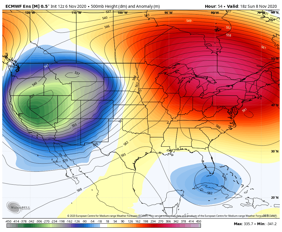
The warmth is being driven by a highly amplified pattern across much of North America. The origins of this pattern can be traced back to the Northern Pacific Ocean. Deep roughing is forecast to develop in the Western United States as a result, pumping up a large ridge to its east.
With very little impetus to bring cold air southward from the Arctic, much of the United States has been flooded with warm Pacific air over the past few days. This will continue into next week, and as the troughing to our west amplifies, the warmth will be exacerbated even further. “It really is a textbook Indian Summer”, said Kathryn Decataldo, who works for New Jersey Law and Public Safety DCA. We agree.
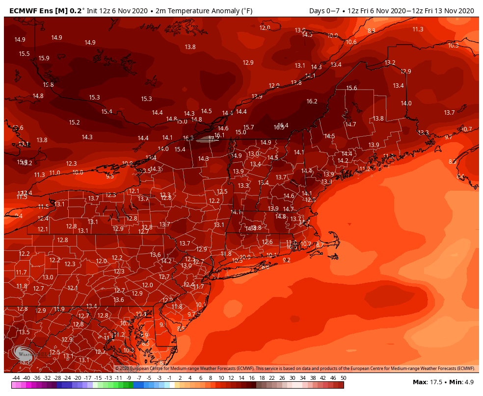
Temperatures from this weekend into early next week could rise to near 20 degrees above normal for this time of year. These type of anomalies are exceptional at any time, but when factoring in the warm overnight lows, they become especially notable. Some records could fall in New England during the week ahead (Portland, Maine broke its daily high temperature record with a high of 71 F today).
The warmth may peak regionally on Sunday. Models suggest that heights in the mid levels of the atmosphere (at 500hPa) will peak at around 590dm in parts of New Jersey and New York. This would set the record for highest 500hPa height at KOKX (Brookhaven, NY) during the month of November.
The longer range forecast features very little signal for the abatement of warmth. The long range ECMWF Ensemble suggests that warmer than normal temperatures could persist into the last week of November, and extended range guidance keeps temperatures near or above normal through around December 1st in NYC.
While “normal” average temperatures drop over the next few weeks as we draw closer to winter, temperatures 10 to 20 degrees above normal remain impressive. If guidance is correct and those anomalies persist, the Indian Summer that we are experiencing could continue well into the latter part of the month.
You can keep the winter clothes in the attic for now.
baran aydin
baran aydin
türk kahvesinin faydaları
My wife and i ended up being very satisfied when Michael could carry out his investigation by way of the ideas he received through the site. It’s not at all simplistic to simply find yourself giving freely hints some others could have been making money from. We really take into account we’ve got you to be grateful to for that. Most of the explanations you have made, the straightforward web site menu, the relationships your site help create – it is all amazing, and it’s really assisting our son in addition to us understand the issue is cool, which is really essential. Thanks for the whole lot!
hurdacı hurdacı firmasıyız. hurdacı hurda fiyatları ile yerinden hurda alıyoruz. Nakit ödemeyle hurda alıyoruz.