-2")
NYC Forecast: Light winter storm Tuesday, bitter cold late week
Winter weather is expected in the NYC Area from Tuesday through Wednesday, with light snowfall accumulations likely. The National Weather Service has issued a Winter Weather Advisory for most of Northern NJ, the NYC Metro and surrounding suburbs until 6:00am on Wednesday.
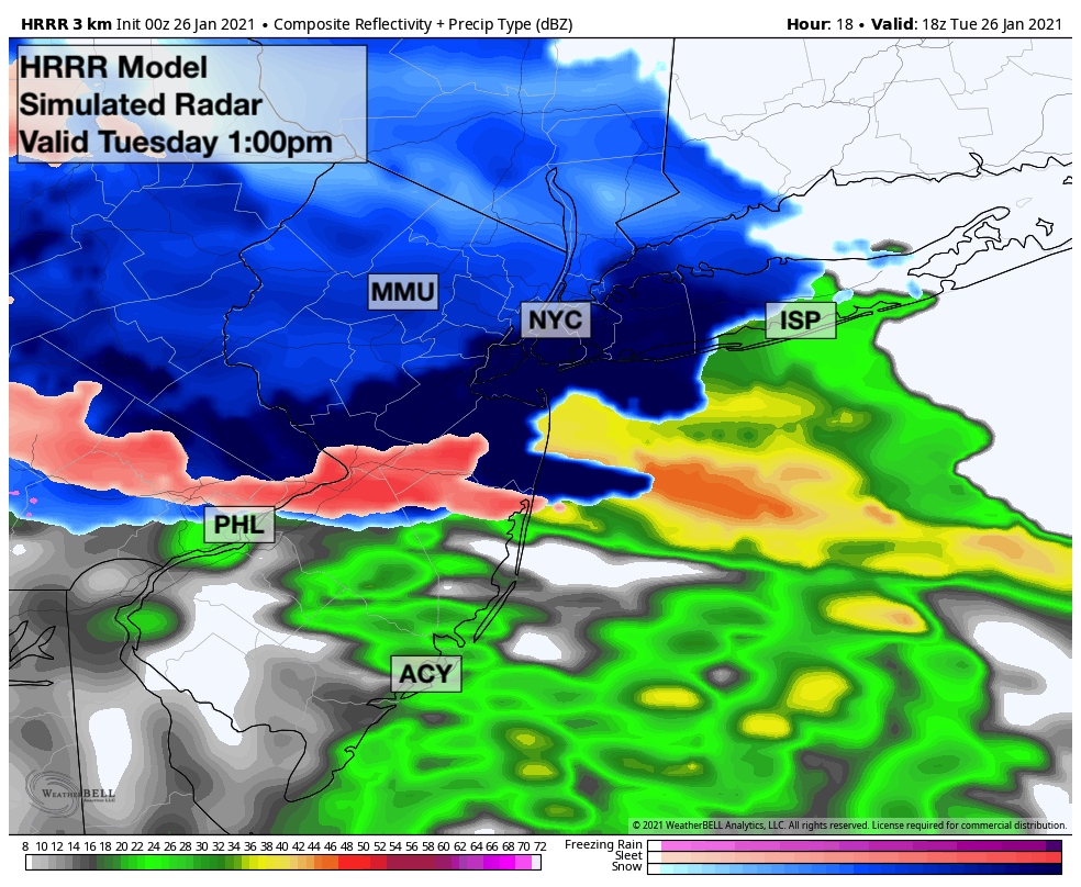
Snow is likely to begin throughout the area on Tuesday morning, spreading into New Jersey from southwest to northeast. Precipitation should be sporadic and mostly light in intensity through mid-morning. By late morning and early afternoon, the intensity of precipitation should breifly increase thanks to an uptick in atmospheric lift.
The steadiest snowfall looks likely to occur between 11:00am and 2:00pm across the area. This is when atmospheric lift is (relatively) maximized. Snowfall rates should be moderate during this time, and the majority of light snowfall accumulations will occur as this band shifts through.
After this band moves northward into New England, precipitation rates will become light and sporadic once again. During the mid to late afternoon hours, snow may mix with sleet or freezing rain at times in the NYC Metro. Even when it is snowing, the snowflakes are expected to be more needles and plates as opposed to classic dendrites. This is thanks to a lack of moisture and lift in the atmosphere. These types of snowflakes do not accumulate as easily as dendrites do. As a result, impacts are expected to be minor.

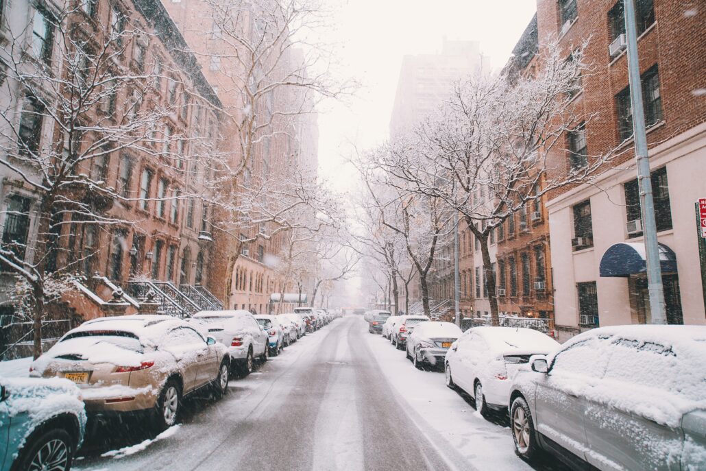
Snow may continue through the early morning hours of Wednesday as a weak coastal storm develops and then shifts away from the region. Additional light accumulations are possible. By the time all is said and done on Wednesday morning, snowfall should total 1-2″ in the NYC Metro, and perhaps a bit higher in the norhern suburbs of New York and Connecticut. Lower amounts are anticipated in Central NJ and along the areas shores.
Polar vortex pays us a visit on Friday
Later this week, another coastal storm is forecast to develop. This one will be much stronger and larger, but is forecast to develop several hundred miles off the coast. Our area will not be impacted by precipitation from this system.
Despite its distance from the area, it will phase with a piece of the tropospheric polar vortex as it moves offshore. The tropospheric polar vortex is the part of the polar vortex that impacts our weather directly (you may often hear of the stratospheric polar vortex as well, which exists way above the height of the majority of our weather).
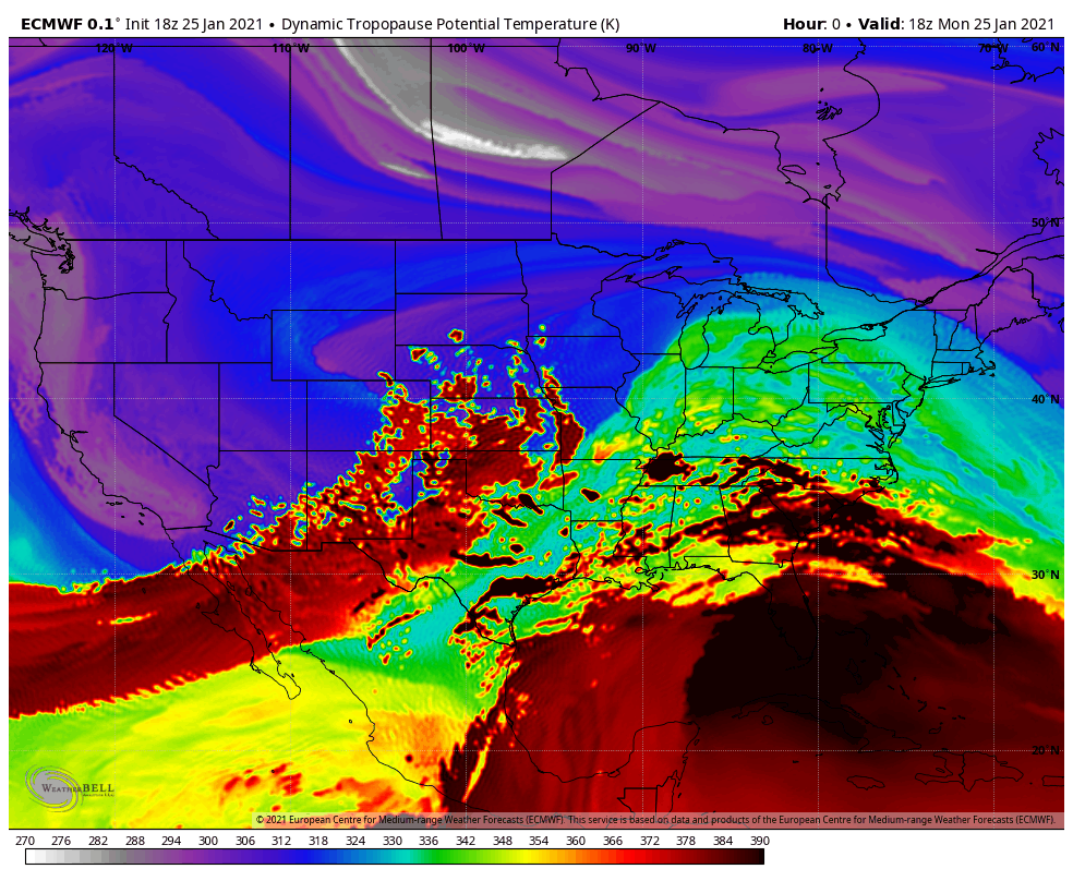
Visualized as a white fuzzball in the loop above, a piece of the tropospheric polar vortex will swing southward through New England and near NYC on Friday. It will bring bitter cold, blustery winds and the possibility of snow showers with it. This will be the coldest air we’ve experienced so far this winter season. Forecast model guidance suggests that apparent temperatures will fall near or below zero in much of New England.
The cold will continue into Saturday, with temperatures averaging nearly 20 degrees below normal. Eventually, the deep troughing associated with the tropospheric polar vortex will exist the region later Saturday and Sunday, with temperatures gradually expected to warm back up towards normal.
The wintry saga won’t be over quite yet, though – guidance is suggesting that a coastal storm could develop later Sunday into Monday. With cold air hanging around and a notable signal on ensemble guidance for storm development, we’ll be keeping our eyes peeled for the possibility of more winter weather.
Rattling fantastic information can be found on site . “I don’t know what will be used in the next world war, but the 4th will be fought with stones.” by Albert Einstein.