-2")

Rain through Tuesday morning, more snow possible late week
An area of low pressure will move northward into New England through Tuesday, leading to rounds of steady rainfall in the NYC Metro Area. The majority of cold air will remain relegated to the interior and higher elevations, where periods of sleet and freezing rain are expected. Pleasant weather will return later Tuesday into Wednesday before another winter storm approaches late week.
Tuesday and Wednesday
Periods of rain will develop late Monday night into Tuesday morning, likely spreading into the NYC Metro after 1am on Tuesday. Rain will be steady and occasionally heavy during the early to mid morning hours, and will begin to taper off from west to east near daybreak. The heaviest rainfall should wrap up in NYC by 10am, but may continue into until near noon in Connecticut and on Long Island. Some localized flooding is possible, and fog is also expected to be exacerbated by snow melt.
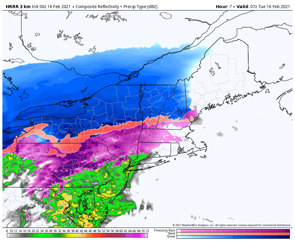
Clearing is expected across parts of the area by the afternoon hours, with high temperatures in the 40’s. Calm and cold conditions are likely on Tuesday night, with pleasant weather continuing on Wednesday – despite colder conditions with high temperatures only near freezing.
Thursday and Friday
The forecast takes a more complicated turn on Thursday as another disturbance approaches the area from the southwest. A strong high pressure system is forecast to build in to New England as it approaches. This will help to lock cold air in place across the area, and deflect the storm to our south and east.
As a result, precipitation that develops northward towards the area will likely do so in the form of snow. Snow is possible as soon as the early afternoon hours on Thursday, spreading into Pennsylvania, New Jersey and the NYC Metro Area. Light snowfall accumulations are possible by the evening commute.
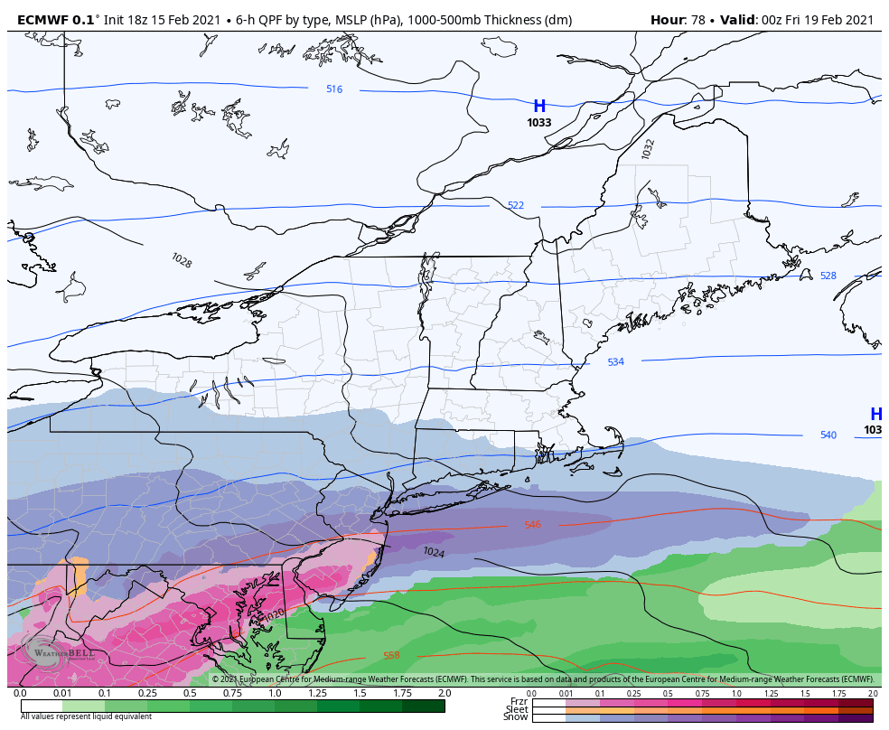
Snowfall intensity should increase as we move into the evening hours, especially across Northern NJ and the NYC Metro. Sleet, freezing rain and plain rain will begin to move northward through New Jersey after sunset. This mixing line will eventually push northward towards the NYC Metro Area as well, likely passing the area between 9pm and midnight.
After the mixing begins, precipitation intensity should decrease but may continue lightly for several hours – with sleet and freezing rain possibly continuing into the early morning hours on Friday. The system should wrap up by Friday morning across the entire area.
Snowfall accumulations currently remain uncertain, but the possibility does exist for as much as 3-6″ of snow in the NYC Metro and surrounding areas (including NJ, PA, CT and Long Island). The exact timing of mixing with sleet and rain will play a major role in just how much snow falls.
Either way, expect travel difficulties and delays on both Thursday evening and Friday morning as this storm moves through the area. This system will undoubtedly be more wintry than the one we are experiencing early this week.
türk kahvesinin faydaları