-2")

Pleasant midweek, storms possible again Saturday
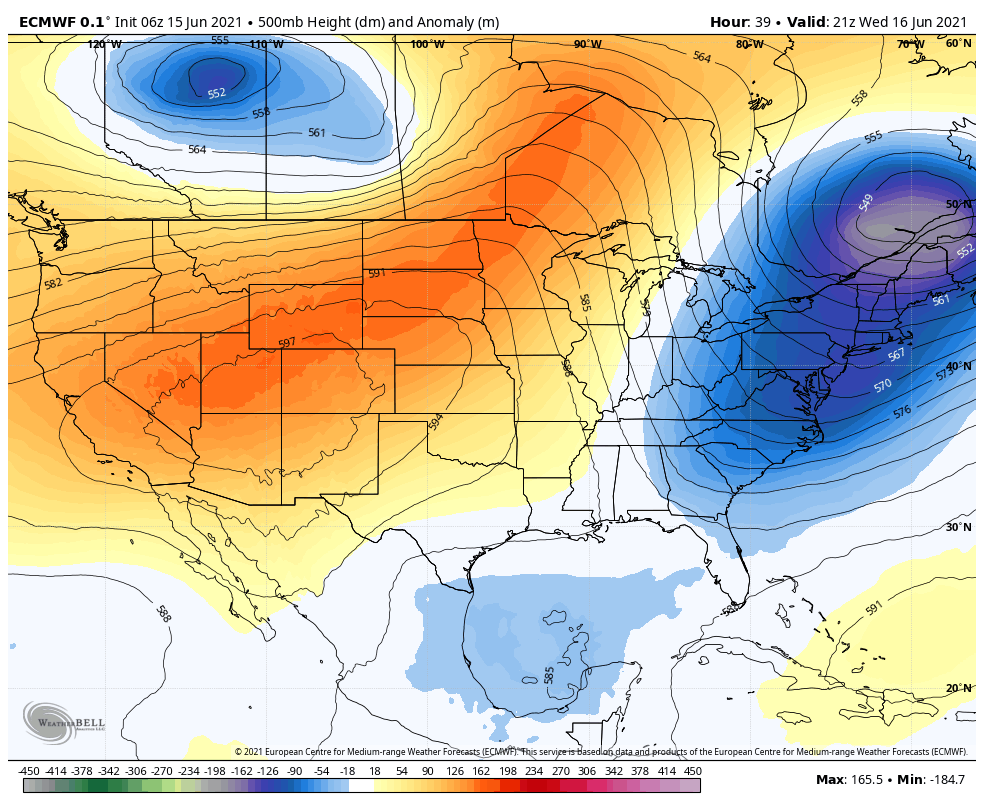
An active weather pattern is expected to continue across the Northeast US over the next week, with temperatures averaging slightly below normal. Troughing over Southeast Canada is to blame, as it will continue to deflect warmer temperatures away from the area and allow for low pressure systems to meander near the area.
Conditions are expected to remain mostly pleasant on Tuesday afternoon, although a few isolated to scattered showers and storms may develop. These are more likely in New England, north of the NYC Metro. Still, isolated showers and storms could produce brief periods of locally heavy rain. No severe weather threat is anticipated.
Calmer and more pleasant weather is anticipated on Wednesday and Thursday. Temperatures will warm up a few degrees, but remain cooler than normal for this time of year. High temperatures will top out in the upper 70’s to lower 80’s each day.
The next chance for impactful weather will come on Saturday, when model guidance suggests that a substantial low pressure system will develop in Southeast Canada. Depending on the timing of the system, ample instability in the atmosphere and plenty of wind shear could support a severe weather threat in the Northeast states. The details of any potential hazards will take a few days to clear up.
Warmer temperatures are likely on then horizon thereafter, with most guidance suggesting temperatures will rise a few degrees above normal as we move into the early and middle part of next week.
You could certainly see your skills in the paintings you write. The world hopes for more passionate writers such as you who are not afraid to say how they believe. All the time follow your heart. “The only way most people recognize their limits is by trespassing on them.” by Tom Morris.