-2")

Heat Wave Early This Week, Unsettled Weather Late Week
After a couple beautiful days at the end of last week, more summer-like weather has returned this weekend with warmer and more humid conditions. The heat and humidity will only continue to become more oppressive during the early part of this week, as a strong 594dm ridge builds over the Eastern US. This will likely lead to the second heat wave of the season for the New York City metro area.
On Monday and Tuesday, high temperatures will reach the lower or middle 90s over New York City metro and New Jersey with southwest winds. Humidity will make those temperatures feel more oppressive with heat index values likely reaching between 100° to 104°F. Therefore, the National Weather Service has issued Heat Advisories for much of the region. Stay hydrated by drinking plenty of fluids and avoiding any strenuous activity outside.
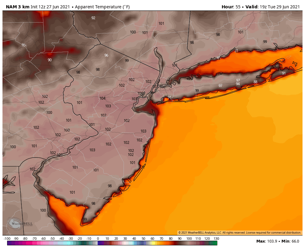
3km NAM shows heat index values between 100-104°F over New Jersey and NYC on Tuesday

There will be little relief from the heat to find in the region. Temperatures will be a little cooler with sea-breezes along coastal locations, but humidity will still be oppressive. The heat and humidity could also lead to some isolated or widely-scattered showers and thunderstorms popping up each afternoon, before diminishing early in the evening.
The heat wave will continue on Wednesday with high temperatures in the low to mid 90s and humidity remaining oppressive. But a cold front associated with an upper-level trough will begin to approach from the Great Lakes later in the day. This could help to trigger more organized showers and thunderstorms during the afternoon and evening hours.
Then later in the week, the upper-level trough begins to dig deeper and break down the ridge over the Eastern US. The heat wave will likely break, but showers and thunderstorms may become more numerous and widespread over the region on Thursday and Friday. A strong southwesterly jet with abundant moisture feeding out of the Gulf of Mexico and Atlantic, could also result in result in higher risk for heavy rainfall and/or severe weather each day.
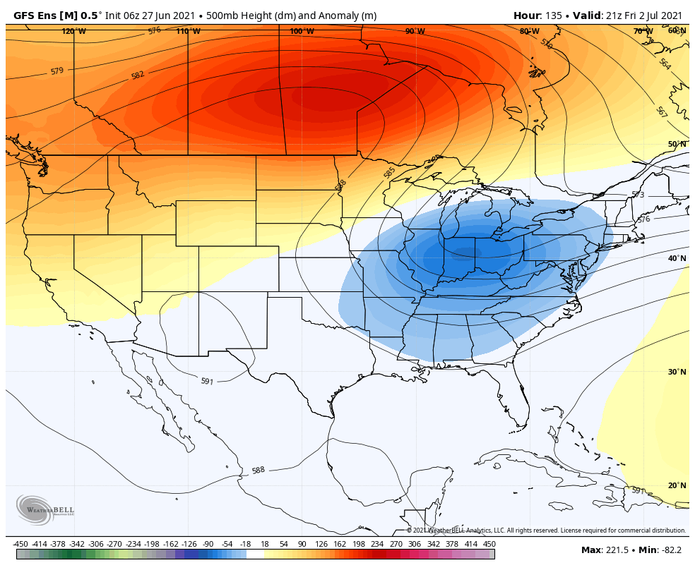
GEFS shows a ridge rolling over Canada with a trough digging over the Eastern US late in the week

The latest guidance suggests that the upper-level trough will slow down and develop into a large cut-off low over the Eastern US. This could lead to more unsettled weather with some cooler temperatures for the July 4th weekend. However, there is uncertainty with model run to run differences on how this cut-off low will exactly evolve. Thus, we aren’t anticipating any washouts for the holiday weekend yet. We will have another update with more details on that forecast later in the week.
I needed to create you the very small note to give many thanks the moment again over the wonderful things you have documented above. It was really wonderfully open-handed of you in giving freely precisely what many of us could possibly have advertised as an ebook to get some dough for their own end, precisely since you could possibly have done it in case you wanted. The points additionally acted as a fantastic way to fully grasp other people have the same eagerness the same as my very own to find out good deal more pertaining to this problem. I believe there are lots of more enjoyable opportunities ahead for people who look into your site.