-2")

Strong Storms Possible Today, Smoke Clears Out Tonight
Very warm and humid conditions are expected today, with high temperatures will likely reach the be in the middle 80s in the NYC Metro. Initially, dense smoke from wildfires over the Western US and Canada will continue cause very hazy skies and reduce air quality for much of the day. Smoke will begin to clear out later today behind a front.
This frontal boundary could also trigger some strong or severe thunderstorms this afternoon. An elevated mixed layer in the atmosphere will support high instability at the surface. but cover from a decaying complex of thunderstorms over the Interior Northeast overnight could act to mitigate storm development. Where high instability occurs, shear and mid-level lapses are high enough to support thunderstorms rapidly organizing and intensifying.
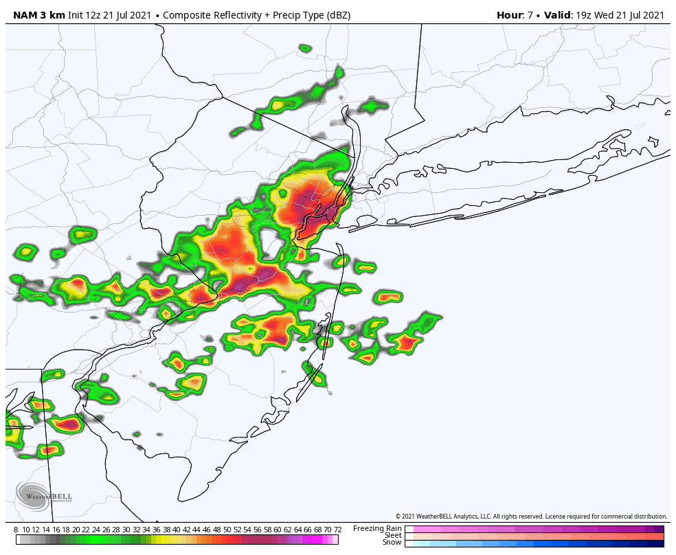
3km NAM model showing some strong thunderstorms over parts NYC metro between 2-4pm this afternoon

The Storm Prediction Center has placed most of the Tri-State area in a Slight Risk for severe thunderstorms today. A Severe Thunderstorm Watch will likely be issued this afternoon as well. The main threats from storms today will be strong, damaging wind gusts and large hail. Low-level winds not veering much with height will mitigate a tornado risk. Storms could also produce frequent cloud to ground lightning and flooding downpours.
These storms will exit the region early this evening. Then skies will clear of clouds and smoke overnight with temperatures dropping into the 60s and humidity lowering as well. Thursday and Friday will be more beautiful days with improved air quality. High temperatures will be in the mid 80s each day.
Humidity begins increasing on Saturday with high temperatures in low to mid 80s. Then Sunday will be very warm and humid again with highs in the upper 80s. A frontal system could bring more showers and thunderstorms on Sunday. But we don’t expect a washout.
baran aydin
baran aydin
türk kahvesinin faydaları
F*ckin’ tremendous issues here. I am very glad to look your post. Thanks a lot and i’m taking a look forward to touch you. Will you kindly drop me a e-mail?
Adrese gelen istanbul hurdacı firması olarak hizmet veriyoruz.