-2")
Locally Strong T-Storms Possible Today, Mainly Dry Rest of This Week
Good afternoon, NYC! While today is not overly warm, it is quite muggy with dewpoints in the mid 60s. This is because there is a large trough situated in the Ohio Valley extending into the Southeast US, which is sending a moist airmass from south to north, into our area.
This moist airmass is important to the forecast, as it helps to trigger showers and thunderstorms — warm and moist air has the tendency to rise, potentially into thunderstorm clouds. You then just need a “trigger” — an ignition to the weather pattern aids the lift further to allow this lift to result in clouds, rain, and thunderstorms.
While the trigger is not necessarily one specific feature, there is evidence of one later today — we see a weak area of low pressure and a cold front. Attached below is a simulated radar from a weather model for 6pm today.
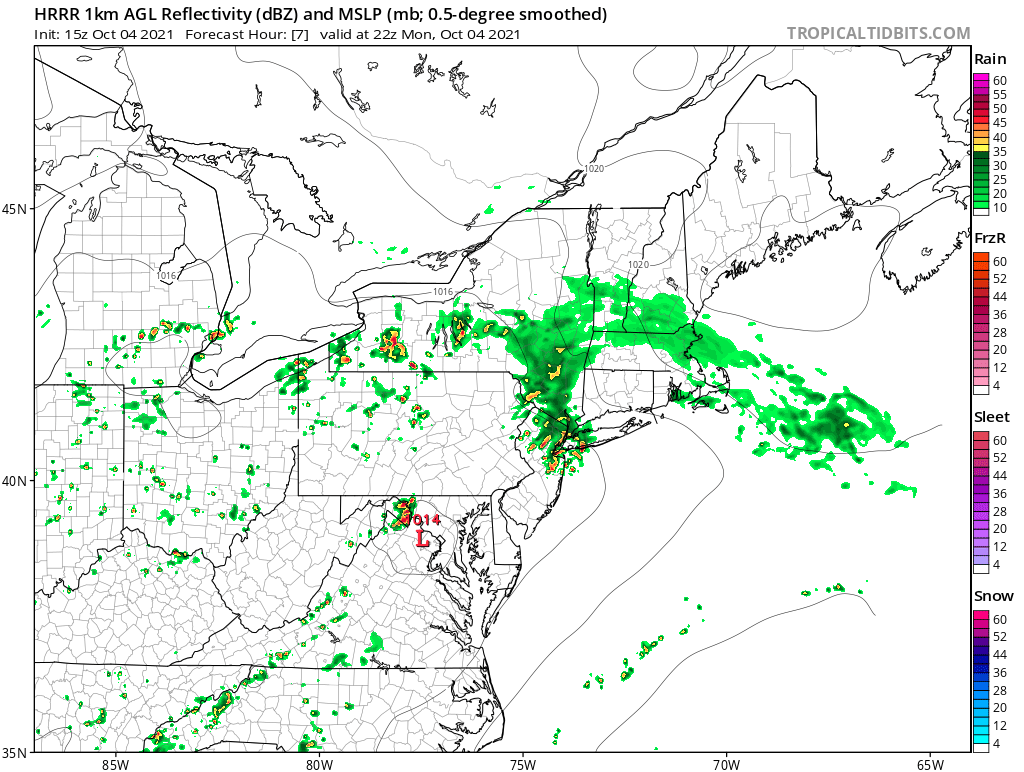
Note the red “L” located in the Mid Atlantic — this area of low pressure will help to trigger showers and locally strong thunderstorms near much of the NYC area later this afternoon. The area of low pressure is fairly weak, which may limit how widespread heavy rainfall truly becomes, but isolated to scattered thunderstorms with gusty winds and locally heavy rain are possible later this afternoon into the evening.
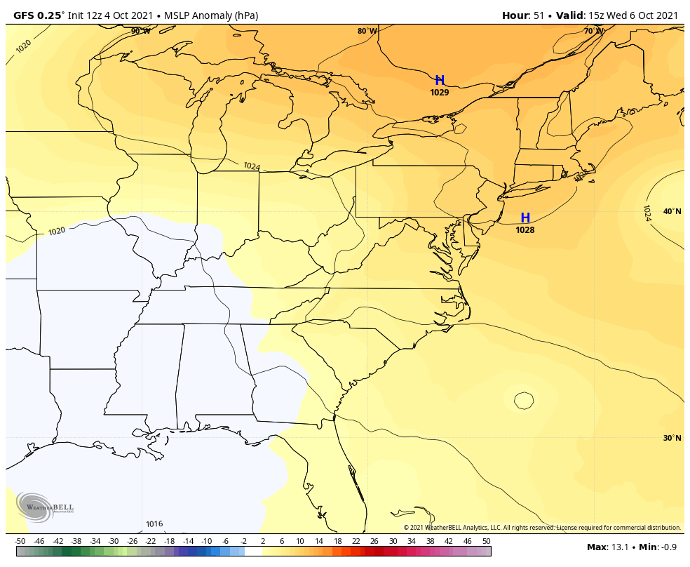
Moving forward into Tuesday, it appears that this weak area of low pressure will mainly slide to our east, and the large trough will actually shift to the west a bit — further away from our area. This should allow for a drying trend to the forecast, although some drizzle can’t be ruled out on Tuesday. While it may not be as overcast as today, there will be more clouds than sun, with slightly less humidity and highs in the upper 60s.
High pressure should become more dominant on Wednesday through Friday, allowing sunshine to increase, and high temperatures rise back into the 70s.
The forecast for the weekend is somewhat uncertain, as it depends greatly on how long this high pressure holds on. The same trough giving us rain today that will shift away from us later this week may again attempt to shift back to the east toward our area — it will be a “battle” between this trough and the high pressure. At this point, it is possible that Eastern areas remain dry this weekend (since they will be closer to the high pressure), and Western areas such as Eastern PA and Western NJ see scattered showers this weekend. Our current forecast has a 30% chance of showers on Saturday and a 40% chance of showers on Sunday for NYC itself.
That’s all for today. Have a great rest of your Monday!
The vibes in Sprunki Talking Vineria Wenda and Pinki are immaculate! The music is an absolute banger, and the gameplay feels so smooth. Can’t wait to see more from this creator!
OMG, Sprunki Talking Vineria Wenda and Pinki is an absolute banger! The music tracks slap so hard, and the visuals are next-level. This dev team never misses!
NGL, Sprunki Talking Vineria Wenda and Pinki is low-key sus in the best way possible. The glitch effects are so well-done and they don’t break the game. Total masterpiece!
Only wanna input that you have a very decent web site , I enjoy the design and style it really stands out.