-2")

Unsettled weather will return Friday and Saturday
While the sun is shining and a beautiful fall day is anticipated today, an active and unsettled weather pattern is expected to continue later this week. Another coastal storm will develop, this one much weaker and more progressive than the last. Still, periods of rain are anticipated from late Friday into Saturday and onshore flow will result in blustery winds and some flooding near the area shores.
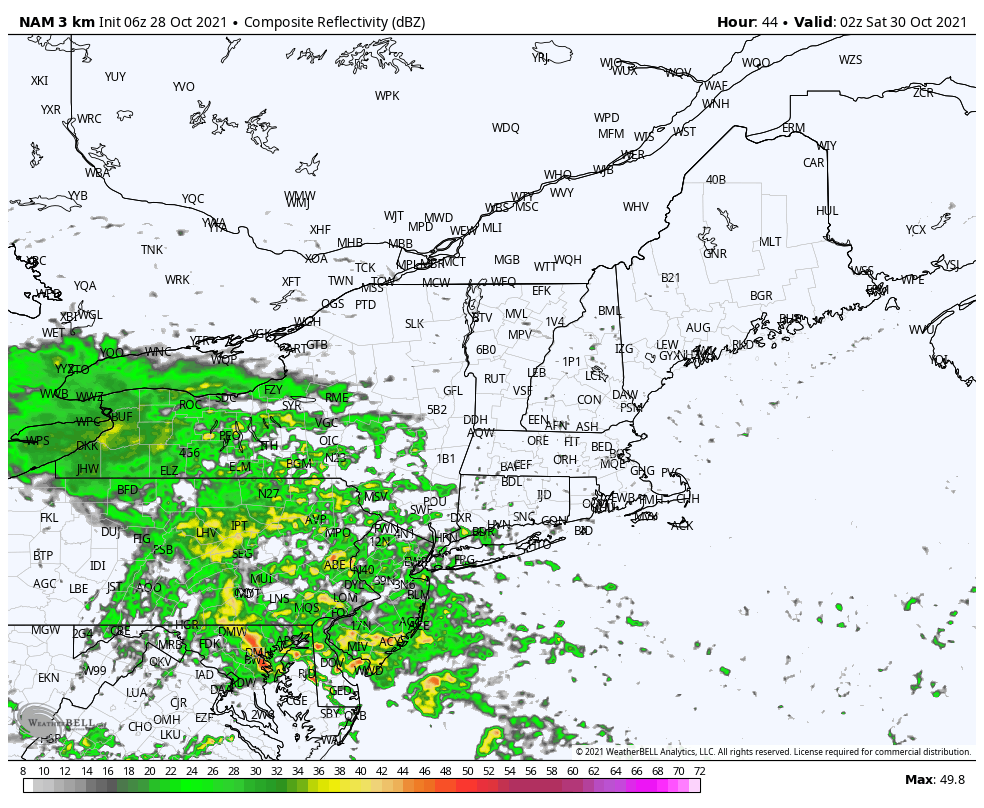
A low pressure system is forecast to develop in the Mid-Atlantic states on Friday, gradually moving northward and transferring energy towards the coast. A weak coastal low pressure will then develop, and moisture will move northward towards the NYC Metro Area Friday night. We expect rain to develop during the evening commute, perhaps holding off until closer to 7pm in some spots.
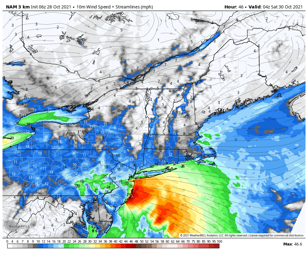
Periodic showers are anticipated throughout Friday Night, with locally moderate to heavy rainfall at times. A high pressure to the north of the developing coastal low pressure will create a pressure gradient, which will enhance easterly winds along the area shores. Forecast models suggest that winds could gust over 30mph for several hours late Friday into Saturday, specifically along the NJ Shore and parts of Southern and Eastern Long Island.
Rainfall totals are not expected to be extreme or anomalous with this storm. Most model guidance suggests about 1″ of rain, with localized amounts closer to 1.25″ where heavier thunderstorms track. Flash flooding issues are not expected to be widespread, but some coastal flooding is possible with the onshore winds and additional flooding is also possible near rivers and flood zones recently impacted by the nor’easter a few days ago.
A low pressure system will eventually move northeast of the area later Saturday and Sunday morning, allowing for a decrease in moisture and generally improving weather conditions.
Colder than normal weather expected in the extended
Ensemble guidance has come into great agreement on a substantial pattern change across the Northern Hemisphere, which will eventually lead to below normal temperatures and an active weather pattern in the NYC Metro Area. The development of high latitude blocking – or large ridges of high pressure in the high latitudes of Canada and the Arctic – will send cold air surging southward into the United States by the middle to end of next week.
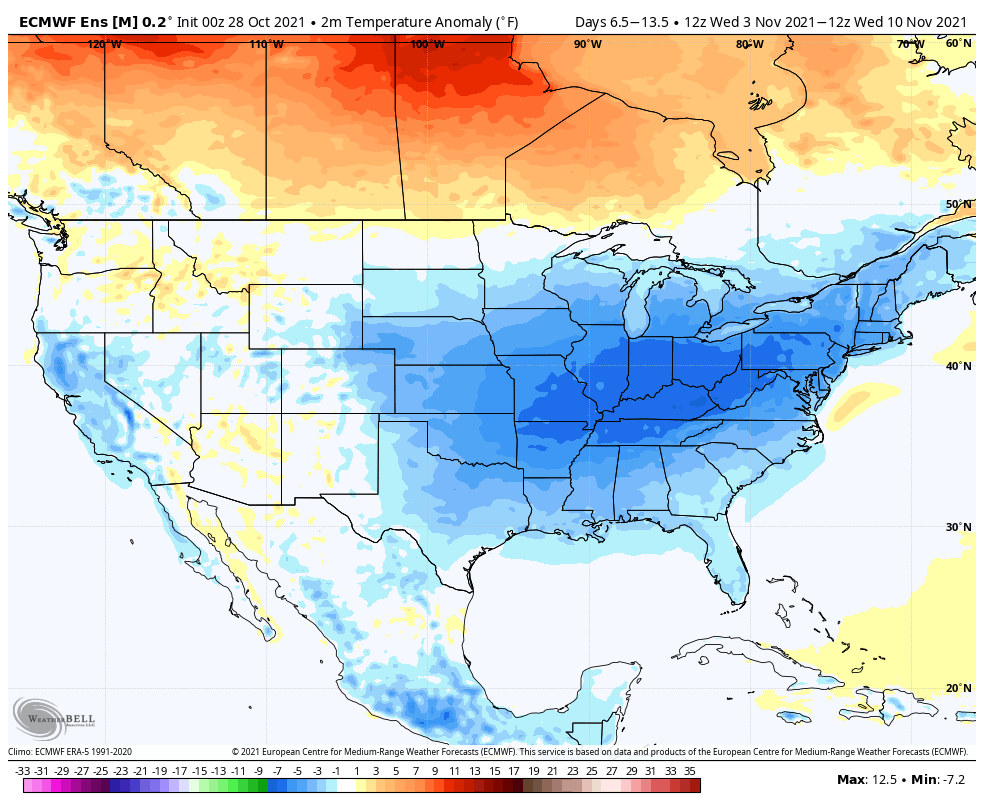
The Euro and GFS models both agree that temperatures will average several degrees below normal beginning during the middle of next week and continuing into next weekend. This will come as a major change from an anomalously warm October. We could very well see our first frost and freeze events of the season during this time frame.
It remains to be seen if any winter weather risk will eventually emerge from this colder and active pattern across the interior or higher elevations. Such an occurrence would not be unheard of, but would be a bit early – usually the interior sees their first winter weather by the middle of November.
That’s all for us today – enjoy the beautiful fall weather and have a wonderful Thursday!
türk kahvesinin faydaları
I’ve been browsing online more than 3 hours today, yet I never found any interesting article like yours. It is pretty worth enough for me. In my view, if all web owners and bloggers made good content as you did, the internet will be much more useful than ever before.