-2")
Coldest Air of the Season Arrives This Week
Good afternoon, NYC! Today turned out to be a pleasant Autumn day, with mostly sunny skies and highs in the upper 50s to around 60. A cold front behind the storm that brought rain a few days ago passed through, giving us our nice weather today, despite northwest winds gusting to 20mph this evening.
Despite a cold front having passed through, these temperatures are not all that cold for this time of year. We are actually out ahead of another cold front to our west, which leads to our temperatures being relatively warmer. But if you like chilly weather, do not fret – it will be arriving soon. The aforementioned cold front will be arriving on Tuesday, leading to increasing clouds and high temperatures a few degrees cooler than they are today. A stray light rain shower can’t be ruled out during the afternoon and evening, but this is primarily a dry frontal passage.
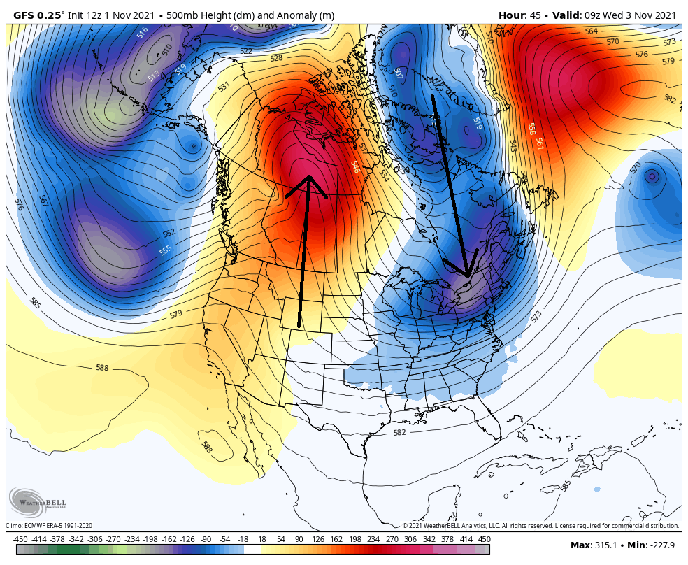
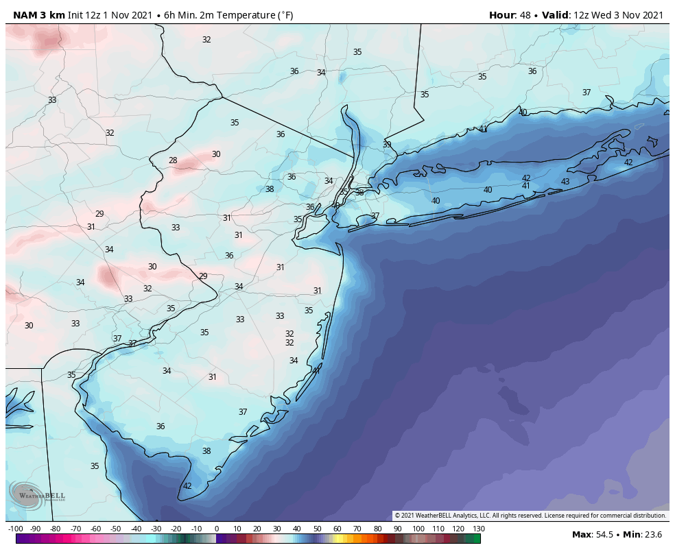
A colder airmass will be reinforced behind this front on Tuesday night. This is because the airmass behind this front has true Northern Canadian roots, leading to temperatures several degrees or more below average. While New York City itself may see lows hold around 40 degrees, most suburbs will see lows in the mid 30s with the potential for frost come Wednesday morning.
Cold continues late week, close pass from a coastal storm
Wednesday and Thursday will both only see highs around 50 degrees, but with mostly sunny skies. With clear skies and light winds, combined with this chilly airmass, the coldest airmass of the season so far is expected. Lows will fall into the low 30s for most NYC suburbs, with widespread frost come Thursday morning.
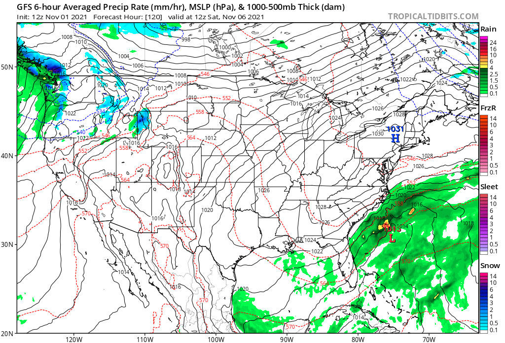
An area of low pressure will attempt to develop along the trough responsible for our cold air. This will lead to an increase in clouds on Friday. Current indications are that this trough, and thus the low pressure, will be too far east for us to see rain from this system. A strong Pacific jet stream will be crashing into the Western US, pushing our trough eastward quickly. Friday will continue to be chilly, but a gradual warm up will occur this weekend and early next week. Both Saturday and Sunday should see sunshine, with highs in the mid 50s, so a nice Autumn weekend awaits.
DST Stinks, and and October 2021 Recap
The one spoiler? The upcoming end of Daylight Saving Time. On Saturday night, we will be turning our clocks back one hour, leading to a 4:45pm sunset on Sunday. We continue to wonder why, as a society, we willingly let this happen. Based on the responses to our tweet this morning, most of you do too.
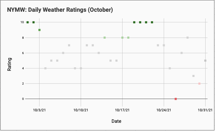
One final note – we closed out our weather ratings for October. October 2021 finished with an average daily weather rating of 6.45, down only slightly from 6.7 in September. There were six days rated a 10/10 and one day ranked a 0/10.
you are in reality a excellent webmaster. The web site loading velocity is amazing. It seems that you are doing any unique trick. Moreover, The contents are masterpiece. you have performed a magnificent job in this topic!