-2")

NYC Forecast: Gorgeous to start the week, unsettled finish
Gorgeous weather is expected to start the week in NYC, with plentiful sunshine and highs in the lower to middle 60’s. Unsettled weather will eventually return later this week and persist into the weekend, with showers possible from late Thursday through Saturday. Temperatures will average several degrees above normal.
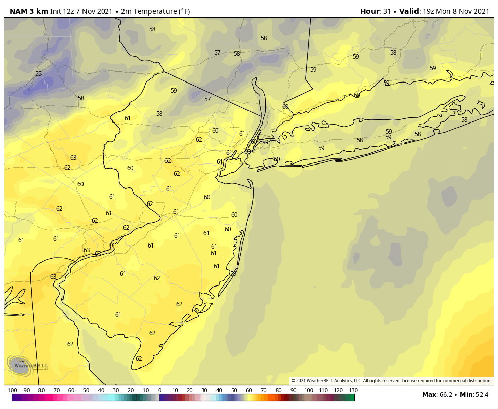
The week will begin with some of the nicest weather in recent memory. Cool, crisp nights will give way to beautiful and warm afternoons on Monday and Tuesday. High temperatures will gradually warm into the middle 60’s. Tuesday looks like the winner of the week (and perhaps month so far) with highs in the upper 60’s and a light breeze. It’ll be so nice, you could almost forget that we issued our Winter Forecast last week.
A weak disturbance will then track north of the area in New England late Tuesday into Wednesday. This will flip the surface wind direction back to north/westerly, which will keep temperatures a bit cooler on Wednesday and Thursday afternoons. Still, with partly cloudy skies and high temperatures near 60, you will find very few people complaining about the weather. These temperatures are several degrees above normal for this time of year.
Unsettled and dreary conditions return to NYC this weekend
While we are enjoying beautiful weather this week, a storm system will be getting organized in the Plains and the Central United States. A low-pressure system will eventually move into the Great Lakes and part of the Northeast states from late Thursday into Friday. Moisture will increase (the dreaded dew point rise) and clouds are expected to stream in by late Thursday.
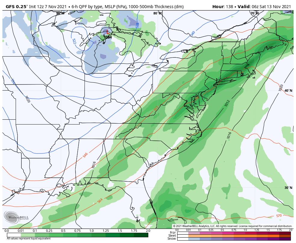
Showers will become common throughout the area on Friday, which is expected to be the worst day of the work-week weather-wise. Unsettled conditions are likely to persist into at least part of Saturday, with an upper-level low and associated storm system lingering in the Northeast states.
Forecast models are inconsistent in depicting how long the system sticks around. Recent guidance suggests rain may continue through Saturday night, while the earlier model runs suggested we’d clear out by Saturday morning. We’ll have to keep a close eye on the evolution of the storm system over the next few days to get a better idea of how Saturday will play out.
Improving weather is gradually expected by Sunday. The forecast next week looks cooler than normal, with a northerly wind component re-introducing air from Canada into the Northeast states.
The app is very lightweight and doesnt lag at all. It makes gaming on the go so much easier. Five stars from me!
I have tried many platforms but this one has the best vibe. The games are exciting and the community is great.
Hello, you used to write great, but the last several posts have been kinda boring… I miss your tremendous writings. Past few posts are just a little bit out of track! come on!