-2")
NYC Forecast: Wednesday Storm Misses South, Warm Pattern Looms
Briefing: A coastal storm system will miss the area to the south on Wednesday, with only a few snow showers anticipated. Cool weather will continue through the end of the week, but a warmup is on the way by this weekend. Temperatures could average several degrees above normal by next week.
Forecast models have been wildly inconsistent in depicting the evolution of a storm system which will pass near the area on Wednesday. Earlier model runs had suggested that a strong low pressure system would move south of Long Island, bringing accumulation snow to parts of the region. Model trends over the past few days have been decidedly weaker and more progressive with the storm.
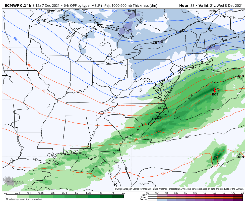
As a result, the expectation is that the storm systems will miss the area almost entirely. A few snow showers are possible Wednesday as the storm skirts by, but appreciable precipitation is not anticipated. No snow accumulation of any kind is expected in the NYC Metro. Temperatures will remain cooler than normal and a light north wind will keep it feeling wintry.
Cool weather is expected to persist through the end of the week with mostly pleasant conditions. Temperatures will begin to warm up as the week goes on, with highs on Friday approaching 50 degrees with partly cloudy skies. An increase in clouds late in the day will signal the approach of a storm system that will bring unsettled weather to the area this weekend.
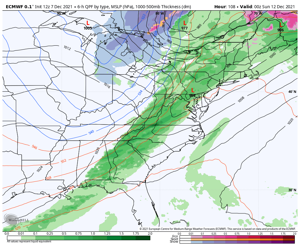
As a low pressure system amplifies into Southeast Canada, temperatures will warm up and moisture will increase across the area on Saturday. Showers are anticipated on Saturday morning with the passage of a warm front. After a brief respite during the day, additional rounds of showers will approach during the afternoon and early evening. High temperatures will be quite warm – into the mid 60’s in some spots – before the cold front swings through.
Old man winter is asleep as warm pattern settles in
Behind the storm system this weekend, Pacific air is expected to flood the country. The persistent stream of cooler than normal air which has been impacting the area will recede back into the Arctic, and temperatures are expected to warm significantly as the week goes on.
Most forecast model guidance suggests that by the middle of next week, temperatures could be averaging several degrees above normal. In fact, some guidance suggests high temperatures could exceed 10 degrees above normal for several days in a row. The ECMWF model in particular suggests that high temperatures could reach into the 60’s during the second half of next week.
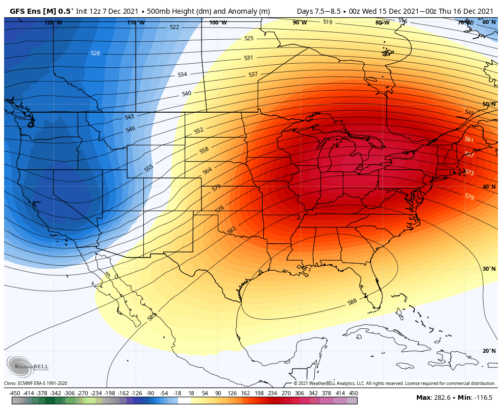
This warmer than normal pattern looks likely to persist until at least the 20th of December. There are some indications that a pattern change could occur later in December (near or after Christmas) that could bring colder and more wintry conditions back into the forecast. But for now, old man winter will remain asleep and so will the hopes of any notable snowfall in NYC.
Leave a Reply
Want to join the discussion?Feel free to contribute!