-2")
NYC Forecast: Warm midweek, unsettled weekend ahead
Briefing: Warmer weather is expected by midweek with temperatures warming into the 60’s. A slow moving storm system will approach the area by the end of the week and weekend, with unsettled and dreary weather expected for several days.
Warmer than normal weather has gradually settled in to the area over the past few days, with the atmospheric pattern across the Eastern US acting more like it typically does in October than in mid December. The pattern will culminate in much warmer than normal temperatures during the next few afternoons.
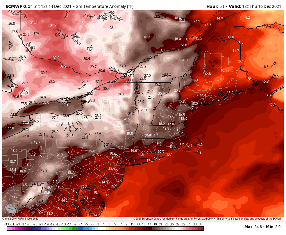
High temperatures on Wednesday are expected to reach into the middle 50’s, which is solidly above normal for this time of year. The real winner will be Thursday, when guidance suggests high temperatures could reach well into the 60’s – more than 20 degrees above normal. Another warm day is expected on Friday, with highs in the upper 50’s.
The weather during most of this week should be pleasant, with the one exception being Wednesday Night when a few passing showers are possible. Things will change considerably by this weekend, as a frontal boundary stalls near the area and low pressure develops along it.
Wet, unsettled and dreary weather expected this weekend
Model guidance is in good agreement that a frontal boundary will stall near the area from later Friday into Saturday. These frontal boundaries often serve as a sort of highway for developing low pressure systems and moisture. That’s exactly what we anticipate will occur this weekend.
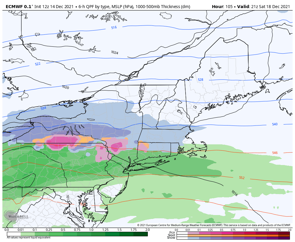
Clouds should increase by late Friday night, with showers moving in to the area from the west. Saturday looks particularly wet and dreary with models indicating up to a half inch of rainfall throughout the day. Rain could persist until the evening hours on Saturday as a low pressure system moves through New England.
Improving conditions are expected on Sunday, as the front finally clears the area. Temperatures will cool off significantly, with highs only expected to reach the lower 40’s on Sunday afternoon.
Trying out Sprunki Phase 9 GGTP V2 right now. That beat drop in the middle is fire! Love how the characters react to the rhythm. Definitely my new favorite phase.
As someone who’s played many Sprunki mods, Sprunki Phase 9 GGTP V2 finally nails the difficulty curve. The new mechanics add strategic depth without being overwhelming. GG to the devs!
Mastering Sprunki Beat Up Simon is so rewarding. The music sync with the enemy patterns (or animations) is chef’s kiss. Pro tip: watch for the tempo changes!
We are a group of volunteers and starting a new scheme in our community. Your web site offered us with valuable information to work on. You have done an impressive job and our whole community will be grateful to you.