-2")
Coastal storm threat emerging in the days before Christmas
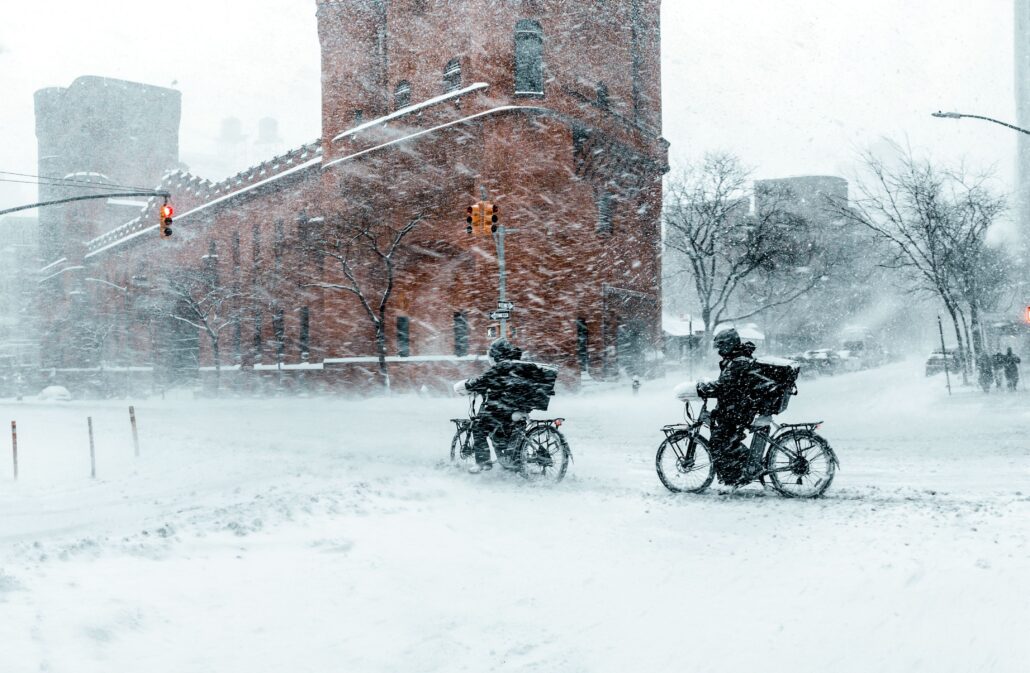
While a cold rain continues to fall in the NYC Metro Area late this week, the weather pattern around us is undergoing significant changes. High latitude blocking developing over both Greenland and Alaska will dislodge cold air into the area – and also slow down the jet stream – next week. The eventual result will be the potential for a strong coastal storm in the days leading up to Christmas.
A few weeks ago, we went into detail on why the development of a large ridge of high pressure over Greenland was important. It may have seemed trivial at the time (we wrote the post in late November), but the impacts will come to light sooner rather than later. Forecast model guidance is good agreement that anomalous blocks will form in both Greenland and Alaska in the next few days.
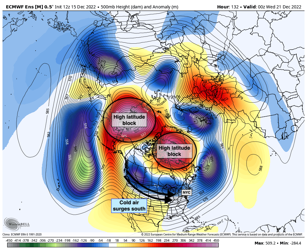
High latitude blocks are pattern-changers. Their formation acts to completely disrupt the typical flow of the jet stream. Think of it like a traffic jam in the atmosphere – the block is completely changing the typical flow of traffic. More often than not, they also slow things down which allows for stronger and deeper storms to form.
The high latitude block developing this week will be one of the most anomalous we’ve seen in over a decade. One has to go back to 2010 to find a similar blocking evolution in both Alaska and Greenland. Accordingly, cold air will surge into the United States next week with temperatures in NYC falling several degrees below normal.
But what about storms? High latitude blocking typically brings the cold first and the storms second. This one looks no different. In the last 24 hours, guidance has begun to hone in on a storm threat during the days leading up to Christmas.
Coastal storm threat before Christmas, but the details remain uncertain
During the early part of next week, a disturbance will drop southward into the United States from Canada. As it does so, the aforementioned high latitude blocking will do some dirty work. Ridging over Alaska will amplify the flow to amplify southward into the United States. Ridging over Greenland will reinforce cold air and block the storms exit route to the north.
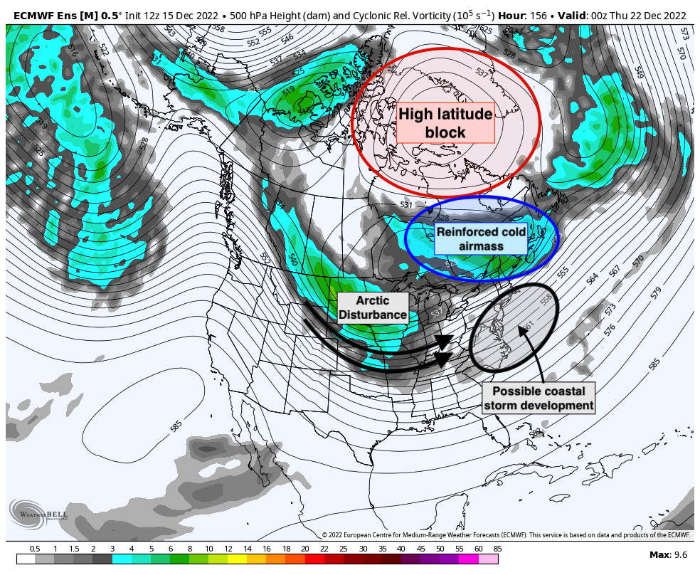
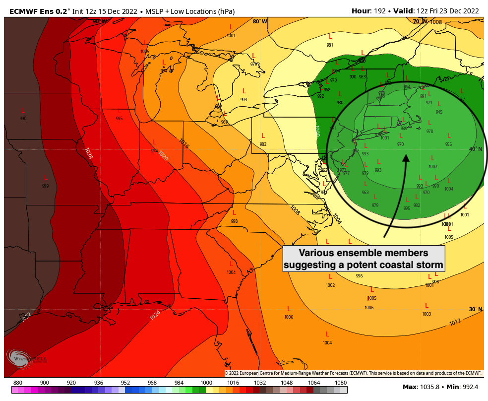
The result will be a propensity for the storm system to slow down and deepen. Forecast models have begun to suggest the development of a strong low pressure system off the Northeast US shoreline on Thursday and Friday.
Despite the rising confidence in the storm forming, one thing has become abundantly clear – we have no idea how this system will evolve yet. There are still several different scenarios at play here, and each of them will bring various impacts to the NYC Metro Area. With the system still 5-6 days away, it’s not a guarantee that our area will be impacted at all.
Still, strong signals on ensemble guidance like this one often signal something significant. Ensembles are subsets of the weather models that you’re more familiar with, like the GFS or Euro. Each of those models also runs an ensemble, or sub-members of that model. Using a mean or average of 20-30 ensemble members can offer us a much more reasonable look at possible outcomes as opposed to looking at just one individual model run.
In the next few days, we’ll have to carefully analyze how ensemble guidance thinks this storm system will evolve. The disturbance responsible for the development of the coastal storm is still north of Alaska, and it won’t enter the United States until Monday of next week. Until then, we’ll have to take it slow and keep all possible outcomes in mind.
Nevertheless, the potential for a coastal storm producing winter weather near our area is higher than usual. We’ll continue to monitor the threat in the coming days. Be sure to stay tuned – both right here on our website and on our social media accounts!
baran aydin
Some genuinely nice and useful information on this website, as well I think the layout has got great features.
Güncel hurda fiyatları ile hurda alan yerler içerisindeyiz. Size en yakın hurdacı firması olarak hizmet sunuyoruz. Hurda satmak için hemen arayın.
What will travel be like to Indianapolis on the Thursday before Christmas
Travel looks difficult especially in the Great Lakes and Midwest (IND included) from Thursday into Friday.