-2")
A Piece of the Polar Vortex Will Visit NYC on Friday as a Powerful Storm Sweeps Through the Northeast
A piece of the polar vortex has decided to pay NYC a visit in the days leading up to Christmas. Its arrival will kickstart the development of a powerful storm which will bring rain, wind and a arctic cold front to our area over the next few days.
Over the last several days, forecast model guidance has hinted at the development of a powerful storm system in the Central and Eastern US. It comes as no surprise, then, that we’re in for a bit of a wild ride as the storm forms from Thursday into Friday. Hopes for a white Christmas in NYC will be thwarted as the low pressure develops too far to our west.
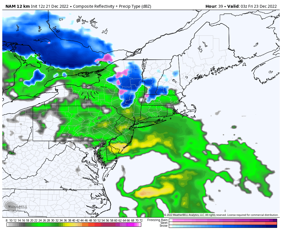
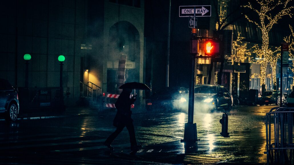
Instead, we’ll get a myriad of weather hazards beginning Thursday evening including rain, wind and coastal flooding. Unsettled conditions will persist into Friday. Eventually on Friday afternoon, an Arctic cold front will sweep past the region. This front is associated with a piece of the tropospheric polar vortex. A rapid temperature drop and flash freeze are expected as a result.
How is the polar vortex reaching NYC, and how long will it be here?
If there’s one piece of good news, it’s that a piece of the polar vortex will only be here for a few hours. Consider it a hit and run visit. Get in, say hello, get a slice of pizza and get out. In all seriousness, a piece of the polar vortex dropping down to reach NYC is not unheard of. In fact, it happened as recently as a few years ago.
Time for some context: The polar vortex always exists, at multiple levels throughout the atmosphere, and it usually resides near the poles of the Earth. What’s passing over NYC on Friday afternoon is just a lobe (or a piece) of the polar vortex in the troposphere – which is the part of the atmosphere that we experience the majority of our weather. The polar vortex still exists at the poles at multiple atmospheric levels, and the entire polar vortex is definitely not coming over Central Park.
The real polar vortex is a quasi-permanent wintertime feature that exists in the stratosphere and to an extend the upper troposphere. “Sometimes, when the shape of vortex in the stratosphere is disrupted it can lead to the jet stream beneath becoming disrupted as well. At its core, the jet stream is a barrier that keeps the coldest arctic air sequestered over the pole”, said Alex Goldstein, a meteorologist who obtained his Ph.D. at University of Wisconsin-Madison. “When the jet is disrupted, it can buckle and allow that air to spill south over the mid-latitudes — exactly what we are expecting to happen in the coming days”, he said.
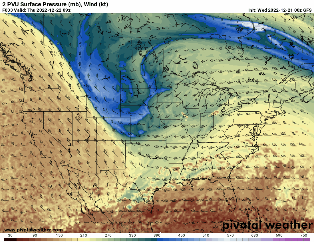
This lobe of the polar vortex is able to amplify southward towards our area as a result of anomalous high latitude blocking, or ridges of high pressure in the arctic and polar regions. These ridges disrupt the flow of air at those latitudes and can cause large storms and anomalous movement of arctic air. We warned about this possibility a few weeks ago.
It’ll be gone in a flash – curling northward into New England later Friday evening and then back into the arctic by the time we get into the weekend. While it’s here, though, it will make its presence known. Expect very cold air Friday Night into Saturday with a strong wind and real-feel temperatures below zero.
When does the storm begin and what kind of disruptions can I expect?
Here’s the latest information on how the storm system will evolve throughout the NYC Metro Area.
Thursday Night: After a decent day on Thursday, clouds and showers will increase Thursday night. Periods of rain are likely from Thursday Night into Friday morning. Winds will also ramp up and become gusty out of the southeast. Localized flooding will occur and coastal flooding is also expected. Travel disruptions will begin and continue as the evening goes on.
Friday Morning: Periods of intermittent heavy rain will continue, as will gusty southeast winds. Temperatures will increase as warm air advects into the area. Localized flooding risks will persist. Travel disruptions will continue, specifically air and rail travel. Driving may also be difficult during periods of heavier rain or wind.
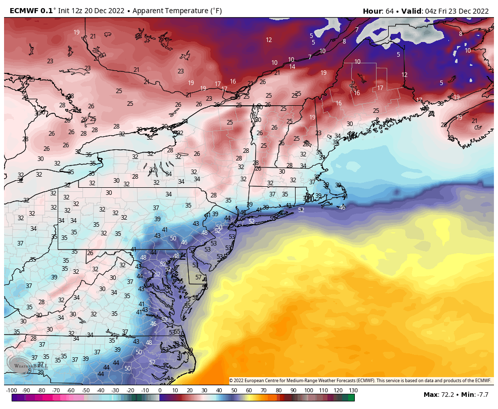
Friday Afternoon: An arctic cold front associated with a piece of the polar vortex moves through the area. Expect a sudden wind shift and rapid drop in temperature. A flash-freeze of standing water is possible. Travel disruptions will continue, and driving may also become hazardous with the rapidly falling temperatures area-wide.
Friday Night: Precipitation will end, but hazardous weather will continue. Any standing water will freeze. Blustery winds will continue. Temperatures will fall into the single digits with real-feel temperatures below zero throughout the area.
Conditions will finally improve a bit on Saturday, although blustery and cold weather is forecast to persist. The impactful storm system will finally begin to pull away from the area late Saturday, setting the stage for a cold but pleasant Christmas Day.
Stay tuned for further updates on the storm as we head through the next few days.