-2")
Accumulating snow possible in NYC on Wednesday as a complex storm approaches
Nope, that’s not a typo.
Forecast model guidance has come into agreement on the track of a midweek storm system that could bring periods of snow to the NYC Metro before a change to rain. The intricacies of the system – including the timing and intensity of precipitation before the change to rain – are still uncertain and will ultimately determine just how impactful the storm system is.
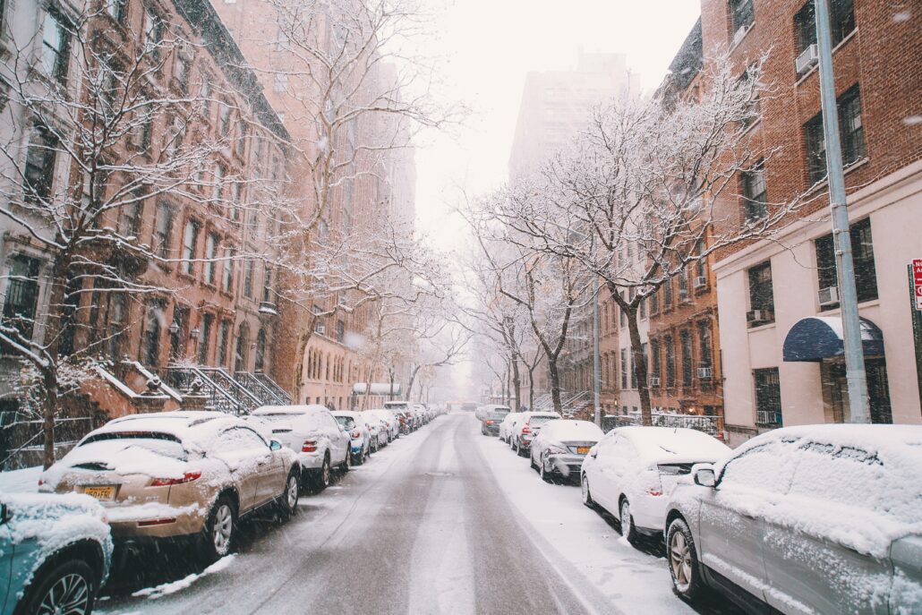
It’s no secret that New York City is trudging through a record-breaking snowless stretch. Sunday was the 319th consecutive day without measurable snowfall at KNYC, the official weather reporting station located in Central Park. This is the third longest snowless streak at KNYC since records began back in the 1890s.
In addition, this is the second latest we’ve made it into a winter season without measurable snowfall. The only winter which saw a later first snowfall was 1973, when the first measurable snowfall occurred on January 29th. Perhaps not coincidentally, that was the least snowy winter on record in NYC with only 2.8″ of snowfall accumulation.
A storm is evolving through the area as we speak, with periods of rain and even some embedded areas of heavy rain with localized flooding. Intermittent rainfall will continue into Monday morning before it begins to wrap up from west to east on Monday afternoon. There is an outside chance that rain could end with a period of wet snow, especially in the interior, on Monday afternoon. No accumulation is expected from this activity.
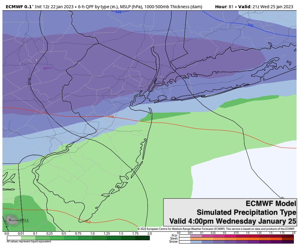
The more notable chance for winter weather comes during the middle of the week. A storm system will approach the area from the southwest and begin sending clouds and moisture into the area on Wednesday. Just enough cold air is present to the north of our region as this moisture approaches, so the caution flag has been raised for possible snow in our region.
Recent model guidance, particularly the European guidance suite, suggests that a few inches of snow are possible in the NYC Metro before a changeover to rain. The system will be driven by warm southwest winds, so the snow threat is far from classic and will be battling the intrusion of warmer air. But with cold air lingering nearby as the event begins, it’s worth starting to pay attention especially given the complete lack of snow over the past several weeks.
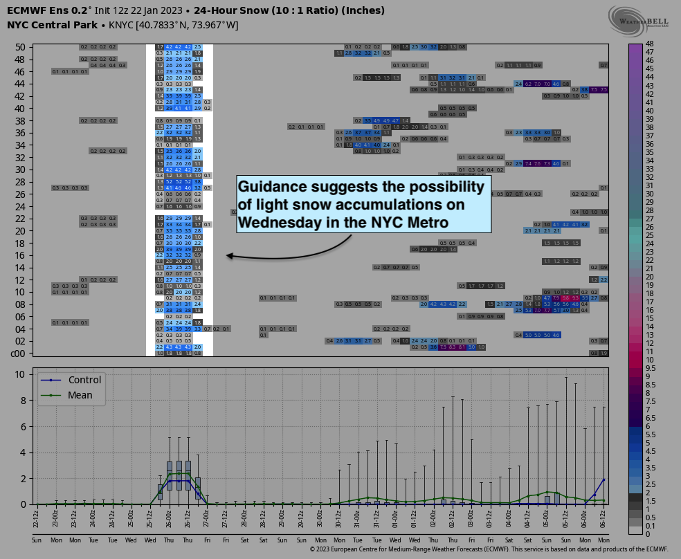
Ensemble guidance suggests a light snowfall accumulation is possible, but there is quite a bit of variability left to sort through. Some guidance suggests as much as 2 to 3 inches of snow could fall before the change to rain, while others suggest precipitation simply starts as rain – a non event. It’ll be worth monitoring this variability as we move closer to the midweek time frame.
If snow does fall on Wednesday, the snowless streak will end at 321 days in New York City, the second longest snowless streak on record. It will also be the second latest snowfall on record, falling short of the record on January 29th, 1973. If measurable snow does not occur with this system, NYC would be in position to break both aforementioned records.
We’ll be watching very closely and providing plenty of updates in the coming days. Every flake counts. Stay tuned!
Trackbacks & Pingbacks
[…] and moisture with it with just enough cold air to present the possibility of snow, according to NY Metro Weather. The high on Wednesday will be 41.If snow does fall, the snowless streak will end at 321 days, […]
[…] and moisture with it with just enough cold air to present the possibility of snow, according to NY Metro Weather. The high on Wednesday will be […]
[…] and moisture with it with just enough cold air to present the possibility of snow, according to NY Metro Weather. The high on Wednesday will be […]
Comments are closed.