-2")
What to Expect From Hurricane Lee in NYC
It has been almost a week since Hurricane Lee formed, and five days since the headlines got out of control. “Hurricane Lee may be headed for New York”, we heard. “The storm may make landfall in New Jersey”, someone said on a TikTok. As we know, none of these things were true then and they still aren’t now. Hurricane Lee is not going to come close to making landfall in New Jersey or New York City.
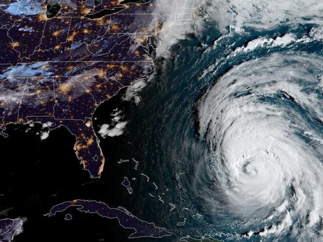
Lee is still a Category 3 hurricane as of this morning, with maximum sustained winds of 115mph. The storm will begin its turn northward soon and is then forecast to begin weakening as it encounters cooler waters and accelerates. It will begin to interact with the mid latitude jet stream later this week as it speeds northward.
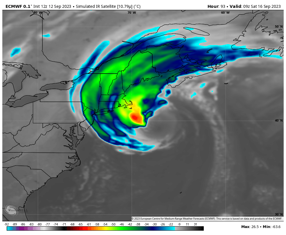
Eventually, it will end up several hundred miles east of New York City late this week. The storm will be briefly tugged back closer to the coast of New England on Saturday as it interacts with a mid level disturbance, but it will still remain well east of the New York City area. Rain bands from Lee are not expected to reach New York City – showers and storms on Wednesday are from a different frontal system.
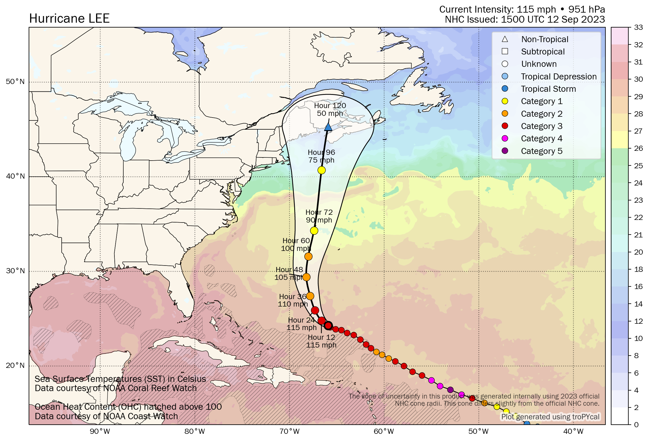
There will still be some effects felt along the area shores. As is typical with systems of this nature, the storm will expand in size as it heads northward. Lee’s wind field will become quite large by Friday and Saturday, so much so that rough seas and high surf/swells are possible even several hundred miles away from the storms center – including along the New Jersey, New York and Connecticut area beaches.
Impacts will be greater the further east and north one goes – particularly from Eastern Long Island into Southern New England where some coastal flooding and beach erosion can’t be ruled out from the storms rough seas. It’s not impossible that some bands of rain reach Eastern Long Island or Eastern Connecticut on Saturday. Heavy rain and some wind is more likely on Cape Cod and in Eastern Massachusetts, New Hampshire and Maine.
Here in New York City, the only tip-off that Lee is close to us will be the cloud canopy, which is forecast to spread over the area from later Friday into the first half of Saturday. Even still, the weather will be pleasant with lower dew points and calm conditions in place as Lee moves away from the region on Saturday afternoon.
Lee offers yet another example of why it is so important to utilize trusted sources for weather information on a regular basis. Remember that many organizations and individuals producing weather forecasts – especially on social media – are doing it specifically to get clicks, views and interaction and will create hysteria as a result.
Tl;dr: Lee will miss New York City by several hundred miles to the east. Some clouds are possible from the storm on Friday evening and Saturday with a few bands of rain possibly reaching Eastern Long Island. Otherwise, rough seas and high surf/swells will be the only noticeable impact as Lee moves past our region.
Trackbacks & Pingbacks
[…] Story continues […]
Comments are closed.