-2")
NYC Area Forecast: Improving weather after fourth March Nor’Easter
Wow, take a deep breath!
The fourth Nor’Easter in just as many weeks has finally departed the area this morning (taking its time doing so, as well) with snow lingering across many areas through the morning. This has been especially true across Long Island and parts of Eastern New England. Some extremely heavy, record breaking snowfall totals occurred across parts of the region – most specifically in Eastern New Jersey and Long Island, with snowfall totals ranging from 12-18″ (some locally higher). Unofficially, Islip, NY broke the record for March snowfall, with 2018 now the snowiest there since records began in 1964 with 27.5″.
The storm system we experienced on Wednesday was, without a doubt, extremely anomalous for March. Not only was it our fourth Nor’easter this month, but is was cold. The boundary layer conditions (Where we live) were much more winter-like with this storm system as opposed to the heavy, wet snow with temperatures in the mid to upper 30’s during the others. This lead to more significant road/pavement accumulations in many areas.
The good news is that the weather will improve over the next few days, sensibly, despite the fact that temperatures will remain extremely cold for this time of year. Behind the storm system, northwesterly winds will draw Canadian air into the Northeast states, with temperatures over the next 7 days averaging several degrees below normal area-wide. But plenty of sunshine is expected as high pressure works its wonders.
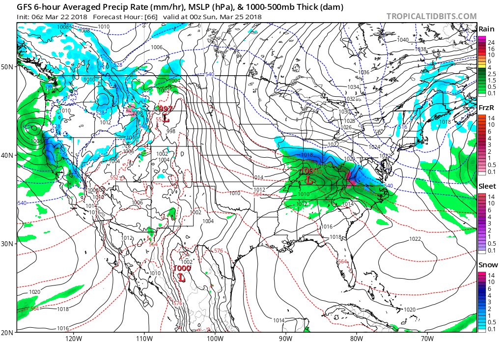
A storm system passes well to the south of the Northeast states later this week and weekend.
Another storm system looks to pass to the south of the area late this week and into this weekend – don’t freak out yet – it appears very likely to stay well clear of the Northeast states, potentially impacting the lower MId-Atlantic with wintry precipitation. The storm should harmlessly exit off the coast. It appears possible – we hesitate to say anything definitive as the pattern remains cold and active – that this long stretch of anomalous Nor’easters has finally come to an end.
As we move into the weekend and early next week, the airmass looks likely to stay cold. There will be a period of moderation this weekend as the airmass begins to adjust, with temperatures rising back somewhere near seasonal averages. But we expect this to be followed by another shot of cold, with cold air lingering into early April as high latitude blocking (or a ridge of high pressure in the high latitudes) continues to dislodge cold air from those areas down into the Northeast states.
Trackbacks & Pingbacks
1prostate
Comments are closed.