-2")
A bit more unsettled today, Karen disorganized
Warmer temperatures have been the trend over the past few days — and the pleasant streak of weather we have experienced over the last few weeks now looks to take a brief respite as we head into the weekend and the early part of next week. Increasing humidity today, coupled with a nearby boundary and mid-level atmospheric disturbance will mean increasing clouds and the chance for showers and an isolated thunderstorm. Showers and storms haven’t been around in a while — in fact, almost two weeks (more in some spots). Today will bring isolated to scattered showers and storms throughout the area from west to east, but the main story will be the humid feeling air and presence of more clouds than sun.

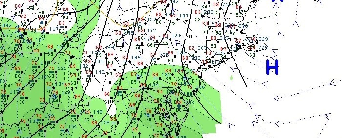
US Water Vapor satellite imagery, frontal positions, and SPC severe weather outlook from the morning of October 4 2013. A disorganized T.S Karen is seen in the Gulf of Mexico.
The unsettled weather will continue through later tonight, but only scattered showers are expected this weekend. The main story will then be the remnants of Tropical Storm Karen, and whether they track close enough to our area up the East Coast early next week to provide tropical rains. Forecast models have diverged in solutions, with some showing tropical rains and some wind while others now shunt the remnants of the system eastward out to sea.