-2")
Update: Freeze possible in area suburbs this week
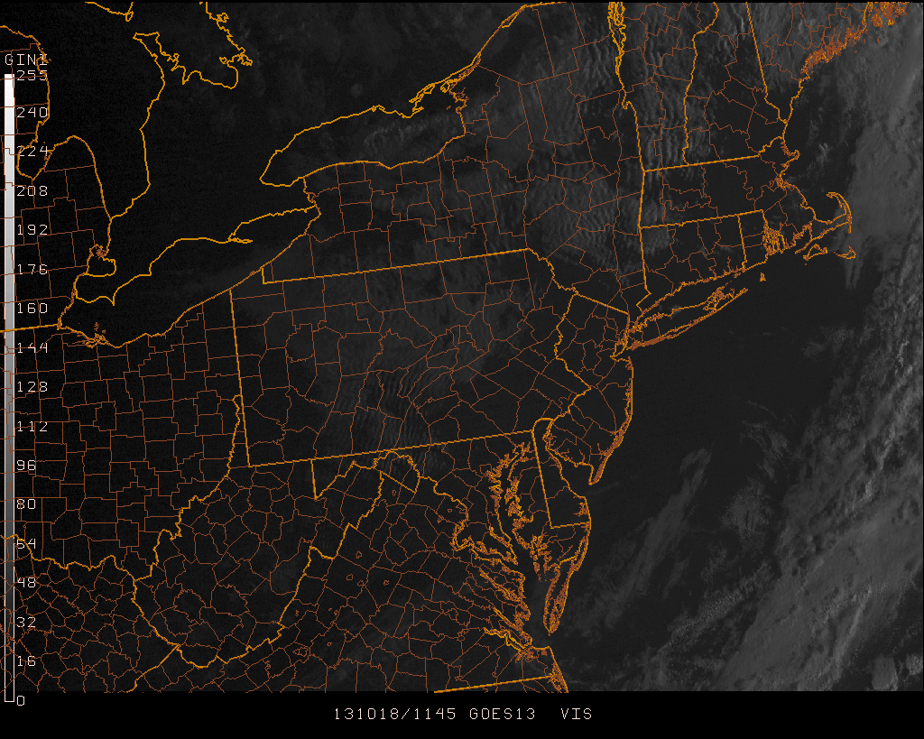
Wednesday AM Update: A weak coastal storm passing offshore, on a frontal boundary which crossed the area last night, is helping to develop some showers along the coast of New Jersey and along the shores of Long Island. The system will move quickly seaward today, owing to a fast and progressive pattern aloft. Temperatures this morning, away from the coast, fell into the 30s and 40s. Highs will reach only the mid 50s.
It is once the storm system passes, that west-northwesterly winds will begin in earnest — and they will usher in the coldest air of the year to date. Low temperatures on Wednesday Night into Thursday morning may fall into the lower 30s across the interior and 40s even in the city and urban areas. This would likely suffice for the first freeze of the year for many interior locations. But more notably in terms of sensible weather, high temperatures will only reach the mid 50s each day later this week, with a blustery wind expected. It will certainly feel more like autumn than it has at any point so far this year.
The NWS has issued a Freeze Warning for Sussex County in NW NJ from 2:00 to 9:00am Thursday morning. Frost Advisories also in effect for Somerset, Morris, Hunterdon, Passaic, Bergen (NJ) Rockland, Putnam (NY) and Fairfield, New Haven (CT).
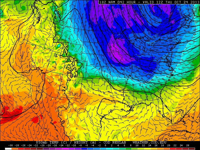
NAM model showing cold temperatures at 850mb moving into much of the Northern and Eastern US by Thursday.