Rain, cold and even snow possible this weekend

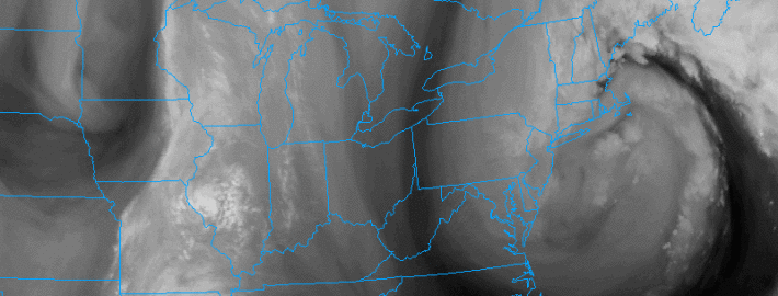
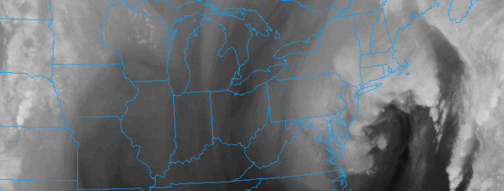
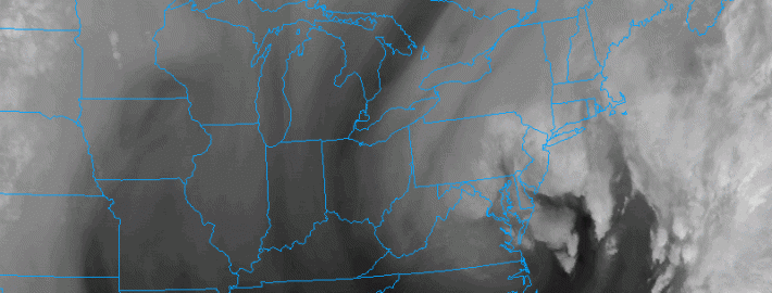
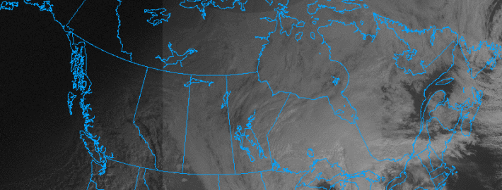
There, we used the “S word” in one of our posts for the first time this season. An energetic mid and upper level disturbance will shift from Central Canada through the Northeast United States late this week into the early part of this weekend, helping to develop a coastal storm. In addition to the coastal storm will come a strong cold front, and a cold Canadian airmass which will drop temperatures into the 30’s and 40’s at times after its passage. With models hinting at the development of multiple surface lows off the coast, the potential exists for not only rain and wind — but some snow in the higher elevations and the first flakes for others.

But the setup remains extremely complicated. The source region of the disturbance means forecast models are already working with a somewhat limited dataset. And, as is often the case with storms in our area, the mid level disturbances will be involved in fragile interactions, all of which will have a major impact on exactly how the storm develops. Confidence, as a result of these small nuances and features, remains very low.

Read more

Coastal storm lingers, improving weekend

As meteorologists, you sometimes just have to toss your hands up and admit defeat. And with this weeks Nor’Easter, we’re doing just that. The storm came in much more intense, much more organized, and much more impactful than we forecasted or anticipated it to be. And while our area saw periods of heavy rain and wind from the storm, the system itself was quite dynamic.  Similar to winter Nor’Easters both aloft and at the surface, the storm featured a deepening surface low and a dynamically impressive mid level trough.

Enhanced lift from the developing surface low, which actually retrograded westward from the Atlantic toward Long Island last night, moved over New England and New York City overnight Wednesday into Thursday morning. The result was heavy rain, and more noticeably, strong gusty winds mixing down to the surface. The dynamic system featured strong winds just above the surface — and so heavy rain brought these down. Gusts over 50 miles per hour were common throughout New England and Long Island.

Read more

Coastal storm update: More heavy rain, wind tonight

A coastal storm, developing as a result of a powerful mid and upper level system, developed today from the Delaware Coast to a position off the coast of the Mid-Atlantic states. Heavy rain moved through much of the area as a result of an inverted trough, and shifted from north to south throughout the day as the surface low moved more seaward. Since then, precipitation has become much more showery in nature — absent are the areas of heavy rain and thunderstorms. Northeasterly winds have increased in intensity along the coast.

Through the evening, the surface low off the coast is expected to strengthen slightly as the mid and upper level systems move south of Long Island. In a form more typical to winter-time systems, the surface low may actually hook back westward later tonight. While the storm itself isn’t necessarily strong in regards to its central pressure, the gradient between the developing surface low and the higher pressures around it will aid in the development of strengthening surface winds, especially along the coast.

Read more

Coastal storm to bring rain, wind through Thursday

A rather impressive mid and upper level trough is developing through the Mid Atlantic and Northeast States today, with a surface low pressure developing off the Mid-Atlantic coast. An inverted trough, extending northwestward from this surface low, is aiding in the development of very heavy rain along much of the area coasts including New Jersey and New York. Places to the northwest and interior have been able to escape the heaviest rain. But the low level jet will continue to support this heavy rain through the morning hours.

Later today, this rain will begin to swing southwest and wrap closer to the surface low. The low level winds which are currently moving in from the southeast (onshore) will shift to a more northeasterly direction and the inverted trough will swing southward, with the best lift for precipitation shifting away from the area. Still, showers and some thunderstorms will be possible throughout the day as the upper level low moves overhead and the surface low continues to develop.

Read more