-2")
Week begins with late season winter storm
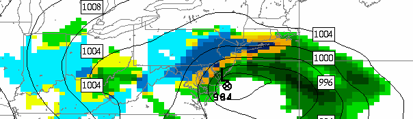
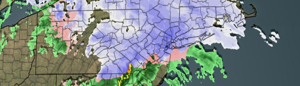
NAM model forecast precipitation totals through Tuesday. Notice the sharp cutoff in precipitation totals from North to South near New York City.
Historically strong blocking, incredibly low Arctic Oscillation values, and a strong negative NAO have been in place for over 7 days. It was only a matter of time. A strong disturbance moving through the Central United States will move eastward towards the Mid Atlantic Coast, and eventually offshore. The surface low, which initially develops towards the Ohio Valley, will be forced to transfer and redevelop off the coast. However, the northward extent of precipitation will be extremely limited with a sharp cutoff likely. This will throw a serious wrench into the forecast — with a large discrepancy in snow possible over small areas.
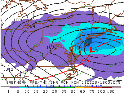
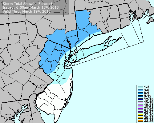
Our Storm Total Snowfall Forecast, valid through Tuesday PM.
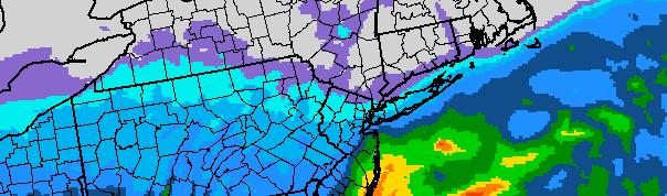
Forecast models have been inconsistent with the developing gradient. As of Sunday evening, the GFS is the “wetter” of the model guidance — and farthest north with the precipitation shield. The NAM (which had previously shown extreme precipitation totals), Euro and SREF remain farther south. The precipitation amounts and intensity become an increasingly important issue due to the time of year. The warm ground and marginally cold low levels of the atmosphere suggest that light precipitation will not accumulate — and may even fall as rain in some locations on Monday.
Accordingly, the forecast remains highly uncertain as we move forward. We have laid out the expected snowfall totals in our Storm Total Snowfall map, but confidence remains extremely low. It is possible that many locations see light snowfall accumulations but only on grassy surfaces. The best chance for solid light to moderate snowfall totals appears to be over Interior Central and Southern New Jersey, where more persistent heavy precipitation is expected.
A Winter Storm Warning from the NWS remains in effect for Southern New Jersey, while a Winter Weather Advisory remains in effect for the remainder of the area.
The periods of snow, which will begin Monday, could linger into Tuesday throughout much of the area. For up to the minute updates on the upcoming storm system, stay tuned to our Facebook and Twitter accounts.