-2")
Big heat on hold for the foreseeable future
We finally saw a nice break today from the high humidity values, as dewpoints dropped into the low 60s this afternoon, making it feel quite comfortable outside this afternoon. With the lower humidity, this means that temperatures have more room to drop tonight — mid 50s in colder, inland areas to mid 60s in more coastal sections. This is quite the stark contrast from the constant stream of 70s for lows that we have had all month.
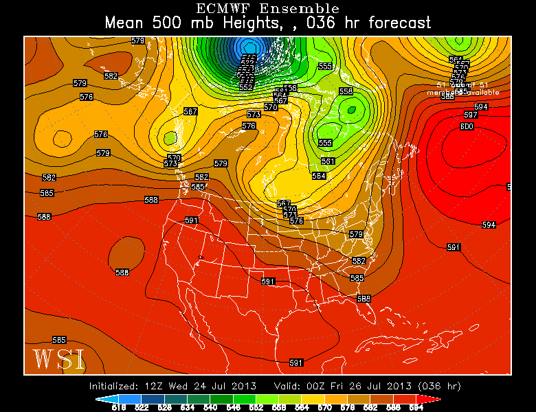
European Ensemble Mean Valid for tomorrow evening shows a frontal boundary being stalled as it runs into the stubborn Western Atlantic Ridge. Image courtesy of the WSI Model Lab.
As far as what is going on with the synoptic weather pattern, the heat wave has broken as that huge ridge has finally dissipated and split into two ridges — one in the southwest, and one in the NW Atlantic. The NW Atlantic ridge is the same one that has been plaguing us all summer with humidity, showers, thunderstorms — and at times, heat. Although it has fluctuated in position at times, it has generally remained in the western Atlantic.
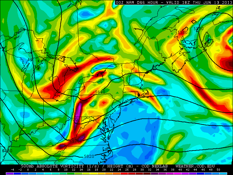
This 500mb image valid for tomorrow evening gives a good general summary as to what is going on now and what we can expect over the next few days. There is a trough in the northeast, as a cold front made its way through the area yesterday, giving us drier conditions. However, there are still clouds around as the front has stalled just to our east. Because of the tremendously strong western Atlantic ridge of 600 decameters (!), the front was forced to stall, as it ran into a “wall”, instead of clearing the coast. This leads to a tight 500mb height gradient along the eastern seaboard (which in this case is pretty much a frontal boundary). This leads to the potential for waves of low pressure to develop along this front.
Since the front is just to our east, the biggest rainfall threat would be east of NYC, with NYC itself being on the gradient. For now, we will mention the relatively high chance of showers, with periods of moderate rain at times — especially in eastern sections of the region (such as Long Island) — in an otherwise relatively mostly cloudy regime for tomorrow. With surface winds more northerly, instability should be too low for much in the way of thunderstorm activity, as temperatures may not get out of the 70s tomorrow. A stark change from last week, considering our lows were often in the mid to upper 70s!