-2")
Overview
Briefing
Hot and humid conditions will continue through Tuesday. Chances for showers and t-storms will increase as a cold front approaches on Wednesday. More comfortable warmth and humidity is expected late week.
Forecaster’s Discussion
Last Updated: 9:30am Thursday, July 26th 2019 by MP
Near Term (through tonight)
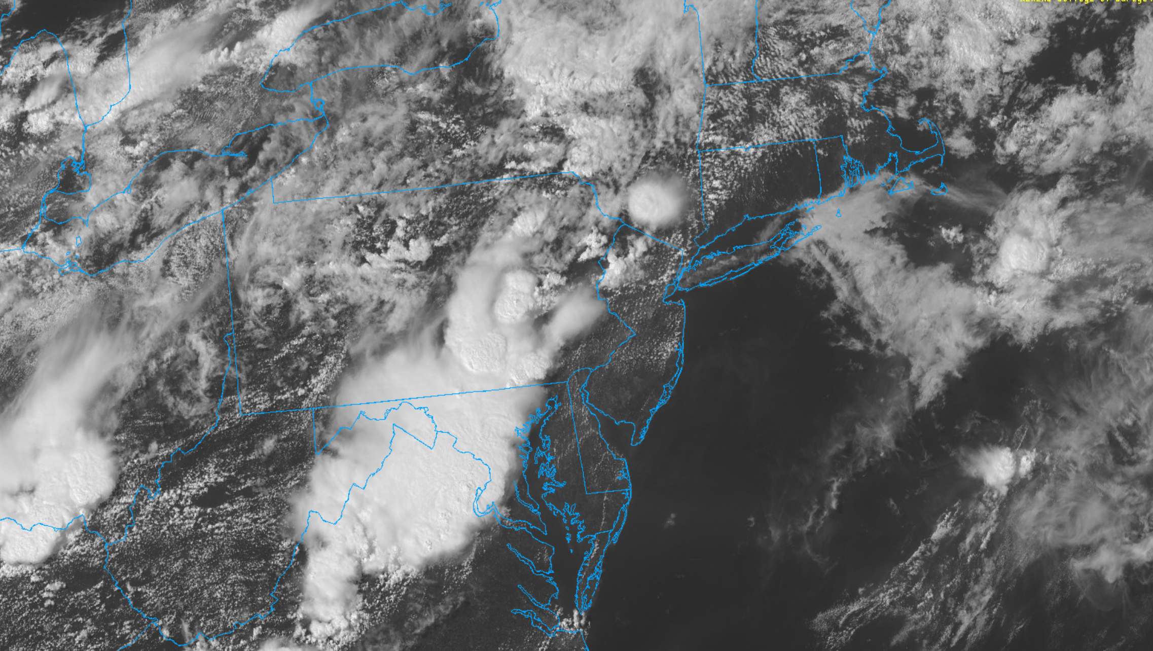
High pressure will provide mostly sunny skies today. 850mb temperatures around 12-13 C with deep mixing and light northwest downslope winds will support high temperatures closer to normal-in the middle 80s throughout much of the region. Humidity will still be relatively low, which will make for another beautiful mid-summer day.
Tonight, will remain mostly clear with light winds. This will result in more radiation cooling. Low temperatures are likely to in the mid 60s many of suburbs and in upper 60s to near 70 degrees in NYC and urban areas. Some of the far northern Interior valleys will likely drop into the upper 50s to lower 60s.
Hello
NYC Area Forecast: Severe storms today, tropics active again
Strong to severe thunderstorms are possible this afternoon and evening. Heat will continue through the weekend, and may peak early next week. Additional showers and storms are possible on Tuesday before temporarily cooler weather arrives.
Heavy rain Thursday morning, very warm Friday
The roller coaster weather pattern will cue have become accustomed to will continue over the next few days. Wednesday will start off inauspiciously enough, with high temperatures in the mid 50’s and plenty of sunshine. Clouds will increase late in the day, however, as a disturbance approaches. Here’s how the next few days will shake […]
A message regarding COVID-19 (Coronavirus)
New York Metro Weather is a weather website first, and will always remain that way. Our main goal and focus will always be to provide accurate, reliable weather forecasts. We are not doctors, biologists, or virologists and we will not claim to be experts on how to handle this ongoing situation. With that being said, […]