-2")
NYC Area Forecast: Severe storms today, tropics active again
Alerts: Severe Thunderstorm Watch in NJ and NYC until 10:00pm. Heat Advisory on Thursday afternoon.
Highlights: Strong to severe thunderstorms are possible this afternoon and evening. Heat will continue through the weekend, and may peak early next week. Additional showers and storms are possible on Tuesday before temporarily cooler weather arrives.
QuickCast
Hazards: Thunderstorms could produce strong, gusty winds and dangerous lightning today. Excessive heat is possible on Thursday afternoon.
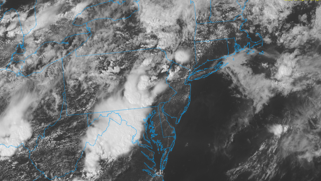
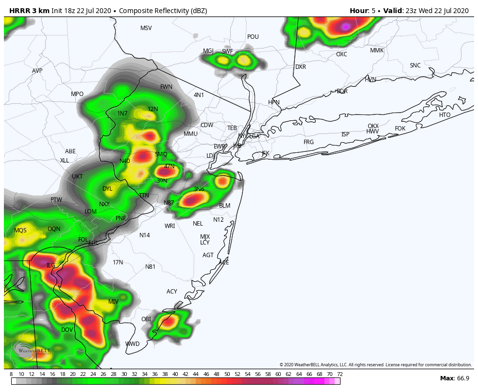
This afternoon: Showers and thunderstorms have developed across Eastern Pennsylvania this afternoon, and will shift eastwards through New Jersey and towards parts of the NYC Metro Area later today. Periods of heavy rainfall are expected from the late afternoon into the early evening as these storms shift into more substantial instability.
- Hazards: Strong gusty winds, small hail, dangerous lightning, flooding
- Timing: Through 10pm
Tonight: Showers and storms could persist into the early evening, but will gradually taper off. Lows will fall into the mid 70’s.
Thursday (7/23): Partly cloudy and more calm with slightly lower humidity. Highs will still reach the lower 90’s. Heat Advisory in effect during the afternoon hours for Heat Index values approaching 100 F.
Friday (7/24): Isolated to scattered showers and thunderstorms will be possible again during the afternoon and evening hours. Otherwise, the weather will be hot and humid once again. Partly cloudy, with highs in the lower 90’s.
Extended Forecast
Hot and humid weather will continue for a few more days, perhaps peaking on Monday when temperatures could reach the upper 90’s. Heat Index values could eclipse 100 F again. We anticipate Heat Advisories to be issued again by the National Weather Service as we draw closer. Active conditions will return by Tuesday, as a disturbance drops into the area from Canada. A front approaching the region could lead to showers and storms on Tuesday afternoon and evening, some of which could be strong to severe. Temporarily cooler weather (relatively speaking) is then expected by midweek.
Tropical Activity Returns
Tropical Storm Gonzalo formed earlier today in the Atlantic, and is expected to track westwards towards the Caribbean over the next five days. The system is expected to gradually strengthen, and could eventually become a hurricane. Additionally, Invest 91L in the Gulf of Mexico is expected to strengthen into a Tropical Depression at some point over the next day or so. This system should track westwards towards the Western Gulf of Mexico, perhaps eventually impacting parts of Texas with very heavy rainfall.
Trackbacks & Pingbacks
1armistice
Leave a Reply
Want to join the discussion?Feel free to contribute!