-2")
Overview
Briefing
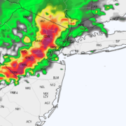
Hot and humid conditions will continue through Tuesday. Chances for showers and t-storms will increase as a cold front approaches on Wednesday. More comfortable warmth and humidity is expected late week.
Forecaster’s Discussion
Last Updated: 9:30am Thursday, July 26th 2019 by MP
Near Term (through tonight)
High pressure will provide mostly sunny skies today. 850mb temperatures around 12-13 C with deep mixing and light northwest downslope winds will support high temperatures closer to normal-in the middle 80s throughout much of the region. Humidity will still be relatively low, which will make for another beautiful mid-summer day.
Tonight, will remain mostly clear with light winds. This will result in more radiation cooling. Low temperatures are likely to in the mid 60s many of suburbs and in upper 60s to near 70 degrees in NYC and urban areas. Some of the far northern Interior valleys will likely drop into the upper 50s to lower 60s.
Hello

Dorian passes offshore, improving weather this weekend in NYC
In New York City, the impacts from Dorian are expected to remain relatively minor. Cirrus clouds from the storm system have made their way overhead today – the first time we’ve seen any part of Dorian up close and personal. Luckily, the remainder of the system is expected to stay a safe distance away.

Active storm season expected to continue
An active year for severe thunderstorms will persist into August.
Tuesday Briefing: Heat Advisory today, storms likely Wednesday
After several days of calm weather, the pattern is finally set for a change. Temperatures will warm into the mid 90s today, and the NWS has issued a Heat Advisory for NYC and surrounding areas. Heat Index values will rise toward 100 F thanks to increasing moisture. Temperatures will remain warm well into the evening […]