-2")
Tuesday Briefing: Heat Advisory today, storms likely Wednesday
After several days of calm weather, the pattern is finally set for a change. Temperatures will warm into the mid 90s today, and the NWS has issued a Heat Advisory for NYC and surrounding areas. Heat Index values will rise toward 100 F thanks to increasing moisture. Temperatures will remain warm well into the evening hours.
Midweek gets stormy
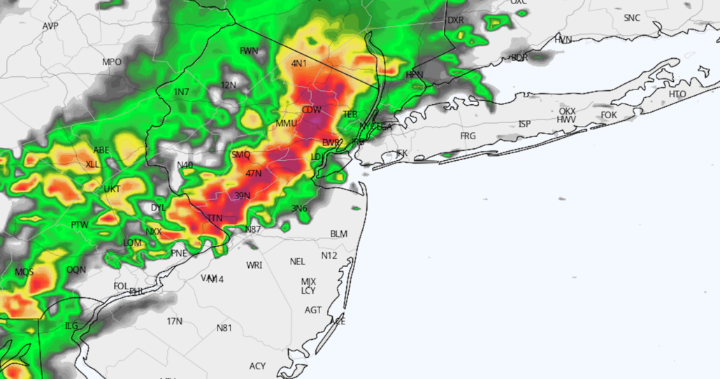
A few thunderstorms are likely across the interior this afternoon, but these will remain isolated. They’ll also stay west of the NYC Metro Area and most of New Jersey. The same can’t be said for Wednesday, when we’re expecting the development of widespread thunderstorms. The potential will exist for heavy rain, dangerous lightning and gusty winds in these storms. Localized flooding will also be possible. Here’s the breakdown on what to expect over the next few days:
- Heat. More heat. Temperatures in the 90’s this afternoon with increasing dew points, leading to Heat Index values near or over 100 degrees.
- A few isolated storms, mostly west of the NYC Area in Pennsylvania. Probably a decent light show to our west at night.
- Warm temperatures again to start the day on Wednesday, but showers and storms developing and becoming widespread by afternoon and evening.
- Multi-hazard day on Wednesday, especially from 4pm through 8pm. Heavy rainfall, lightning and gusty winds all possible. The evening commute won’t be great, and local outdoors sports games are in jeopardy.
- Improving conditions from Thursday toward the weekend. Woohoo!
Stay tuned for more information as we head through the week. Have a great Tuesday – and stay cool today!
Trackbacks & Pingbacks
3insignia
Leave a Reply
Want to join the discussion?Feel free to contribute!