-2")
Overview
Briefing
Hot and humid conditions will continue through Tuesday. Chances for showers and t-storms will increase as a cold front approaches on Wednesday. More comfortable warmth and humidity is expected late week.
Forecaster’s Discussion
Last Updated: 9:30am Thursday, July 26th 2019 by MP
Near Term (through tonight)
High pressure will provide mostly sunny skies today. 850mb temperatures around 12-13 C with deep mixing and light northwest downslope winds will support high temperatures closer to normal-in the middle 80s throughout much of the region. Humidity will still be relatively low, which will make for another beautiful mid-summer day.
Tonight, will remain mostly clear with light winds. This will result in more radiation cooling. Low temperatures are likely to in the mid 60s many of suburbs and in upper 60s to near 70 degrees in NYC and urban areas. Some of the far northern Interior valleys will likely drop into the upper 50s to lower 60s.
Hello

Record warm temperatures expected on Wednesday in NYC
High temperatures on Wednesday are expected to climb into the upper 80’s and lower 90’s in New York City, challenging daily and monthly records for October. Rising dew points will lead to heat index values into the mid 90’s during the afternoon.
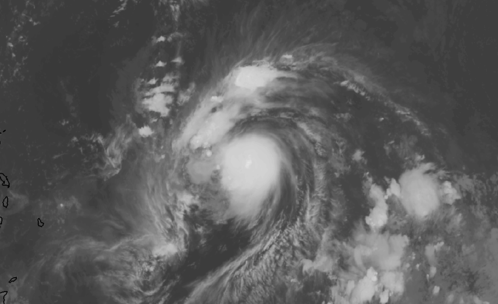
Tropical Storm Jerry strengthens, recurve not a guarantee
Tropical Storm Jerry strengthened again today, with maximum sustained winds now at 60 miles per hour. The storm is moving steadily northwestward in the Tropical Atlantic Ocean. It is expected to move north of the Antilles later this week, while strengthening into a hurricane.
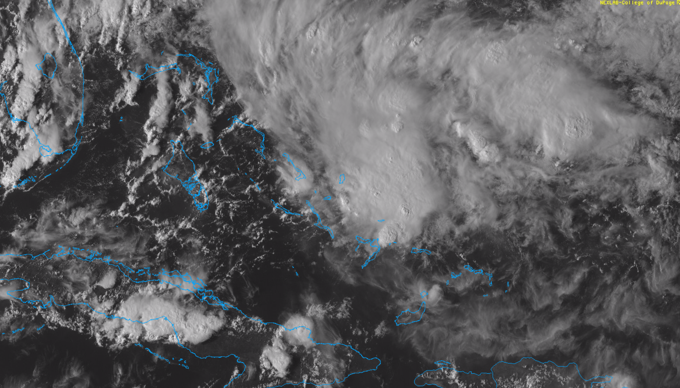
NHC initiates advisories on PTC 9 in the Bahamas
The National Hurricane Center has initiated advisories on Potential Tropical Cyclone (PTC) 9 this evening. The area of organizing thunderstorms is located in the Bahamas, and is expected to drift northwestward over the next day or so while continuing to organize.